
A strong cold front will push southeast across Texas today, bringing gusty northwest winds and a 20 to 30-degree drop in temperatures. Wind gusts may become excessive across the Texas Panhandle, with 50+ MPH wind gusts and blowing dust. Meanwhile, we’re going to have to keep an eye on the Ark-La-Tex, East Texas, and the Golden Triangle late this morning through the mid-afternoon hours for the possibility of severe thunderstorms.
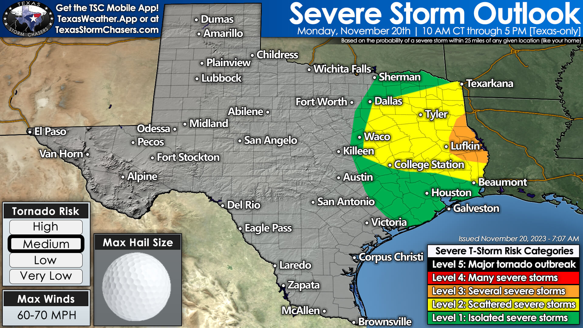
Showers and storms will increase in coverage this morning across eastern North Texas south into the Brazos Valley. As those storms move east of Interstate 45 later this morning, they’ll begin entering a more favorable environment for severe weather. While initially disorganized, some storms may begin to acquire supercell characteristics.
Localized damaging wind gusts and hail will be the primary concern with stronger storms. However, as storms approach the Louisiana state line, the threat of a few tornadoes may increase. We encourage folks in the Piney Woods to keep tabs on the weather later this morning into this afternoon. Storms will move east of Texas by dinner time, ending the threat of severe storms.
Cooler, more seasonable weather is expected on Tuesday and Wednesday across Texas. Wednesday itself will be fine travel-wise across Texas. As we head into Thanksgiving Day, it now appears that we may have some rain to deal with across the southeastern half of Texas. This part of the forecast remains quite uncertain.
Some weather models are spinning up an area of low pressure near the Texas Gulf Coast. If that were to occur, we’d likely see rain chances on Thanksgiving Day into Thanksgiving Night across the southeastern half of Texas.
Another strong cold front will begin moving south into Texas as we get into Friday and the weekend. Some precipitation may occur, but we’ll deal with the extended range of the forecast once we’re past today’s severe weather issues.
Get the FREE Texas Storm Chasers Mobile App for your local weather forecast, interactive weather radars, live Texas weather coverage, and more! Available in your device’s app store.


0 Comments