We’ve enjoyed a few days of less active weather across Texas, and hopefully, it’ll remain that way for the remainder of today. Thunderstorm chances return on Wednesday and Thursday as a cool front moves south into the state.
Isolated severe thunderstorms are possible through the early evening across the Hill Country and South-Central Texas. The chance of a storm busting through the cap is under 25 percent. However, if a storm gets going, it’s going to throw out some really big chunks of ice along with localized damaging winds. Otherwise, the remainder of today will feature mostly clear to partly cloudy skies across the state.
Wednesday will see scattered severe thunderstorm chances return to the northeastern portions of Texas. North Texas, Northeast Texas, and the Ark-La-Tex may see thunderstorms develop during the mid to late afternoon hours. The strongest storms will likely produce destructive hail, localized damaging winds, frequent lightning, and perhaps a few tornadoes. The highest risk of severe storms seems to be in the Ark-La-Tex. Storms will move slowly east/southeast and should weaken a few hours after sunset. There are questions on how far west/southeast into North Texas the dryline/cool front will unzip.
As the cool front slowly moves south on Thursday, we’ll see another round of afternoon and evening thunderstorms in the Concho Valley, Hill Country, South-Central Texas, Central Texas, Brazos Valley, and East Texas. Like tomorrow, the strongest storms will likely produce very large hail, localized damaging winds, and heavy rainfall. The tornado risk looks very low on Thursday but not completely zero.
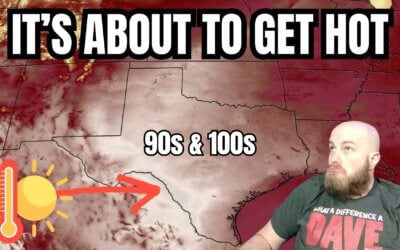
The cool front will bring relief from our early taste of summer. High temperatures by late week and weekend will drop from the 90s and 100s to the 70s and 80s. We’ll also see much lower humidity as a drier continental airmass moves in from the north. Rain chances will return to Texas somewhat on Saturday, especially Sunday. Thanks to the more stable airmass, the severe thunderstorm risk looks low. Rain totals look fairly low with the weekend round of rain, helping to keep the flash flooding risk lower. A warmup will begin early next week.
Check out our current LIVE STREAM: https://texasweather.video/
Our FREE WEATHER APP: https://texasweather.app/
Our WEBSITE/RADAR: https://www.texasstormchasers.com
Our SOCIAL PLATFORMS: https://linktr.ee/texasstormchasers


Thank David we sure appreciate ya even in the blackout y’all had.
Blessings ❤
Thank ya!
Howdy Mr baldy n chief
Howdy!!
Thank you David glad to see you are okay after what you went through yesterday God Bless you!!
Love your report 🤠
Thank you David and crew. Glad your power is back. Future says we’re going to need all hands on deck. We’re at war with the weather war mongers. Federal government, ie, NWO. God help us please.
Hebrews 4:16 ”
Let us, then, approach the throne of undeserved kindness with freeness of speech, so that we may receive mercy and find undeserved kindness to help us at the right time.”
good evening David, thank you for the weather update. yeah,,,ouchies for the temps but hopefully not too long. enjoy your evening and see you tomm
Thank you.🌷🌷🌷🌷
Glad to see y’all hit 33K!🎉