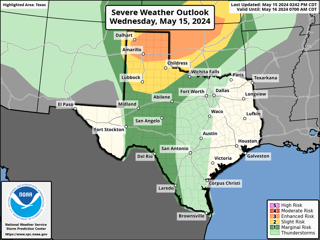
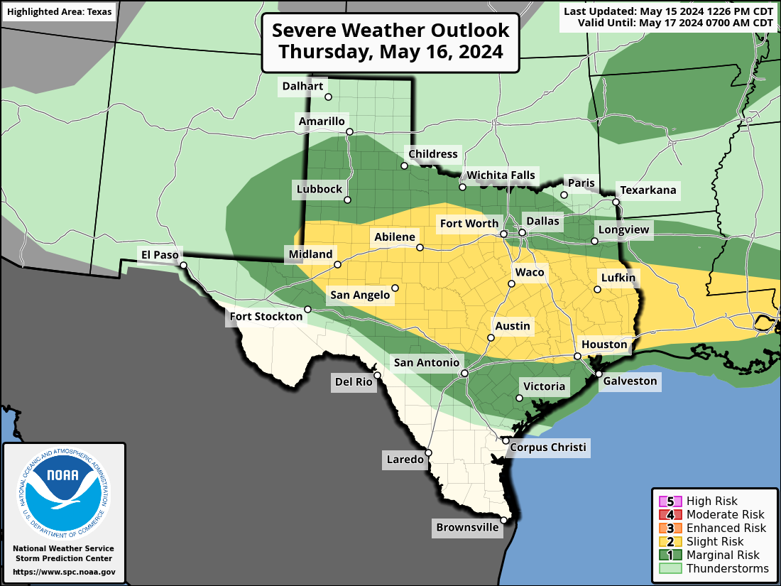
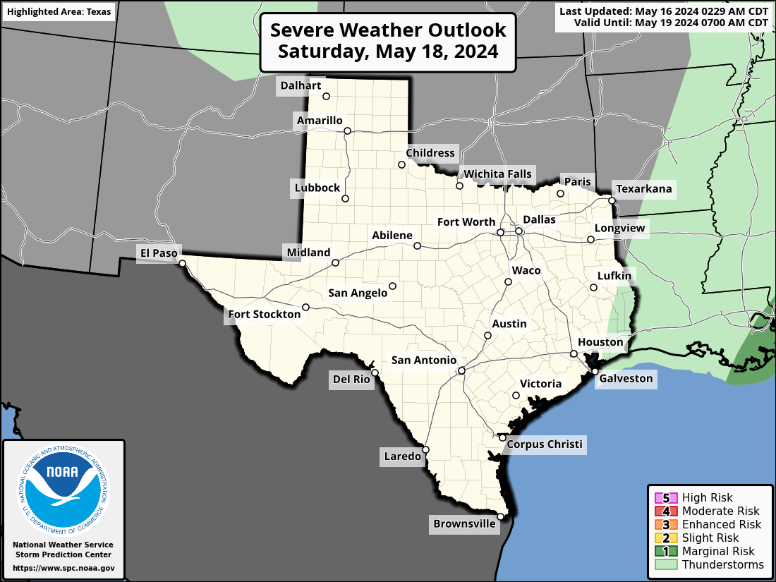
SEVERE WEATHER OUTLOOK FOR TEXAS
Severe thunderstorms can and do happen every month out of the year in Texas. Outlooks for upcoming severe weather threats are issued nationally by the Storm Prediction Center. They issue multiple outlooks daily for a timeframe extending out to eight days. Each day’s severe weather potential is based on a five-level risk scale. Click here to learn about severe weather outlooks and the risk names.
day 1 severe weather outlook
today & tonight
The severe weather outlook for today and tonight, or the Day 1 period, is updated several times a day. Typically, the Day 1 severe weather outlook is updated at 1 AM, 8 AM, 11:30 AM, 3 PM, and 8 PM CDT. Tap on the outlook graphic for a detailed meteorological discussion and hazard-specific probabilities (tornado, large hail, damaging wind).
DAY 2 SEVERE WEATHER OUTLOOK
TOMORROW
The severe weather outlook for tomorrow and tomorrow night, or the Day 2 period, is typically issued twice daily – 1 AM and 12:30 PM CDT. Tap on the outlook graphic for a detailed meteorological discussion and hazard-specific probabilities (tornado, large hail, damaging wind).
DAY 3 SEVERE WEATHER OUTLOOK
DAY AFTER TOMORROW
The severe weather outlook for the day after tomorrow, or the Day 3 period, is typically issued daily around 2:30 AM CDT. Tap on the outlook graphic for a detailed meteorological discussion.
DAY 4-8 SEVERE WEATHER OUTLOOK
EXTENDED RANGE
The extended range severe weather outlook is typically issued daily around 3:30 AM CDT. Severe weather highlights in the extended range are meant as a heads up. The probabilities shown are for severe thunderstorm impacts within 25 miles of any given point. Tap on the outlook graphic for a detailed meteorological discussion.