
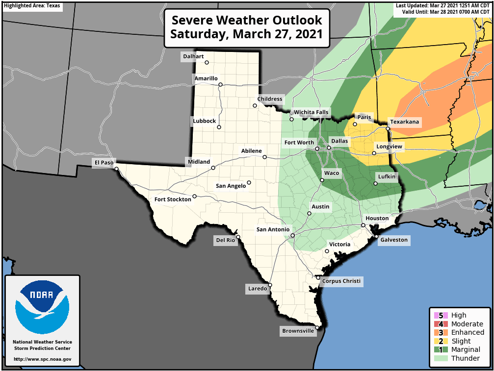
Good morning and happy Saturday, everyone! Strong to severe storms are in the forecast for later today across parts of north-central and northeast Texas. The Storm Prediction Center has issued a Marginal Risk (level 1) for the DFW area south to Waco then east to around Lufkin.
A Slight Risk (level 2) is in place for northeast Texas from around Paris down to Tyler and Carthage. A cold front is making its way south/southeast from the panhandle region this morning, while a warm front is working its way north from southeast Texas, which will prime the atmosphere for storms to kick off later this afternoon.
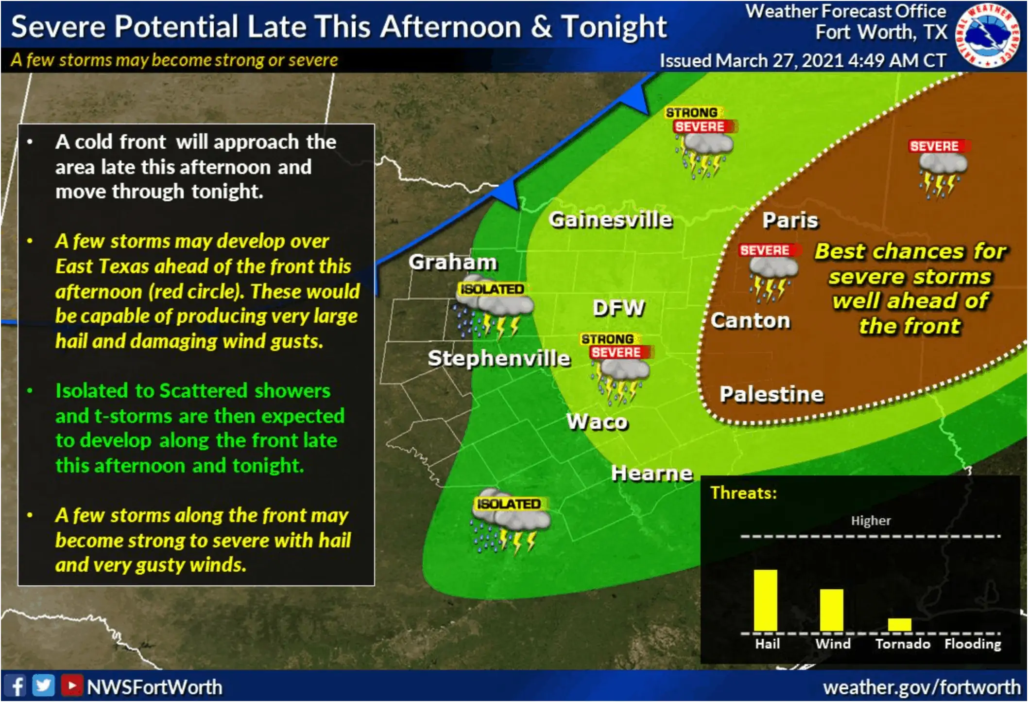
We should begin to see scattered showers begin to develop after around 2 pm this afternoon, mainly east and southeast of the DFW metroplex. These will gain traction pretty quickly, increasing in intensity as the afternoon wears on. All severe weather modes are possible, including supercell thunderstorms capable of producing large hail, damaging winds, and even a few tornadoes.
A majority of the severe storms are expected to remain east of the DFW metroplex within or near the Slight Risk area; however, we cannot rule out a couple of stronger storms across the DFW metroplex later in the evening as the cold front arrives. Keep a weather eye out today and make sure you have a way to receive weather warnings if any are issued for your immediate area.
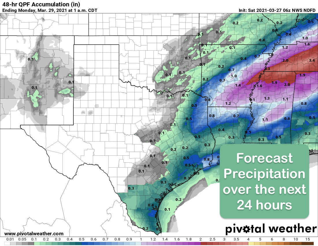
These storms will continue across far eastern and northeast Texas during the late evening and overnight hours before shifting southeast towards the coast by early Sunday morning. This event’s rainfall is not expected to be significant, with generally less than 1/2 inch accumulations expected.
Forecast Rainfall over the next 24 hours
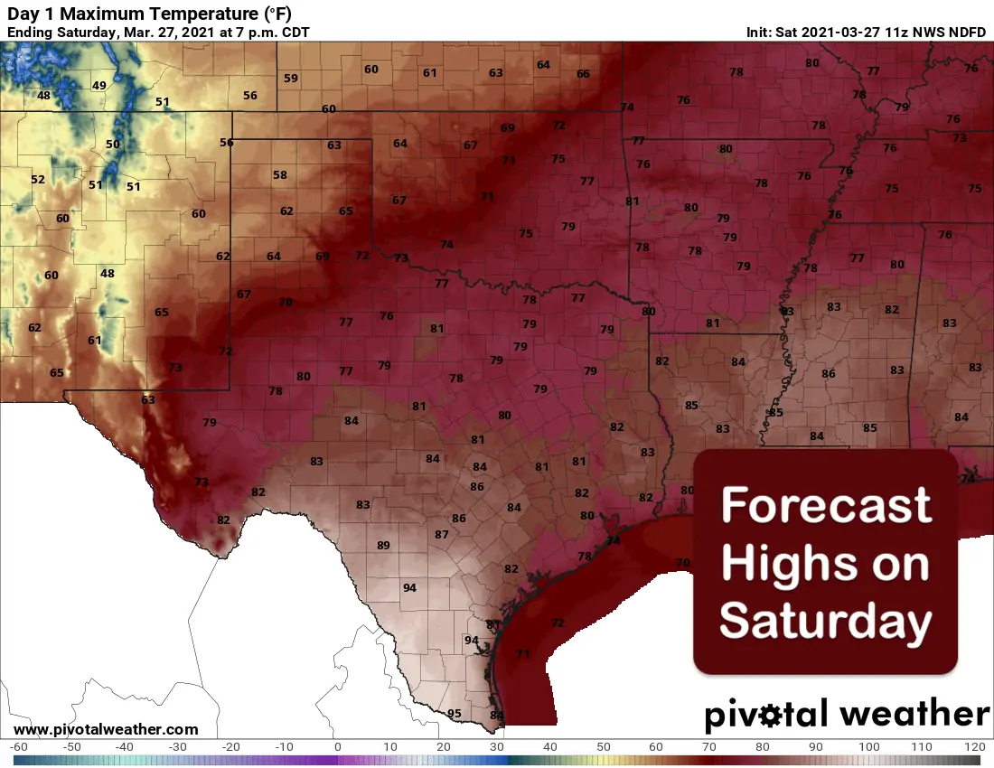
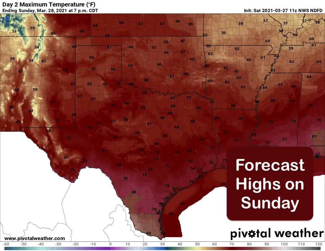
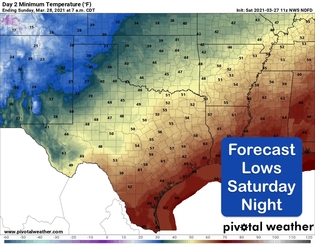
Even with the cold front arriving today and pushing through the state overnight, forecast highs this weekend will be mostly season except for parts of the deep south Texas brush country and the Rio Grande Valley region, where temps will soar well above normal and into the mid to upper 90s today. Dry and breezy conditions will be in place across western Texas, where Wind Advisories will be in place today for the Van Horn/Guadalupe Mountains region and southwestern panhandle region. The passage of the cold front today and overnight will knock temps down about 10 degrees for folks on Sunday, but still seasonal for this time of the year.
This Weekend’s Temperature Forecast


0 Comments