
Good morning and happy Saturday everyone! This weekend’s weather highlights will be the chance for strong to severe storms this afternoon and into the overnight hours followed by the arrival of another strong cold front on Sunday. Yes, I think it’s safe to say we’re still on the temperature rollercoaster so keep both t-shirts and coats handy this weekend!
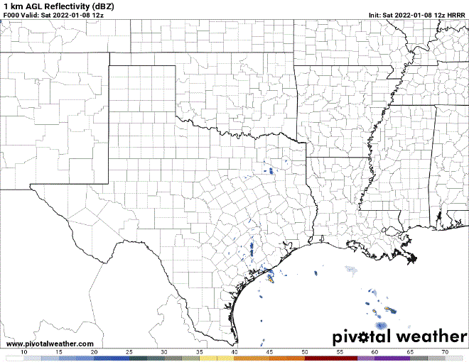
Short Range HRRR Forecast Model 24 Hour Radar Outlook
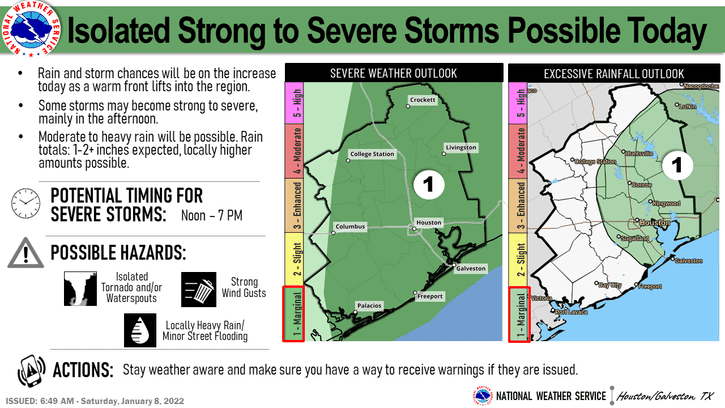
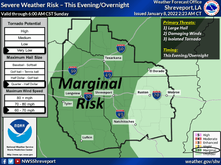
Saturday’s Severe Weather Potential
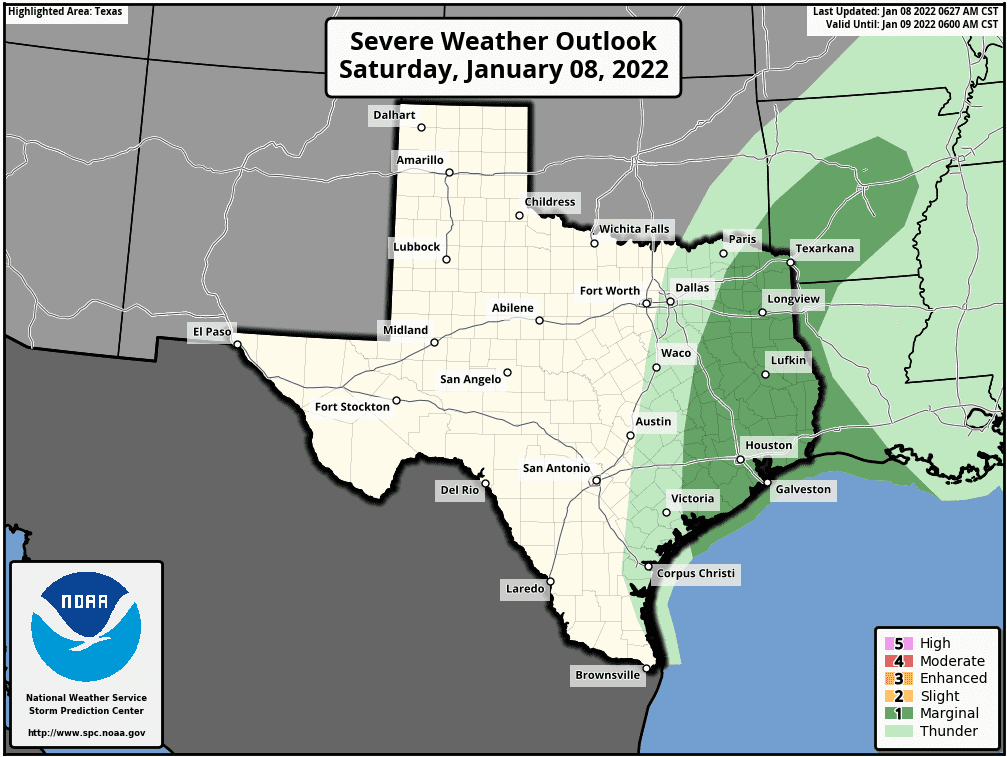
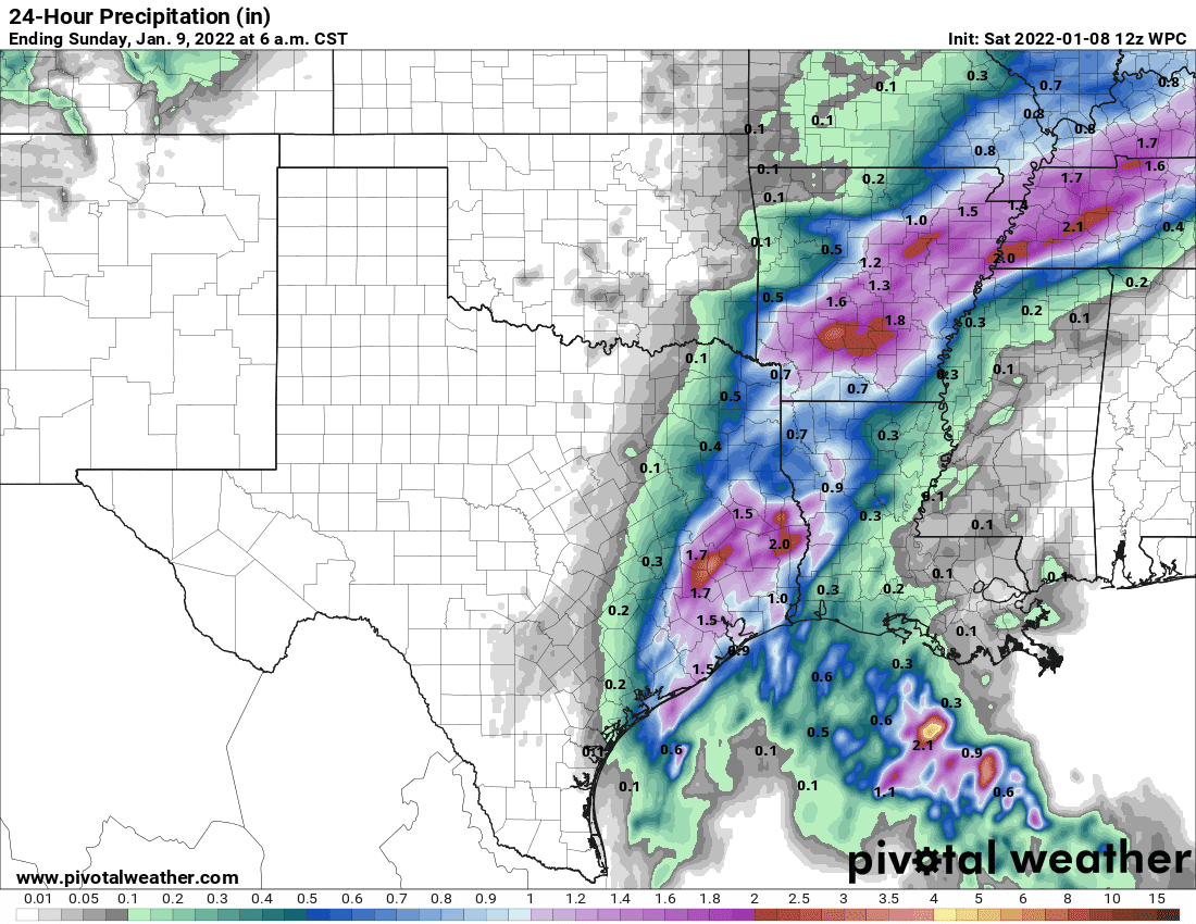
The Storm Prediction Center has outlined much of coastal Southeast Texas, Eastern Texas and portions of Northeast Texas under a Marginal (Level 1) risk for severe weather today. While widespread severe weather is not anticipated, by later this afternoon and into the overnight hours, folks in these regions could experience a few strong to severe storms with large hail and a few damaging wind gusts being the main threats. The tornado threat is very low, but cannot be completely ruled out…especially for coastal and southeast Texas where instability and wind shear values will be the greatest and quick waterspout or tornado spin-ups will have the highest probability of occurrence…if they occur at all. At any rate, folks within and near the Marginal outlook area will need to stay weather aware today and have a way to receive weather notifications today and tonight. Heavy rainfall will also be possible within any of the more robust storms that develop. Isolated Flash Flooding will be possible, especially for low lying areas already prone to flooding.
24-Hour Rainfall Outlook
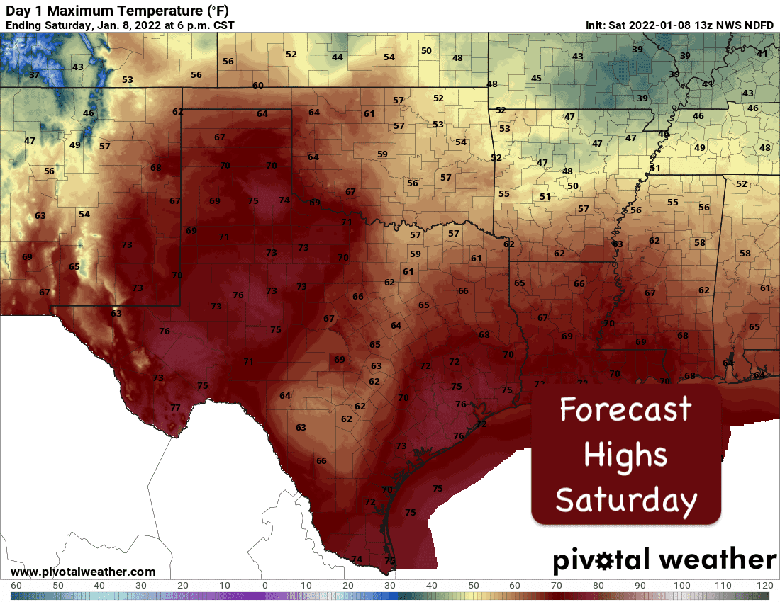
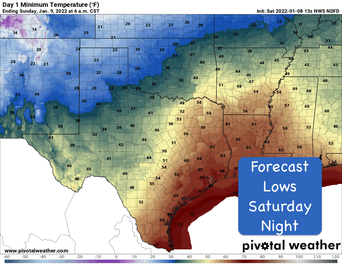
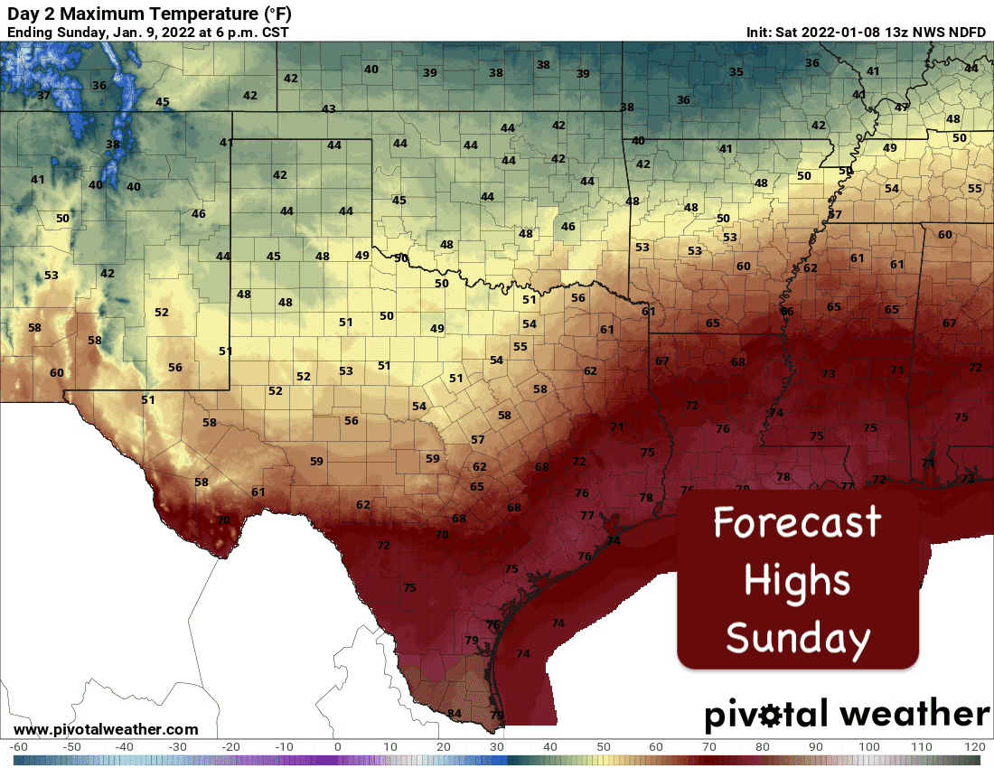
Weekend Temperature Outlook and Cold Front Timing
Another somewhat strong cold front will sweep into the state for Sunday. This front will bring more seasonal temps back to the state for at least a few days before we begin to warm up again. Highs on Saturday across many parts of the state will exceed seasonal normals. We could even see a few locations, especially across coastal and south/southeast Texas reach near record warmth. The cold front will begin moving into the panhandle region late this afternoon and into northwest Texas by Midnight. By Sunday morning, the front should be moving through the DFW metro area and into Central Texas. By mid-afternoon, the front should be pushing into the Houston/Galveston Metro area and by late afternoon into parts of South Texas. Gusty winds and much drier air will arrive with the front which will help knock out much of our typical humidity for the start of the work week ahead. At this point, it looks like we stay dry for the first several days next week with rain chances possibly returning mid-week and again next weekend.


0 Comments