
Episodes of severe thunderstorms, each with their own unique characteristics, are expected to bring large hail, damaging winds, tornadoes, and flooding rainfall to portions of Texas through the weekend. Some areas may experience nothing more than gusty winds, while others could face significant problems. With multiple rounds of thunderstorms expected, it’s crucial to remain vigilant and adapt to the ever-changing weather conditions.
Now through early Afternoon
A cluster of thunderstorms developed late last evening in the Permian Basin. Those storms, producing large hail and wind gusts up to 70 MPH, moved across West-Central Texas, Northwest Texas, and Oklahoma. Storms have produced multiple brief tornadoes and damaging winds across the eastern half of Oklahoma this morning. The tail end of those storms has extended to Highway 82 on the Texas side of the Red River. Folks from Wichita Falls to Gainesville have received rainfall. That line will continue moving east this morning. The southern portion of the squall line never got going in the Big Country or Concho Valley.
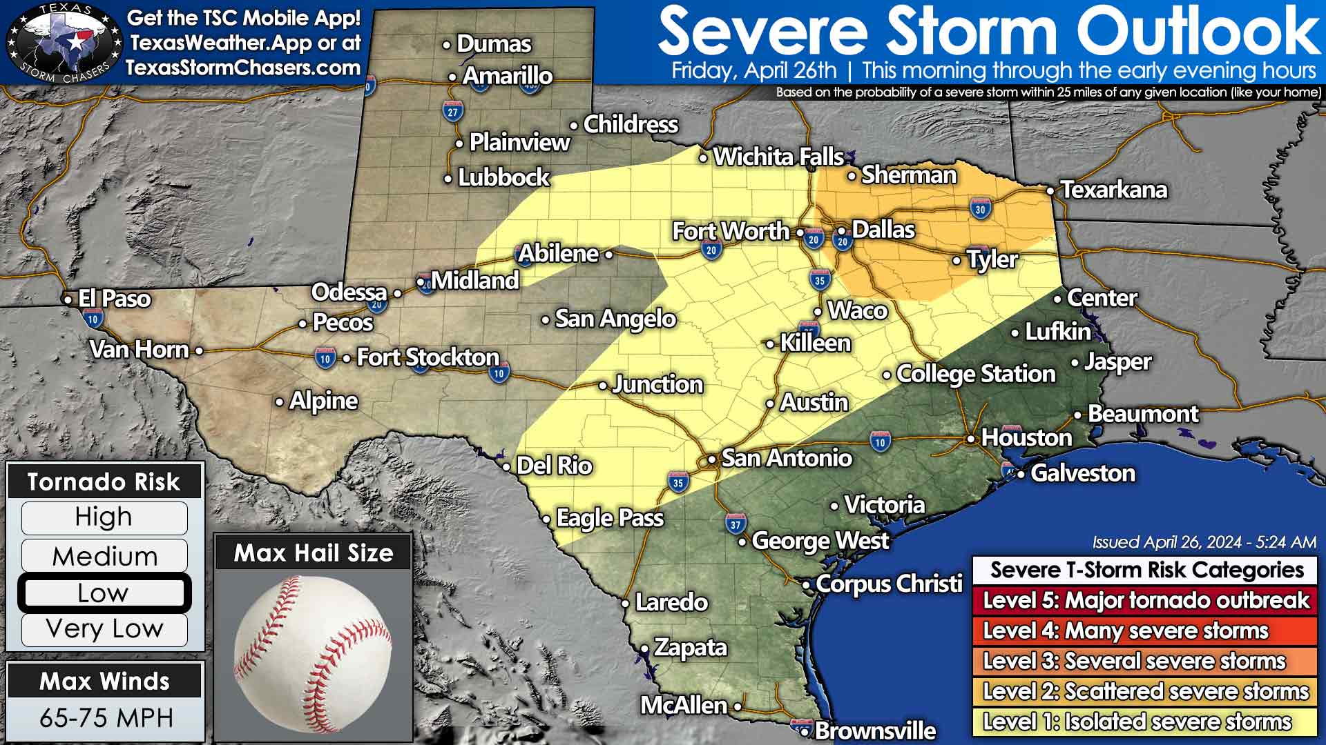
However, we believe scattered thunderstorms may organize this morning across portions of North Texas and Central Texas. The higher storm chances will be in the north. Some storms may become severe with large hail, damaging winds, and a low tornado threat. Those storms will move into Northeast Texas by mid-afternoon.
Severe storm threat this afternoon and evening
Back in North Texas, Central Texas, and the Hill Country late this afternoon – clearing skies will allow the atmosphere to destabilize after this morning’s round of storms. Isolated severe storms are possible between 4 PM and 10 PM east of the dryline. 90 percent or more of folks won’t get a storm late this afternoon or evening. However, any storms that do develop will do their best to throw softball-sized hail, damaging winds, and perhaps a tornado as they slowly move southeast. Any storms would dissipate by late evening.
Multi-State Severe Weather Outbreak Possible Tomorrow

Scattered thunderstorms are possible on Saturday morning in Northwest Texas and Texoma. Large hail can’t be ruled out with stronger storms. A significant severe weather event is likely Saturday afternoon into Saturday night across the eastern half of Kansas, Oklahoma, Northwest Texas, Texoma, the Big Country, and Concho Valley. Isolated superceulluar thunderstorms are possible after 3 PM in Northwest Texas and Texoma, with some potential for them farther south along the Big Country and Concho Valley dryline. Giant hail, damaging winds, and at least a low threat of tornadoes are expected with any afternoon or early evening thunderstorm. An outbreak of tornadoes may occur in Kansas and Oklahoma, though questions surrounding morning thunderstorms and afternoon destabilization make that a murky picture.
Line of Severe Storms Develops Saturday Night
The dryline will ‘unzip’ Saturday evening with a nearly solid line of thunderstorms from Del Rio north to Wichita, Kansas. The strongest storms in the squall line will produce damaging winds, hail, embedded tornadoes, and very heavy rainfall. The strong to severe storms will approach Interstate 35 from Texoma south through North Texas, Central Texas, the Hill Country, and perhaps South-Central Texas by sunrise Sunday.
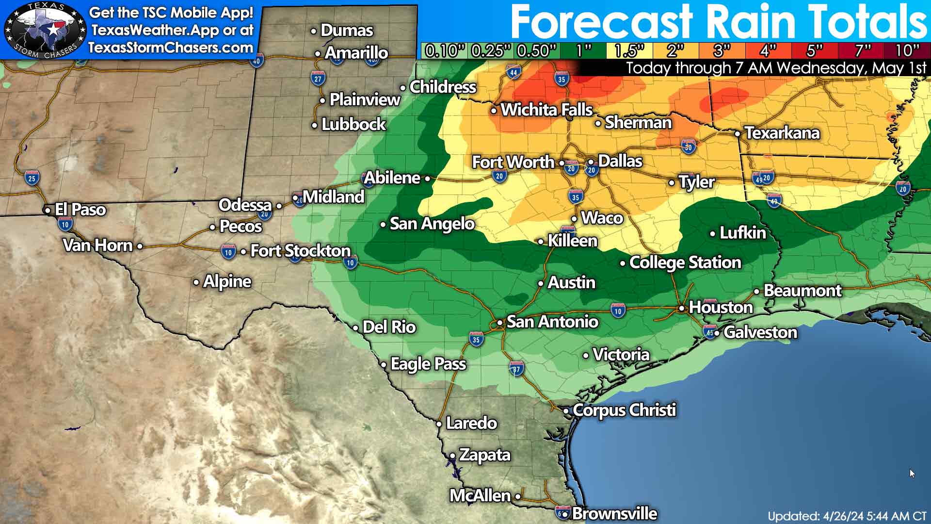
We anticipate storms to continue on Sunday into early next week across Texoma, North Texas, and Northeast Texas. Flooding will become a significant concern, with some risk of damaging winds and hail. Next week looks active, though we’ll probably switch from a spinny-spinny doom-doom risk to a hydrometeorological one (flooding, heavy rain). We’ll deal with the next several days, one day at a time. Let’s get through today, and then we can deal with tomorrow, etc.
Helpful Links
Check out our LIVE STREAM: https://texasweather.video/
Our FREE WEATHER APP: https://texasweather.app/
Our WEBSITE/RADAR: https://www.texasstormchasers.com
Our SOCIAL PLATFORMS: https://linktr.ee/texasstormchasers
0 Comments