
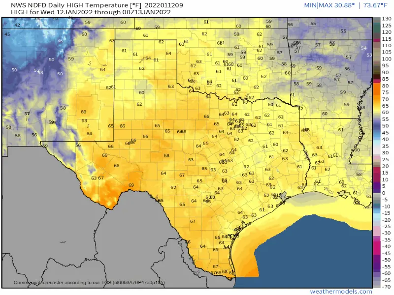
Last week I published a blog post indicating we were likely to see widespread rain across parts of Texas today through Friday. Fast-forward to ‘today,’ and it’ll be drier than a popcorn fart. Weather models evaporated our rain chances a few days ago. Unfortunately, we’re looking at dry weather for at least another week. Warm weather will continue across Texas through the end of the workweek. The upcoming weekend will feature an intrusion by crashy the cold front and strong northwest winds.
We’re looking at an extended period of above-average temperatures and no precipitation chances outside of this weekend’s brief return to winter. Winter-cured fuels, warm temperatures, and worsening drought conditions mean we need to be mindful not to set stuff on fire. If we don’t end up getting some big-time rains soon, we’re going to be in a world of hurt in the wildfire department across Texas by March.
Crashy, the Cold Front, Arrives on Saturday
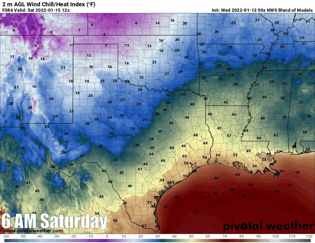
A strong cold front will bring gusty northwest winds on Saturday and Sunday to Texas. Temperatures will drop into the 30s, 40s, and 50s (colder north, warmer south). As shown above, wind chill temperatures will be ten to twenty degrees colder than the air temperature. It won’t be crazy cold, but we are looking at two days of ‘winter’ before we rapidly return to spring early next week.
Grass Fire Danger This Weekend
Gusty northwest winds of 35 to 45 MPH will accompany the cold front on Saturday and Saturday Night. Even though temperatures will be considerably colder, humidity values will remain on the low side behind the front. There will be an increased risk for fast-moving grass fires on Saturday after the cold front’s arrival. Winter-cured surface fuels across Texas mean we’ll have to be careful not to ‘light something off’ in the gusty wind conditions.
Maybe some snow flurries? Probably not.
It is hardly worth mentioning, but there is a low chance for some snow flurries Saturday Night in Northeast Texas. If we even see snow flurries, precipitation would be very light and not result in accumulations. In all likelihood, it’ll remain dry, windy, and cold into Sunday morning.
We’ll return to ‘spring’ and dry weather Monday through Wednesday. We may see a weather pattern change occur late next week – hopefully with precipitation chances accompanying it.


0 Comments