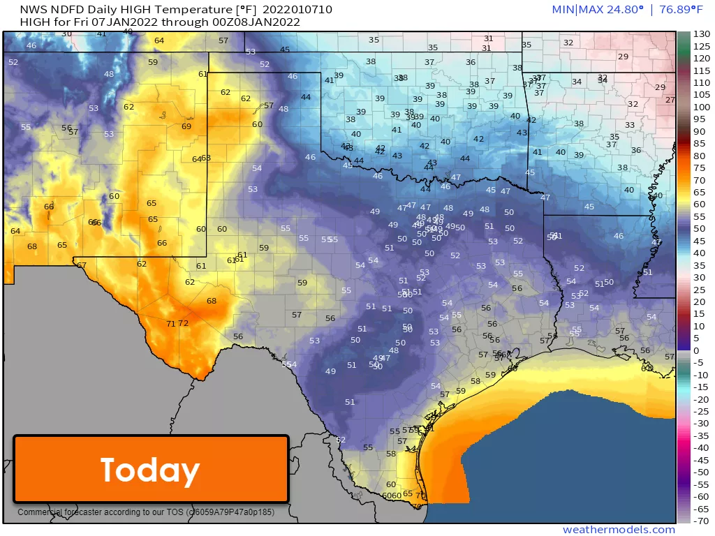
Temperatures are downright chilly this morning across a good chunk of Texas. We’ve got teens from the Permian Basin, Concho Valley, and western North Texas into the Panhandle and Texoma. Warmer weather fans will be happy to know we’re about to climb up the temperature roller-coaster.
It’s a Temperature Roller-coaster!
Today’s temperatures will be cool across the eastern two-thirds of Texas. Southerly winds will start pumping a warmer and more moist airmass north tonight. We could see drizzle and fog across several regions. Some fog may be dense.
Tomorrow will be much warmer with high temperatures ranging from the lower 60s up into the lower 80s – a good twenty to thirty-degree jump up compared to today. A cool front, not as strong as the last couple earlier this week, will bring temperatures back down to ‘seasonal norms’ late Sunday and Monday.
We’ll start slowly climbing the temperature roller coaster on Tuesday and Wednesday. Saturday, and for some, Sunday will be the warmest out of the next five to seven days. There will be an uptick in initial attack wildfire potential on Saturday and Sunday across the Texas Panhandle and West Texas.
Rain/Storm Chances Tonight – Sunday
Rain chances will increase tonight along the Southeast Texas coast and into South-Central Texas. A thunderstorm is possible closer to the coast. On Saturday, thunderstorm chances will increase across Southeast Texas as a more unstable airmass advects inland from the Gulf of Mexico.
Locally heavy rain and isolated severe storms are possible Saturday afternoon through Sunday morning. Localized damaging wind gusts, small hail, and a very low threat for brief/weak tornadoes are the hazards with the most intense storms. Widespread severe weather is not anticipated, but most folks in Southeast Texas will see some rain tomorrow through Sunday morning.
Rain chances will relocate into South Texas and the Rio Grande Valley Sunday night through Monday.
Rain chances Tuesday through Thursday
After a brief period of ‘less active weather,’ we’ll see precipitation chances begin on Tuesday in the western third of Texas. Perhaps on the more widespread side, Rain chances are possible across the eastern seventy-five percent of Texas on Wednesday and Thursday. Next week’s rain chances will not be a drought-breaker, but we may see one to two inches of rain in part of North and Northeast Texas. There are hints in weather-model voodoo land of another arctic cold front arriving late next week.


0 Comments