
A messy night of freezing drizzle, freezing rain, and a bit of sleet can be expected across a large chunk of Texas real estate.
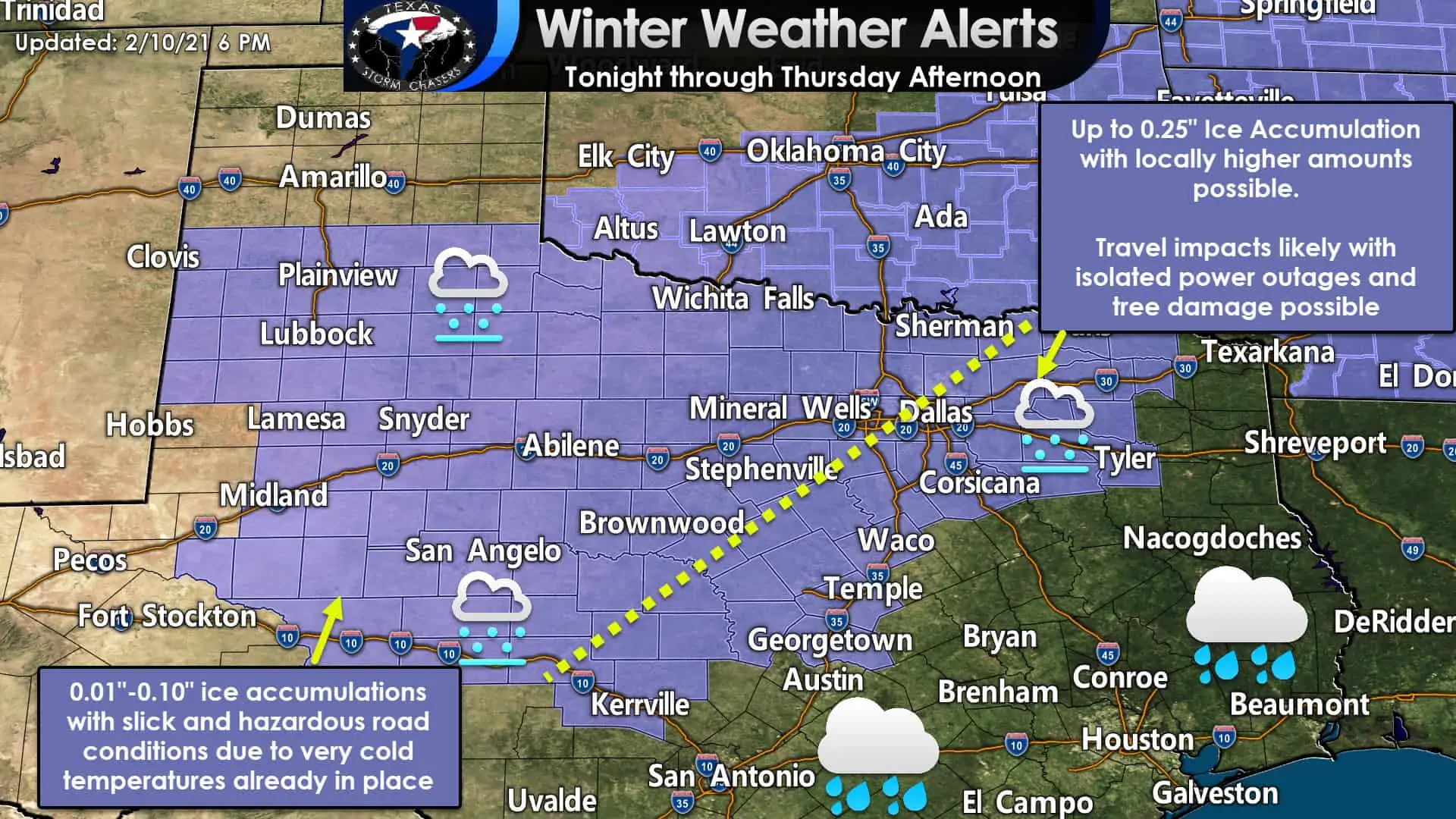
Winter Weather/Travel Advisories include West Texas, the eastern Permian Basin, the Concho Valley, Big Country, Northwest Texas, Hill Country, North Texas, and some of Central Texas. Plainview, Lubbock, Lamesa, Midland, Snyder, San Angelo, Kerrville, Brownwood, Abilene, Wichita Falls, Mineral Wells, Stephenville, Sherman, all of D/FW, Tyler, Paris, Waco, Temple, and Georgetown are a few cities included. A winter weather advisory means accumulations of ice are expected to cause travel difficulties tonight and on Thursday.
Most of the winter weather advisory can expect another night of freezing drizzle and light freezing rain. Temperatures tonight will be a couple of degrees colder, so hazardous road conditions are likely to extend farther south and east. Slick and hazardous roads are anticipated across the aforementioned regions due to the very cold airmass already in place.
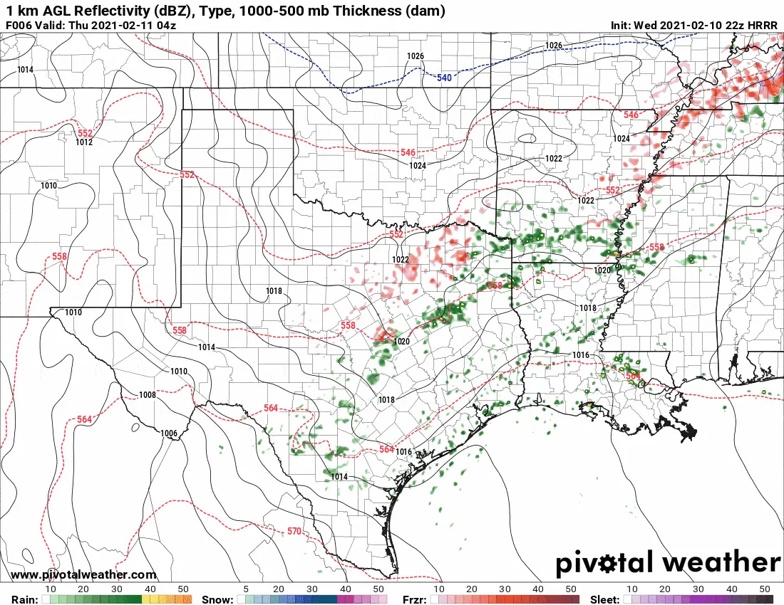
Simulated weather model radar for tonight and Thursday morning. The pinks delineate potential freezing rain. Freezing drizzle will be too light to show up on this simulation but will cause slick roads across the advisory area.
Sub-freezing temperatures will be juxtaposed with heavier freezing rain from a line near Kerrville to Temple and Waco northeast to Corsicana and Paris. There is the potential for heavier ice accumulations to around one-quarter of an inch on elevated surfaces. In addition to turning bridges and overpasses into skating rinks, those higher ice accumulations may be enough to cause isolated power outages and tree damage on Thursday. If temperatures can remain in the 31-32 degree range where heavier rains fall, we might be able to keep things from getting too out of hand.
Showers and a few thunderstorms are likely on Thursday across the southeastern half of Texas. Severe weather is not expected, and recent dry weather should allow soils to absorb most rains without flooding becoming an issue.
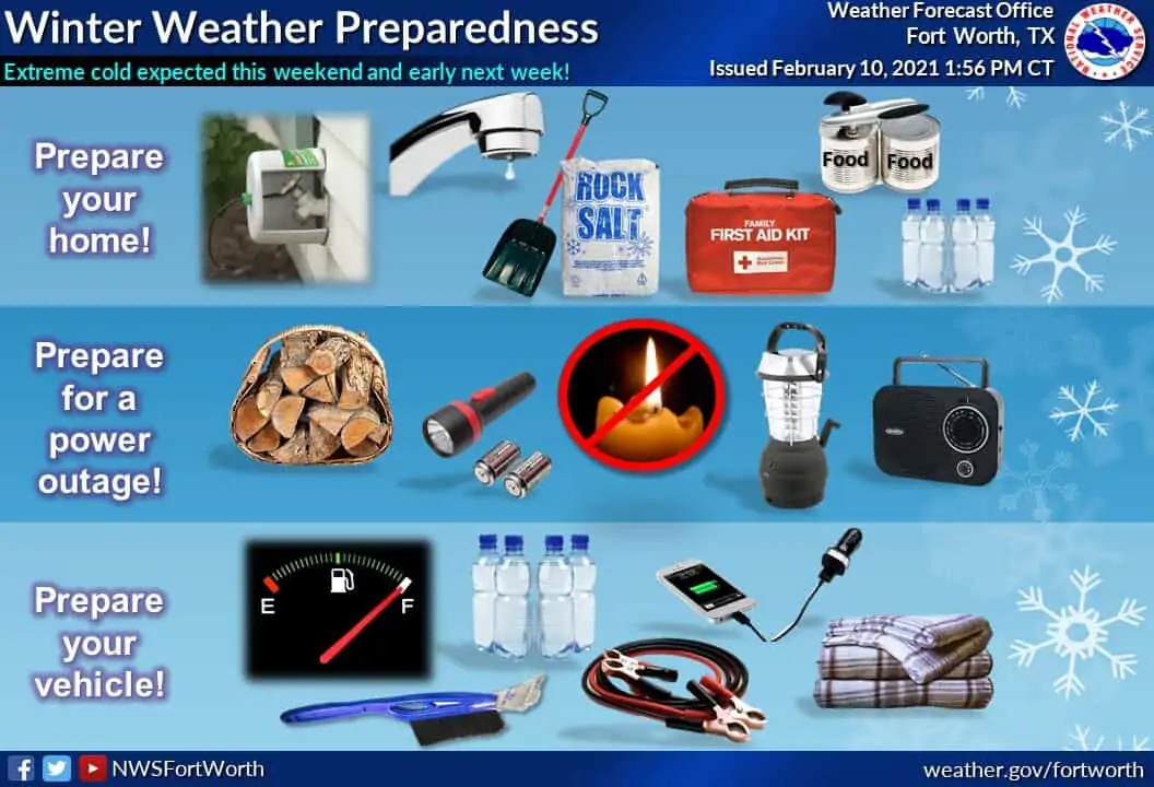
Frigid air will arrive this weekend across all of Texas. Sunday and Monday will be the coldest, with the potential for record-breaking low temperatures. Some may remember the super bowl week of 2011 or the arctic outbreak of 1989. We’re forecasting similar conditions this weekend and at least the first several days of next week. Your smartphone’s weather app is probably throwing out all sorts of temperature numbers, but needless to say, it’s going to be very cold.
Winter Storm Outlook for Sunday and Monday
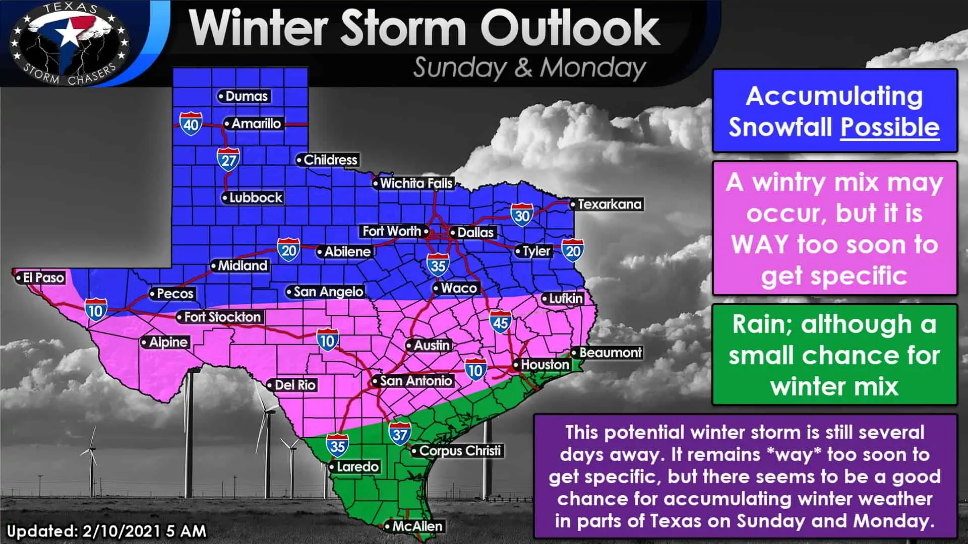
Confidence is increasing that a winter storm will impact at least the northern half of Texas. It will start sometime Sunday in western sections of the state and progress eastward Sunday Night and Monday. Given the arctic airmass expected to be in place, significant snow accumulations appear possible. Please understand we’re talking about a potential winter storm several days away. It is difficult enough forecasting winter weather in Texas inside of twenty-four hours.
We are not putting out specific accumulation numbers at this point. Perhaps we’ll do so tomorrow morning after we get through tonight’s system. A mixed bag of winter precipitation could also occur south to the Gulf Coast and in portions of South Texas. Again, we’ll deal with the Sunday and Monday system after tonight, but it could be an impactful winter storm with strong northerly winds…


0 Comments