
Significant severe thunderstorms are possible across parts of Texas today. All modes of severe weather are on the table. Tornadoes, very large hail, damaging wind gusts, and flooding are hazards. There is a chance some tornadoes may be strong (EF2+).
Isolated storms were already underway at 7:30AM in the southeastern Texas Panhandle. A tornado watch was in effect for that area through the late morning. Those storms will likely move into western Oklahoma soon, and they may become severe and an all-hazard threat by mid-morning.
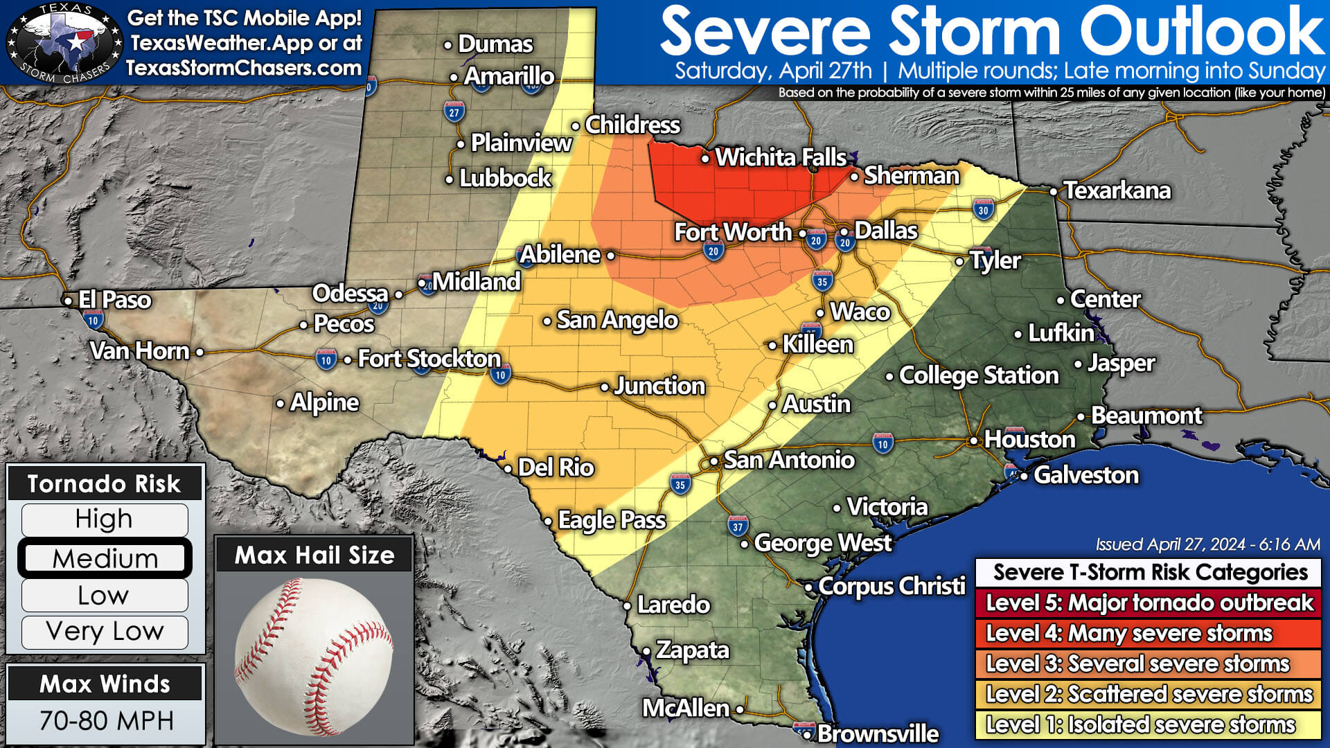
Back in Texas: There is a conditional threat of isolated supercell thunderstorms in portions of the Big Country, Texoma, and North Texas late this morning through the afternoon. Yesterday’s thunderstorms may have left outflow boundaries. Those boundaries can be focal points for thunderstorms to develop on, much like the dryline, if the cap becomes weak enough. It is not guaranteed we’ll see these storms develop. However, if they do, significant severe weather will be possible. Storms would move northeast.
By early to mid-afternoon, scattered severe thunderstorms are expected to develop east of a dryline in Northwest Texas into western Oklahoma. These storms will move northeast with a substantial all-hazards severe weather threat. We’ll need to monitor areas farther south into the Big Country in case the dryline lights off there, too.
This evening, a line of strong to severe thunderstorms will erupt along the dryline/cool front from Del Rio in the Edwards Plateau north into Kansas. This nearly solid line of thunderstorms will move east across Northwest Texas, Texoma, Big Country, Concho Valley, Edwards Plateau, Central Texas, and North Texas by sunrise Sunday. Some storms in the squall line will be severe, with damaging winds, large hail, embedded spin-up tornadoes, and heavy rainfall.
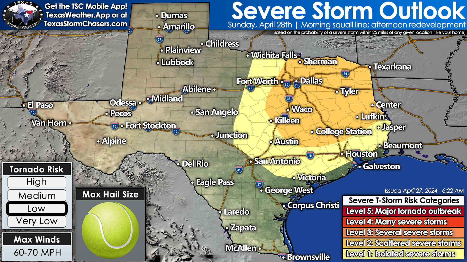
The threat of storms will continue into Sunday across the eastern half of Texas. Some storms may be severe and produce heavy rainfall capable of causing flooding.
We’ll post multiple updates as soon as possible (either by video or by community post). Once we begin severe weather coverage later this morning or by late afternoon, we expect to keep it going until late tonight or Sunday morning.
Helpful Links
Check out our LIVE STREAM: https://texasweather.video/
Our FREE WEATHER APP: https://texasweather.app/
Our WEBSITE/RADAR: https://www.texasstormchasers.com/radar
Our SOCIAL PLATFORMS: https://linktr.ee/texasstormchasers
0 Comments