
Mother Nature wants to remind us that we’re not quite done with summer just yet. We will see a cold front arrive late Wednesday to knock temperatures down a bit, but its effects will only be temporary and we’ll be right back up to above normal for the weekend and possibly into early next week as well. Rain chances overall look pretty slim this week. We will see a chance for showers across southeast Texas tomorrow, and a chances Thursday into Friday behind the front as a weak upper level disturbance arrives, but overall accumulations will be light and really nothing to write home about.
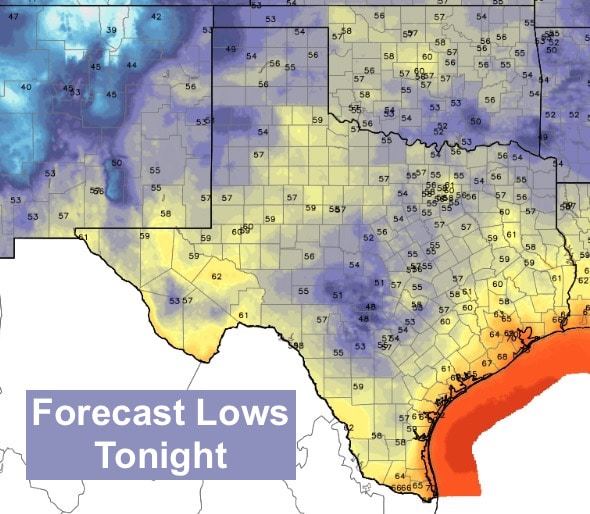
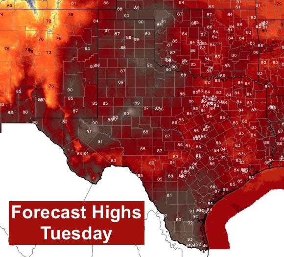
Lows tonight will be mild and in the 50s for much of the state. Warmest spots will be right along the coast where upper 60s to low 70s will be about as far as temps drop tonight. For tomorrow, I wouldn’t be surprised to see a few places in the panhandle, rolling plains and western Texas see highs reach 90 by mid-afternoon. Deep south Texas will also see highs climb into the low to mid 90s with the remainder of the state reaching the mid 80s. Definitely a good 5 to 10 degrees above where we should be by this time of the year.
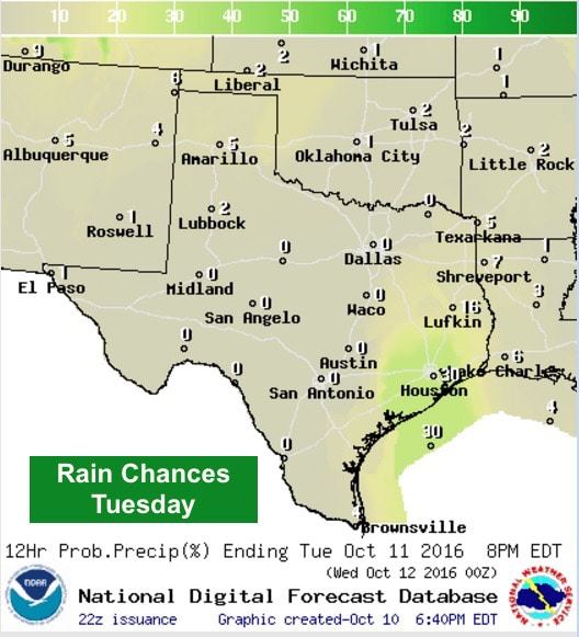
Best rain chances tomorrow will be across southeast Texas in and around the Houston/Galveston/Victoria areas. Scattered showers and storms are forecast to develop offshore during the overnight hours and slowly work their way inland during the day tomorrow. Severe weather is not expected, but a strong storm or two with gusty winds, lightning and localized heavy rain is not out of the question during peak heating tomorrow afternoon. Just something to keep in mind if you have outdoor plans tomorrow afternoon.
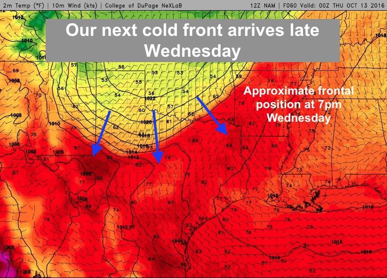
Our next cold front arrives Wednesday saying “Howdy” to the panhandle area first during the early part of the day, then continuing to push south Wednesday evening through early Thursday. At this time, the front does not look robust enough to reach the coast and will likely stall out and dissipate across central Texas by Thursday evening. The front also looks like it will arrive dry with the best chances for rain not until Thursday into Friday behind the front as a couple of weak disturbances move in over us. We’ll have more details on rainfall chances and amounts as we get closer to Thursday, so be sure to check back!


0 Comments