
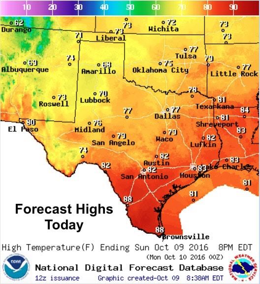
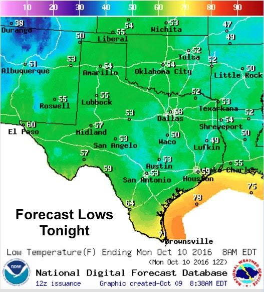
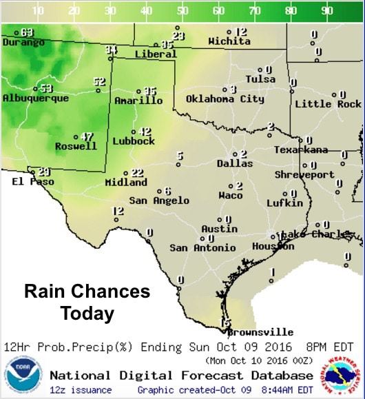
One more day of temps slightly below average across much of the state before we begin to warm back up before the arrival of a mid-week cold front. Scattered rain will continue to affect parts of far western Texas and the panhandle region today as a couple of weak upper level disturbances advance eastward across New Mexico. Clouds will likely hang around all day across these regions and we’ll see highs today struggle to get into the 70s. Further east into north, central and eastern Texas, we’ll see much more sunshine and highs in the upper 70s. For southeast, south central and south Texas, we’ll be warmer today with highs in the 80s to low 90s for deep south Texas. With relatively dry air remaining in place across the eastern half of the state, lows will have a chance to dip down into the 50s overnight…with a few places possibly dropping into the upper 40s before daybreak tomorrow. The western half of the state with higher moisture content and residual cloud cover overnight will see lows in the upper 50s to low 60s.
Again, best chances for rain today will reside across the panhandle and far western Texas aided by a couple of disturbances off to the west across New Mexico. We may see some stronger storms develop across the New Mexico plains this afternoon which will approach the TX/NM border, but severe weather is not expected to impact Texas this afternoon or evening.
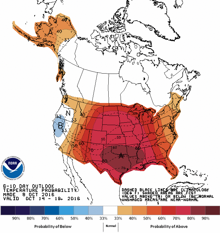
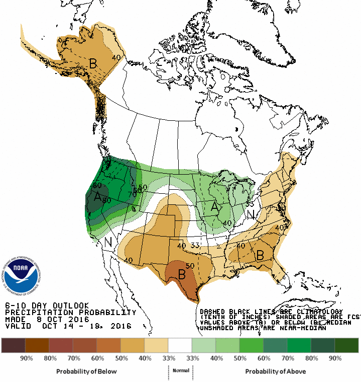
A look ahead – We’ll warm back up this week with highs expected to be higher than average until our next cold front arrives Wednesday-Thursday. Unfortunately, this front looks like it will be pretty weak and will likely stall out somewhere across northern Texas providing no cooling benefits for those in the southern half of the state. We will have some rain chances with the front by Thursday through Friday as an upper level disturbance arrives after the front has passed. Severe weather those days does not look too likely at this time, but we’ll have to monitor for changes in the forecast during the week ahead. Going into next weekend and beyond, the forecast looks to stay warmer than average and drier than average which means we’ll have to wait a bit longer for some more serious fall weather.

0 Comments