
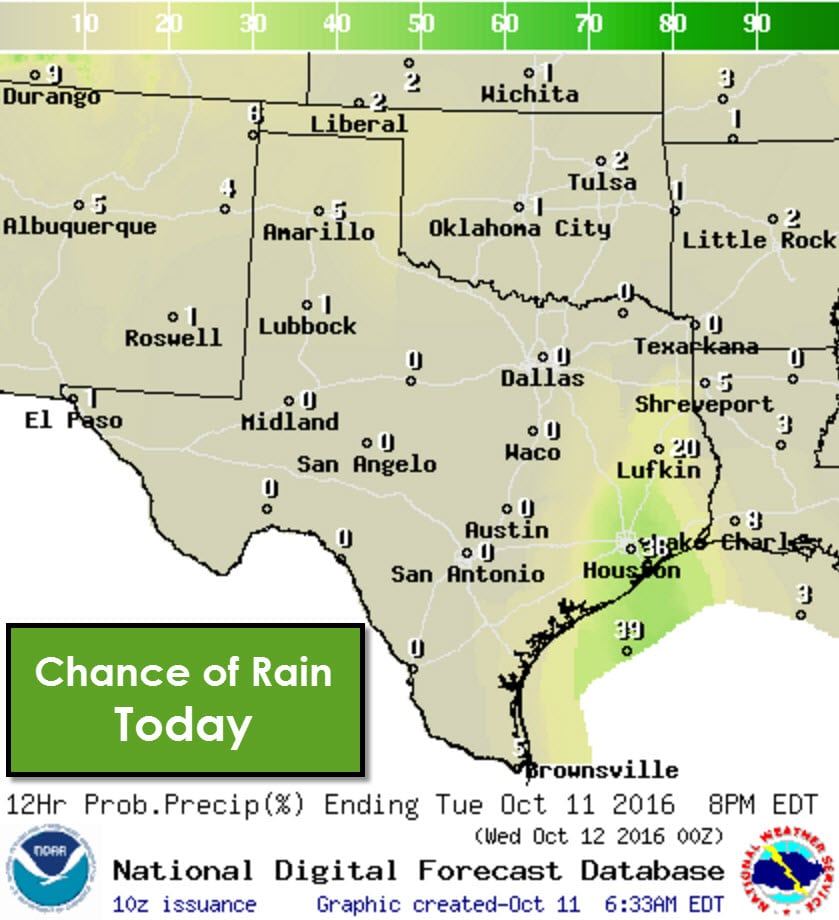
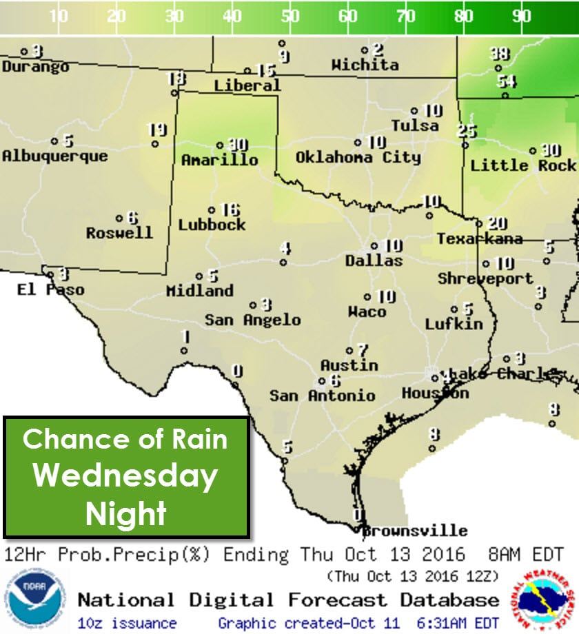
Showers are already moving into parts of the Houston metro this morning. These showers are producing locally heavy rain which will undoubtedly cause morning rush-hour difficulties. These showers will continue into the afternoon hours as new activity moves inland from the Gulf. Scattered showers with a few storms are expected to continue most of the day in Southeast Texas. A shower or two may make it as far north as Interstate 20 in East Texas. Severe weather is not anticipated, but a few storms may produce brief gusty winds. Activity should dwindle by the early evening with the loss of daytime heating. Tonight and much of Wednesday is looking mostly dry across Texas.
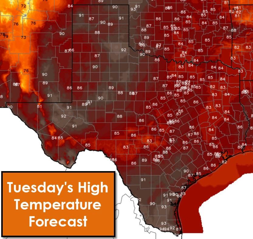
Temperatures will remain near or above average for mid-October today. High temperatures will range from the middle 80s up into the middle 90s. Winds will generally be out of the south with gusts up to 20 MPH. Those winds will veer to the southwest in the Panhandle into West Texas. Moisture levels will be on the increase as well into tonight.
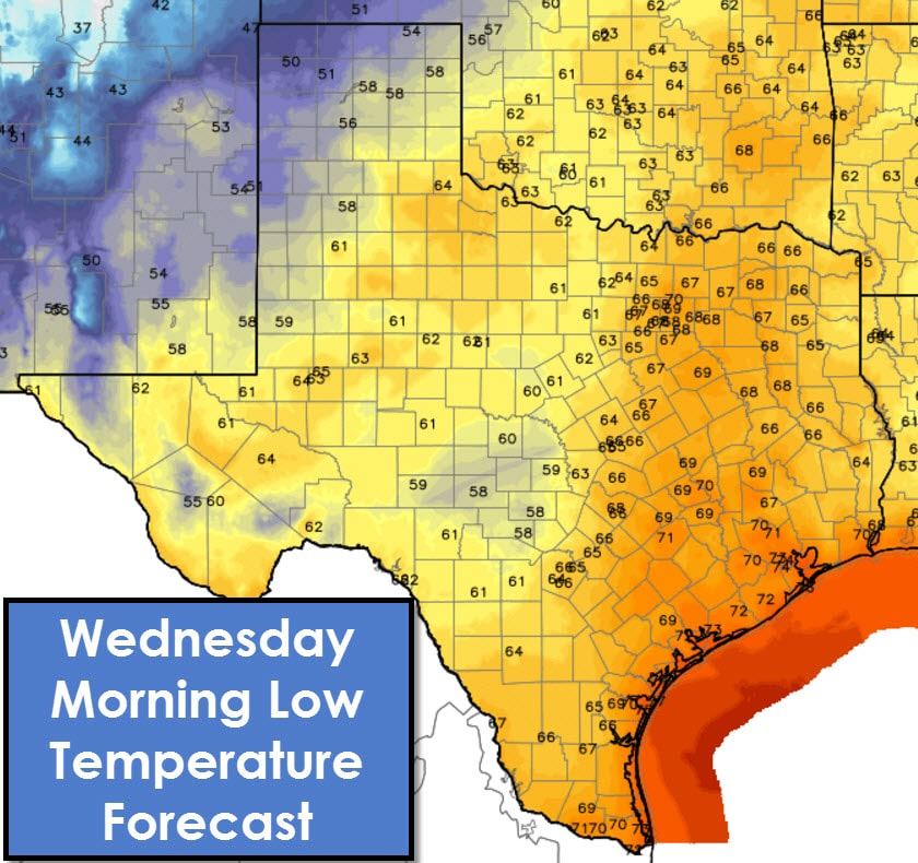
With increasing moisture and south winds we’re expecting a warm Tuesday night. Temperatures won’t make it below the middle to upper 60s across the eastern half of Texas. A few more protected areas may be a tad cooler. Southeast Texas, the Middle Texas Coast, Brazos Valley, into South Texas, and the Rio Grande Valley will only bottom out in around 70 degrees tonight. Fog – some locally dense – is a good bet for a few hours Wednesday morning in those locations as well.
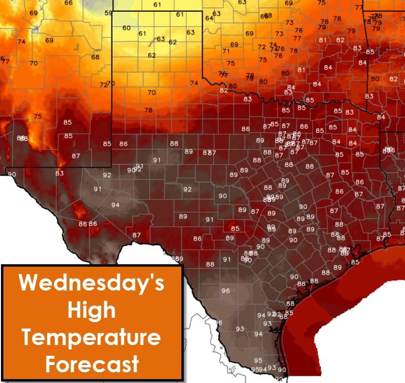
A cool front will begin making progress south into Texas on Wednesday. For a majority of the state temperatures will remain above average with middle 80s to middle 90s. The exception will be in the Texas Panhandle and West Texas. Depending on the front’s timing some of these temperatures may need to be adjusted. It looks like the Panhandle will struggle to climb above the lower 60s tomorrow with a sharp transition from the upper 60s to the lower 90s in West Texas.
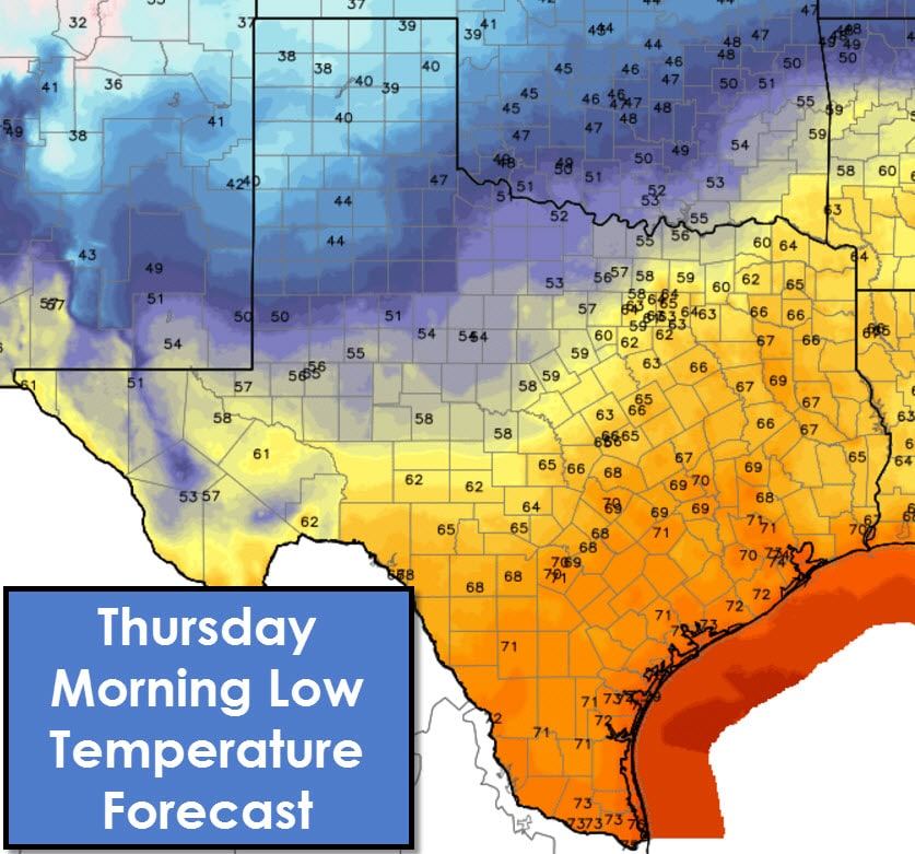
The front will move south into the Permian Basin, Big Country, into North Texas Wednesday evening. Temperatures will bottom out in the 30s in the Panhandle with 40s to lower 50s into the Big Country and Northwest Texas. Temperatures south of the front will remain warm with humid conditions. Fog is likely again in the Rio Grande Valley, South Texas, Southeast Texas, into parts of Central Texas and East Texas.
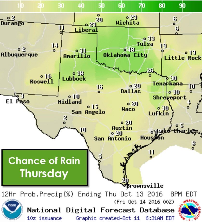
Drizzle and showers will be possible Wednesday Night in the Texas Panhandle as we start to see increasing lift. Even though surface temperatures will be cool we will have a layer of more warm, moist air a few thousand feet above the ground. By Thursday we’ll see scattered showers increase across West Texas east along the Red River through Texoma into Northeast Texas. Low rain chances are possible in North Texas, Central Texas, and South Texas.
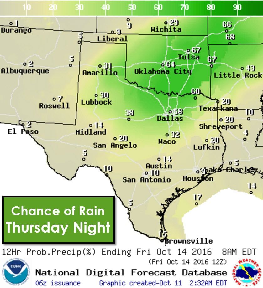
It isn’t until Thursday Night when we’ll see rain chances become more likely across portions of the state. The best chance for rain will be north of the stationary front sitting near Interstate 20 from the Big Country into North Texas. The best chance of rain will be in the eastern Texas Panhandle, West-Central Texas, Big Country, Northwest Texas, North Texas, into Northeast Texas. A few storms may also develop during this timeframe.
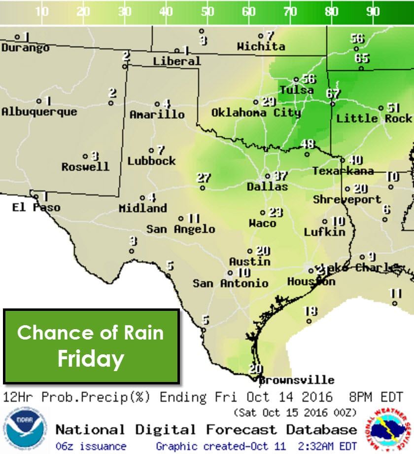
By Friday isolated to scattered showers and storms will remain possible from the Big Country east through North Texas and Northeast Texas.
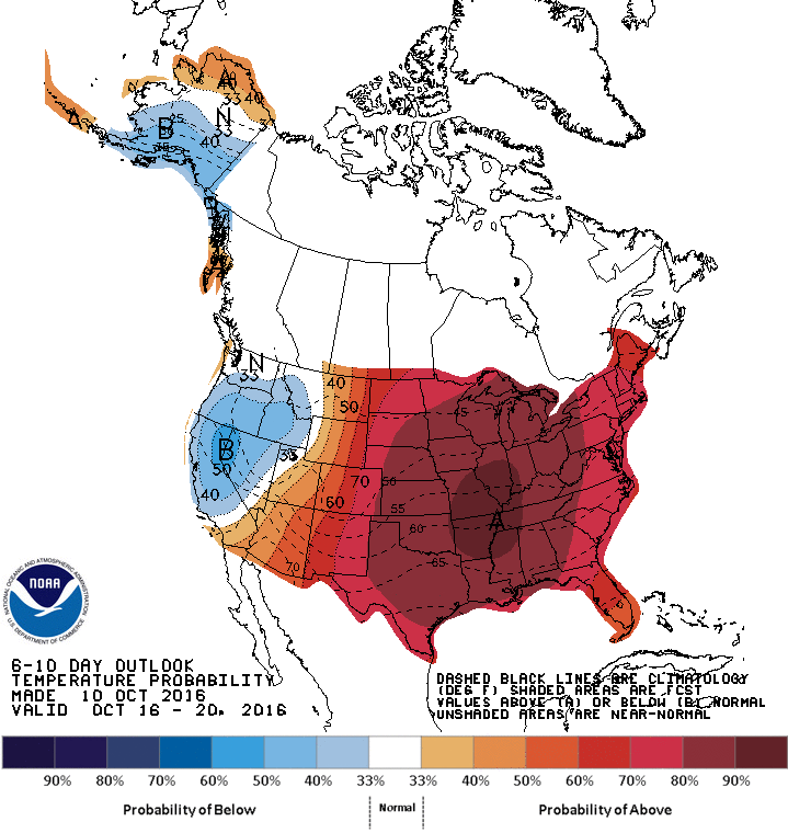
More clouds plus a shallow layer of cooler air behind the front should allow for fall-like weather on Thursday across the northwest half of Texas. Folks in the southeast half of Texas will be stuck with the above-average heat with humidity. The front will stall out somewhere in Central Texas on Thursday. By Thursday Night and Friday the front will dissipate – or move back north as a warm front. The result will be a rapid warm up as we head into the weekend with above-average temperatures in the 80s and 90s. Above-average temperatures look to continue into next week as indicated by the Climate Prediction Center’s outlook.

0 Comments