
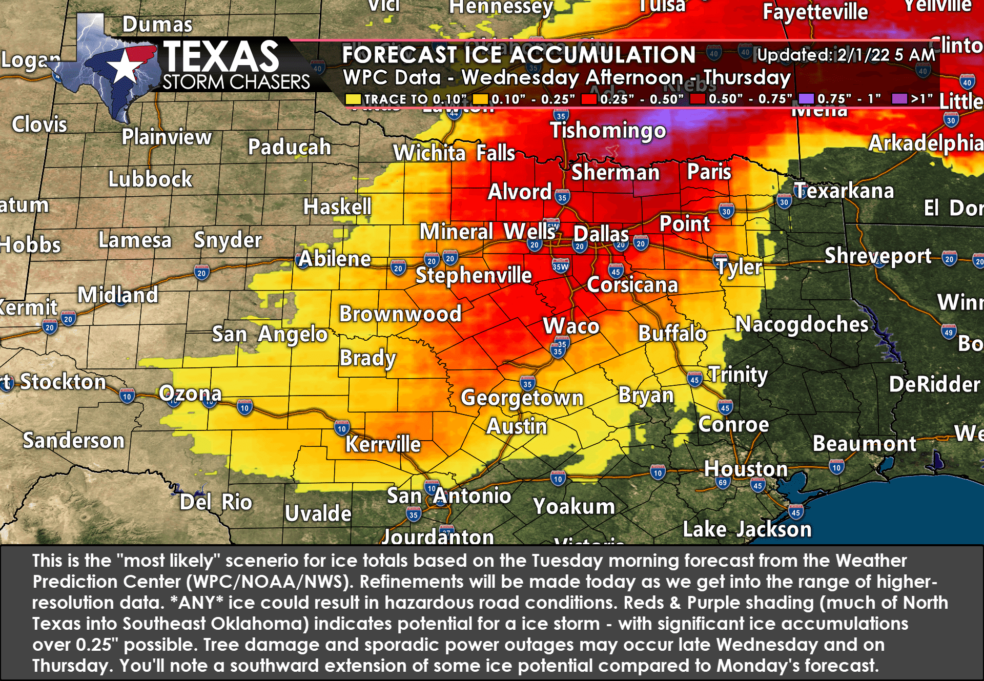
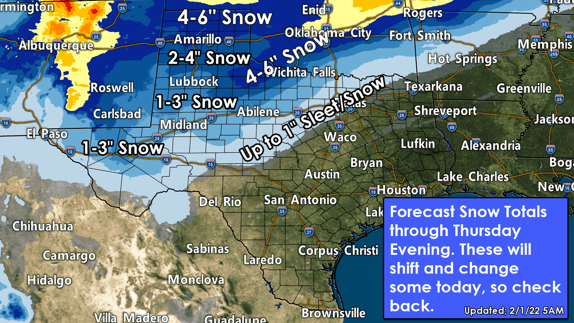
We have not seen many changes to the forecast since my detailed discussion yesterday afternoon. Last evening, Jason Cooley put together an excellent live stream that went over the upcoming setup. I believe he plans to do one again later this morning or early this afternoon. I’ll also have a detailed written discussion this afternoon with the latest timing and accumulation changes. The newest accumulation forecast graphics are below. A Texas Winter Storm remains likely to bring hazardous travel conditions and perhaps some power outages (from ice/tree damage, not the overall power grid – that isn’t our department).
Tuesday Morning Notes & Discussion on Upcoming Winter Storm
While we’ve been focused on the winter storm potential, I want to reiterate that a frigid air mass will be moving into Texas beginning late tonight in the Panhandle and moving south through all of Texas by Thursday morning. We’ll see cold mornings through the weekend. It is not a February 2021 repeat in duration or intensity, but it will still be freezing with dangerously low wind chills.
We are also becoming a bit more concerned with the delay in temperatures rising above freezing in the hardest-hit areas. Where we have significant ice or snow accumulations, we may not rise above freezing until Sunday. Those without substantial accumulations should be above freezing by Friday afternoon, with high temperatures in the 40s on Saturday.
The threat of winter weather will begin late tonight across the Texas Panhandle and West Texas. Winter weather will spread east on Wednesday – and the speed of the ‘freezing line’ will also be an essential factor we’ll be watching.
I am becoming more concerned about a full-blown ice storm across portions of Southeastern Oklahoma, Texoma, and North Texas Wednesday night and Thursday. With strong north winds gusting over 30 MPH, areas that see ice accumulations over one-quarter inch could be dealing with tree damage and power outages. We’ll hit that point harder this afternoon if it becomes apparent that’s going to be a significant issue.
Winter precipitation will be most widespread Wednesday Night and the first half of Thursday across the impacted regions. We’ll see a decrease in precipitation intensity and coverage Thursday afternoon as the upper-level storm system departs. Light snow may continue Thursday Night and into Friday morning across the Panhandle, Northwest Texas, Texoma, and much of Oklahoma.
For the latest forecast for your specific area, visit the National Weather Service’s website at weather.gov (or click the link)


0 Comments