
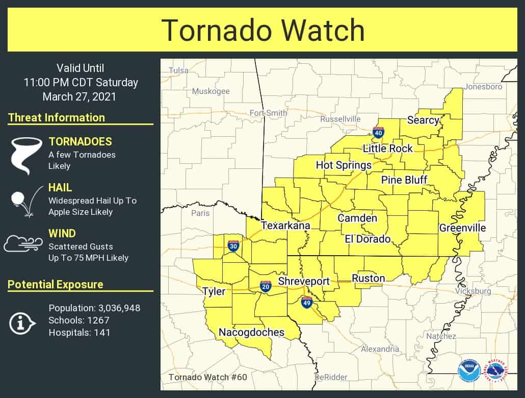
A tornado watch has been issued until 11 PM for much of Northeast Texas and East Texas. The tornado watch runs east of a line from Mount Pleasant to Tyler to Nacogdoches. Very large hail up to the size of baseballs, localized damaging wind gusts over 70 MPH, and a tornado would be possible with the strongest storms.
Isolated supercelluar thunderstorms could begin developing any time now through the early evening. Thunderstorm coverage, or the number of thunderstorms, will not be high. However, those storms that do develop could become supercelluar. Storms will tend to move east/northeast, but we may see some deviate from ‘left’ or ‘right’ (move more northeast or east).
Large to very large hail seems to be the primary hazard this evening in Texas. While there is a tornado threat, the comparatively higher risk for tornadoes seems to be in Southern Arkansas. Of course, if we have one tornado in Texas today and it comes down your street, today is a huge deal for you. Keep an eye on the sky and have a way to receive severe weather warnings.
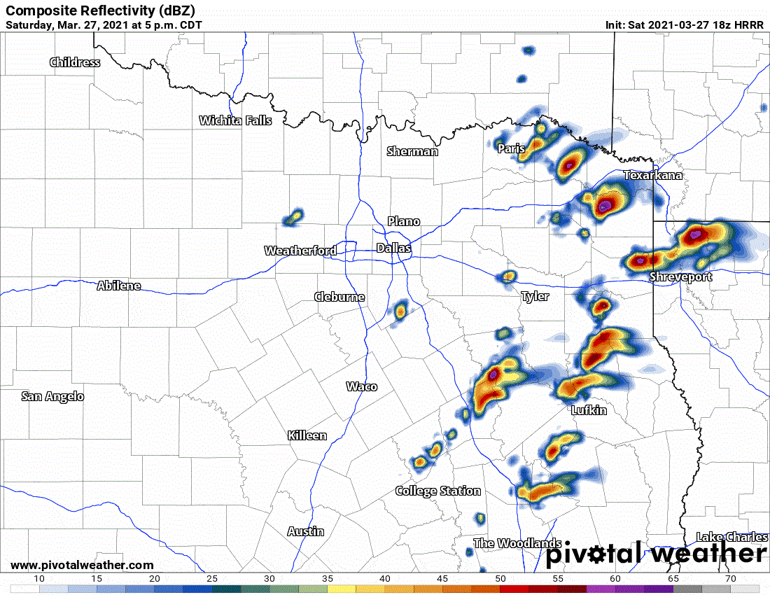
Simulated weather model radar from the 1 PM high-resolution rapid refresh (HRRR) model for this evening.
More storms may fire up this evening in East Texas, with a risk of some being strong. We could also see a few stronger storms fire up west near Interstate 35 in North Texas this evening.


0 Comments