
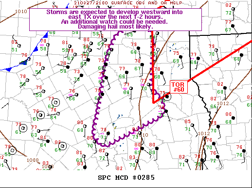
The Storm Prediction Center is monitoring portions of eastern North Texas, East Texas, and the northeastern Brazos Valley for another severe weather watch. It looks like they’re eying along and east of a Terrell to Madisonville line. Overall storm coverage looks to remain on the low side. However, any storms that get going to become severe with a threat of damaging hail. A brief tornado can’t be ruled out, but the higher tornado threat looks to be closer to Texarkana, Shreveport, into southern Arkansas.
Mesoscale Discussion 0285
NWS Storm Prediction Center Norman OK
0434 PM CDT Sat Mar 27 2021
Areas affected…parts of east Texas
Concerning…Severe potential…Watch possible
Valid 272134Z – 272330Z
Probability of Watch Issuance…60 percent
SUMMARY…Storms are expected to form into east Texas over the next
few hours, with primarily a damaging hail threat. A brief tornado is
also possible.
TECHNICAL DISCUSSION…Strong instability has developed over the region, with
MLCAPE in excess of 2000 J/kg beneath strong southwesterlies aloft.
This area is well ahead of the cold front, currently over southern
OK into northwest TX. Only minor capping exists near 700 mb, and it
is expected that the convection developing northwest of Houston will
continue to deepen and eventually become severe southeast of the
Metroplex. Low-level winds and shear are a bit marginal for a
tornado threat, but supercell storm mode may favor a brief tornado
given strong updrafts. Hodographs are quite elongated, and will
support supercell storm mode favoring large, damaging hail this
evening after 23-00Z.


0 Comments