
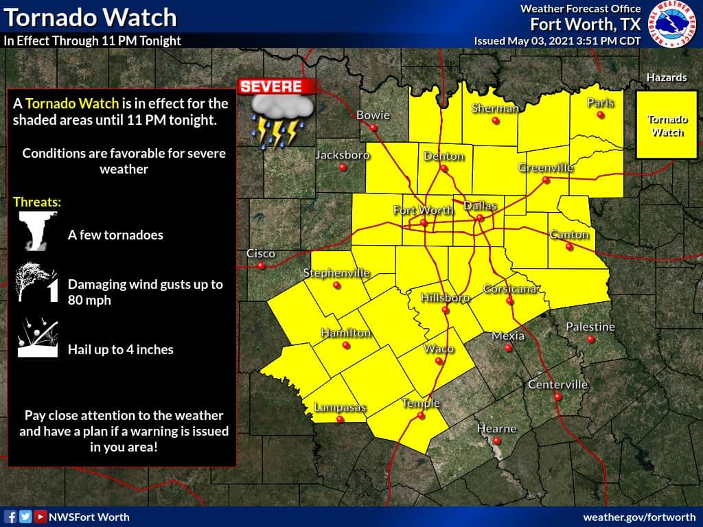
The Storm Prediction Center has issued Tornado Watch #133 until 11 PM for all of North Texas. This watch includes Fort Hood, Waco, all of the D/FW Metroplex, up to Paris. Additional weather watches are probable later this evening for Northwest Texas (for storms in West Texas moving east) and for Northeast Texas (for two rounds of storms). The strongest storms in North Texas this evening may produce giant hail up to the size of softballs, localized hurricane-force winds gusts up to 80 MPH, and a few tornadoes. Remain weather aware and keep an eye on the sky. We’ll be live streaming chase video on our YouTube channel (which will add a post on our site) and live digital severe weather coverage (which will add another post here on the site).
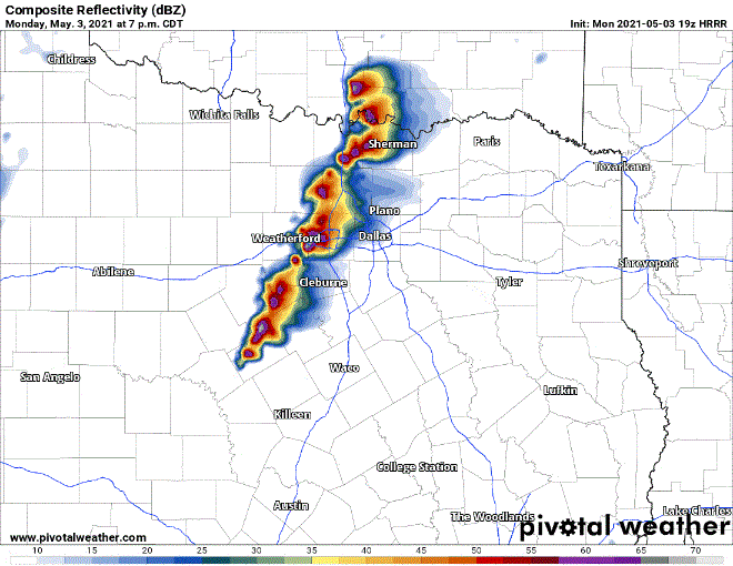
Simulated weather model radar from this evening through Tuesday morning.
URGENT – IMMEDIATE BROADCAST REQUESTED
Tornado Watch Number 133
NWS Storm Prediction Center Norman OK
350 PM CDT Mon May 3 2021
The NWS Storm Prediction Center has issued a
* Tornado Watch for portions of
Southeast Oklahoma
North-central Texas
* Effective this Monday afternoon and evening from 350 PM until
1100 PM CDT.
* Primary threats include…
A few tornadoes likely with a couple intense tornadoes possible
Scattered damaging winds and isolated significant gusts to 80
mph likely
Scattered large hail and isolated very large hail events to 3.5
inches in diameter likely
SUMMARY…Intense supercells are expected to initiate along the
dryline in north-central Texas and the surface front in southeast
Oklahoma by about 6 PM CDT. Very large hail will be the primary
initial threat, but tornadoes and significant severe winds will be
possible as well. Supercells should grow upscale into one or more
clusters with an increasing risk of damaging winds this evening.
The tornado watch area is approximately along and 60 statute miles
east and west of a line from 10 miles northeast of Muskogee OK to 40
miles southwest of Waco TX. For a complete depiction of the watch
see the associated watch outline update (WOUS64 KWNS WOU3).
PRECAUTIONARY/PREPAREDNESS ACTIONS…
REMEMBER…A Tornado Watch means conditions are favorable for
tornadoes and severe thunderstorms in and close to the watch
area. Persons in these areas should be on the lookout for
threatening weather conditions and listen for later statements
and possible warnings.


0 Comments