
Thunderstorms are making a ruckus across the Ark-La-Tex and East Texas this morning. Some storms have produced large hail up to the size of ping-pong balls. Most activity is moving to the east. We’ll see the primary source of lift depart the region by late morning, ending our stormy mischief.
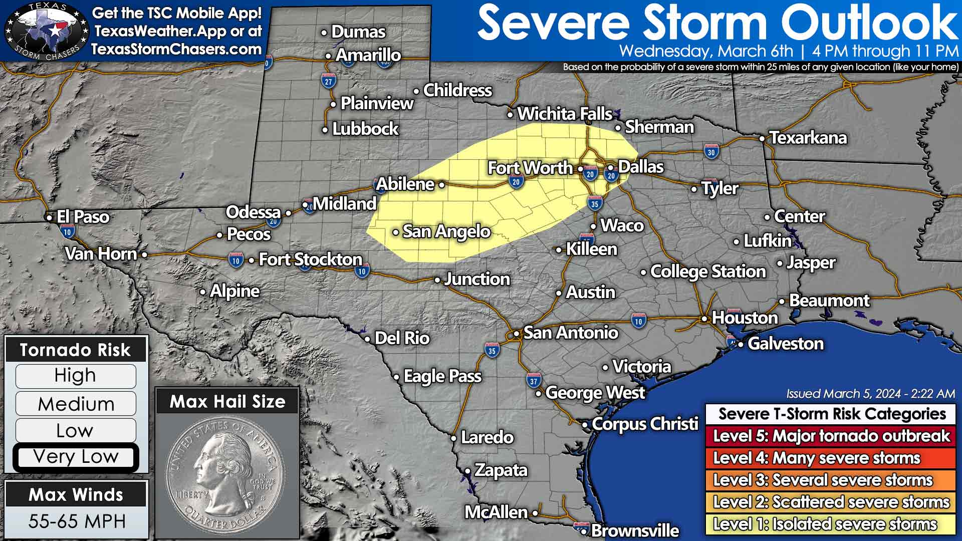
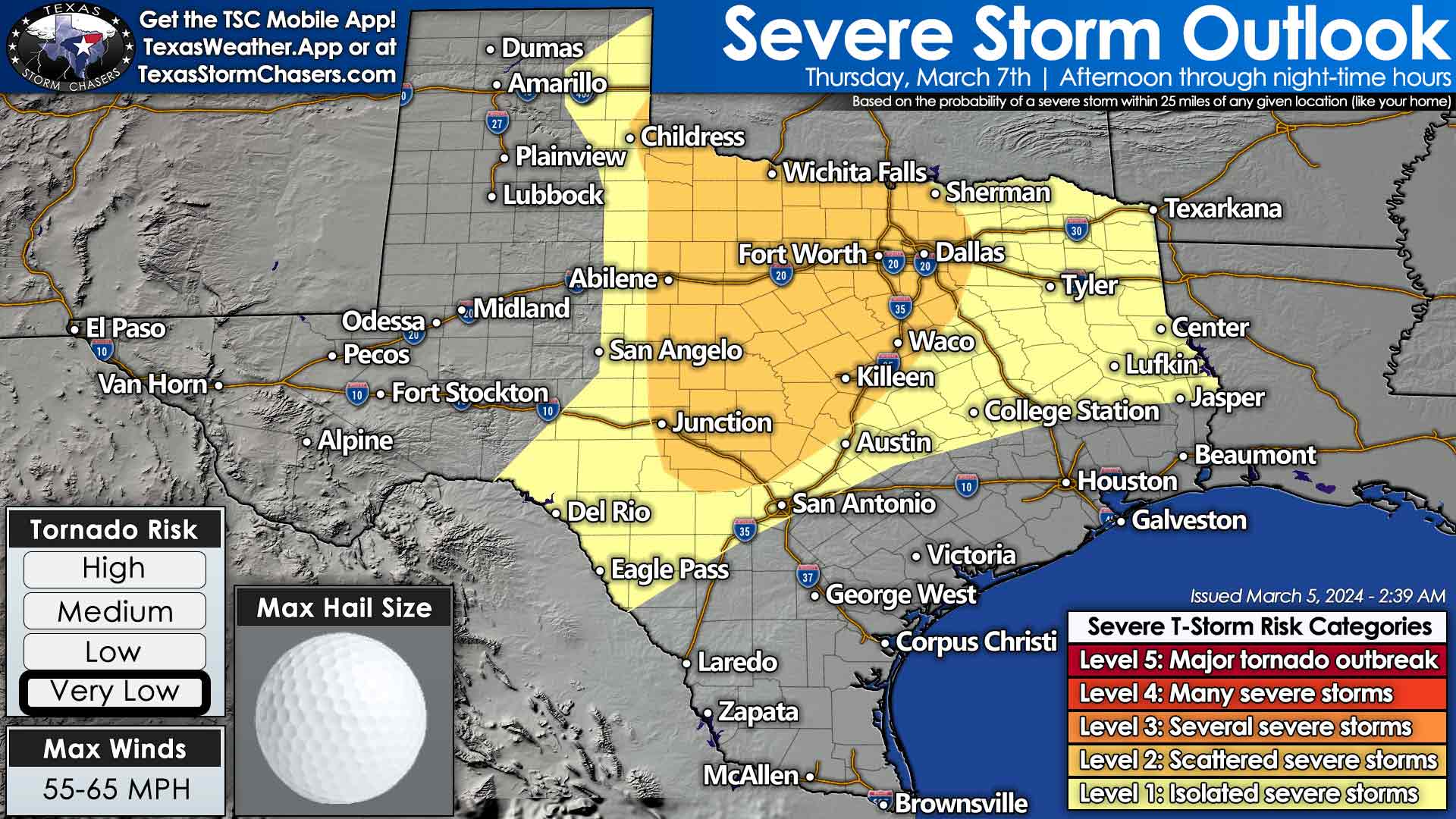
Active weather will continue for the remainder of the work week. We expect isolated thunderstorms to develop east of a dryline Wednesday afternoon in the Big Country and Concho Valley. There may not be many storms, but those that get going could produce large hail. If those storms develop, they would likely move toward North Texas during the early evening hours. Scattered thunderstorms will be possible by Thursday morning across the eastern two-thirds of Texas. Another round of stronger thunderstorms are expected Thursday afternoon into Thursday evening across the eastern half of Texas. These storms will likely be more numerous than Wednesday and could have strong winds and large hail.
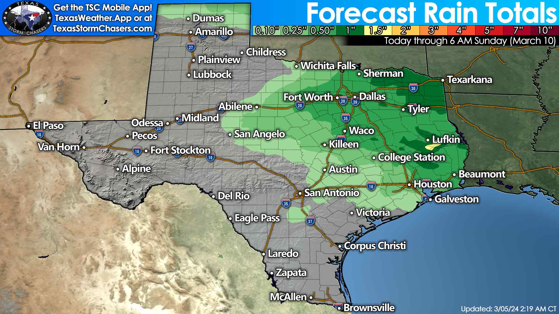
The upper-level storm system responsible for Thursday’s round of storms is still off the West Coast. Once the system moves onshore later tonight into Wednesday morning, we can start narrowing down the specific timeline, locations, and threats. Storms may continue across the eastern third of Texas on Friday. One to two inches of rainfall will be possible across the eastern third of Texas through Sunday, with a few hundredths to two-tends of an inch possible in Texoma, the Big Country, Concho Valley, Hill Country, and the northern Texas Panhandle.
Some snow may occur on Friday in the Texas Panhandle. The prospect for winter weather will highly depend on the track of the upper-level storm system. Minor snow accumulations can’t be ruled out, but we’ll need to pin down more specifics before we know much more. A decent cold front will push southeast on Friday into the northwestern half of Texas. It’ll be much cooler behind the front with north winds. That cooler weather will continue into the weekend, with some slightly cooler air entering the southern half of Texas.

0 Comments