
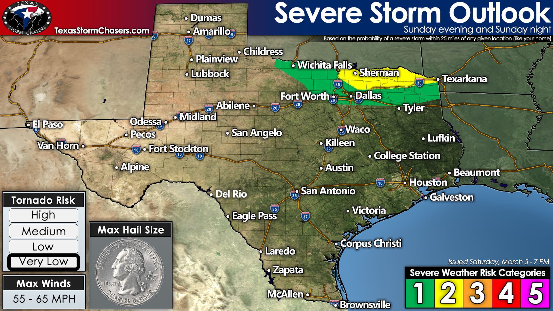
Severe Weather Threats on Sunday
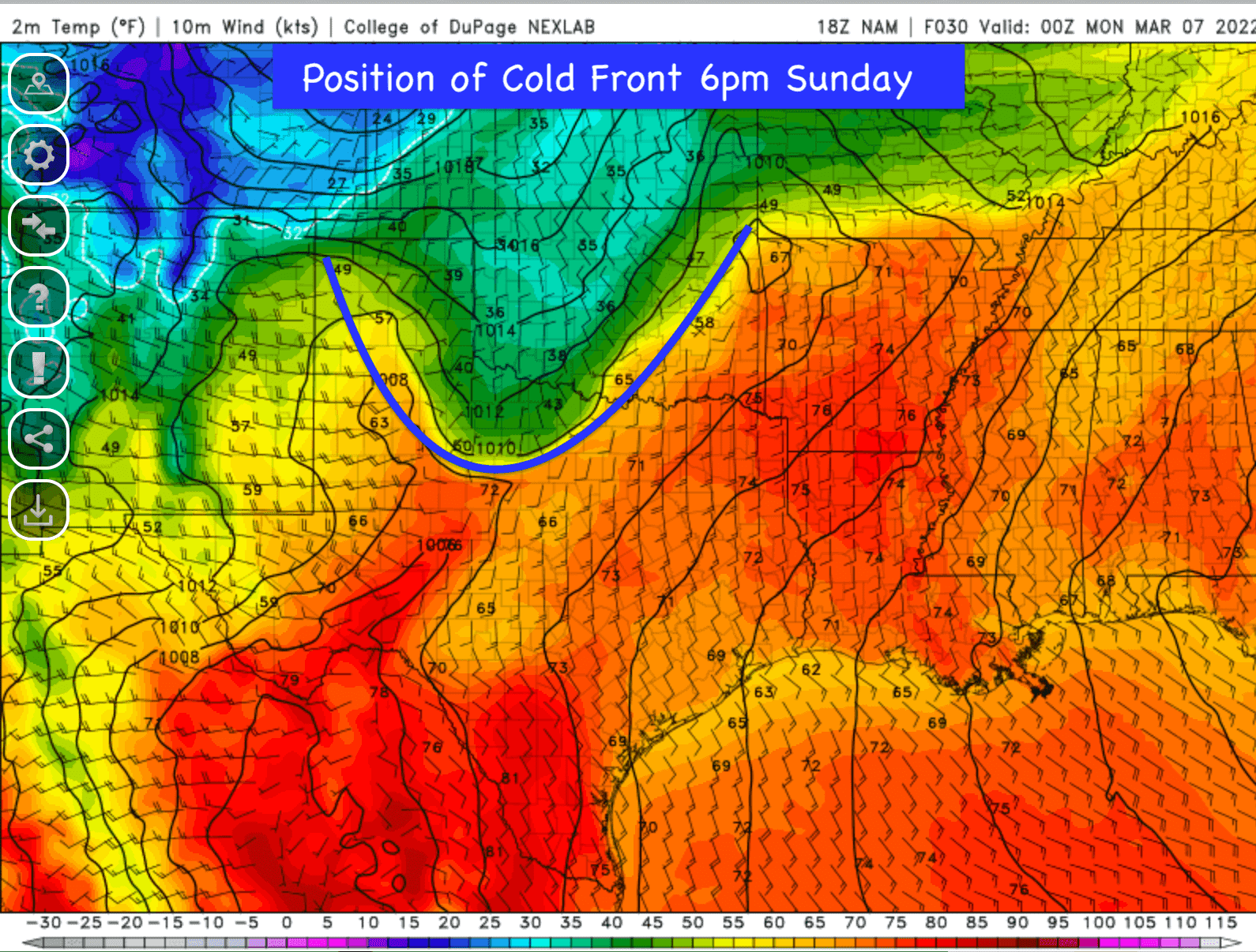
For Sunday March 6th, we’ll see the return of severe weather threats across part of north central and northeast Texas. During the early part of the day on Sunday, a few scattered non-severe showers will likely develop across the rolling plains of far western north Texas and quickly scoot northeast into southwestern Oklahoma. No impacts aside from gusty wind and perhaps some lightning are expected with those early-day storms. Further east across north central Texas, scattered showers are expected to develop and continue throughout the afternoon hours gradually increasing in coverage as they also scoot across the Red River into southern and southeastern OK. We may see a bit of a break in rain chances late in the afternoon and into the early evening hours before the next round of storms begins to develop along the leading edge of our next cold front. This front, as you’ll see from our graphics and discussion below, will have stalled out from northeast to southwest across OK and draped across the south rolling plains of western north Texas. As the front begins to push south during the late evening hours, we could see the development of a squall line west of the DFW metroplex which will track southeast during the late evening into the overnight hours. At this time, the main threats late Sunday evening and overnight across north central into northeast Texas will be damaging winds and hail. The tornado threat is non-zero but looks low and confined to areas mainly along and north of the Red River in far northeast Texas. We’ll continue to monitor for any increase in the tornado threat with the data that rolls in overnight and will provide another detailed update tomorrow if there are any additional concerns. As always, make sure you have a reliable way to receive weather notifications during nighttime hours…loud enough to wake you up…should any be issued for your location.
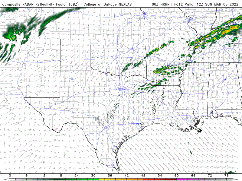
Simulated radar from 6am Sunday to Noon Monday
High Fire Danger on Sunday
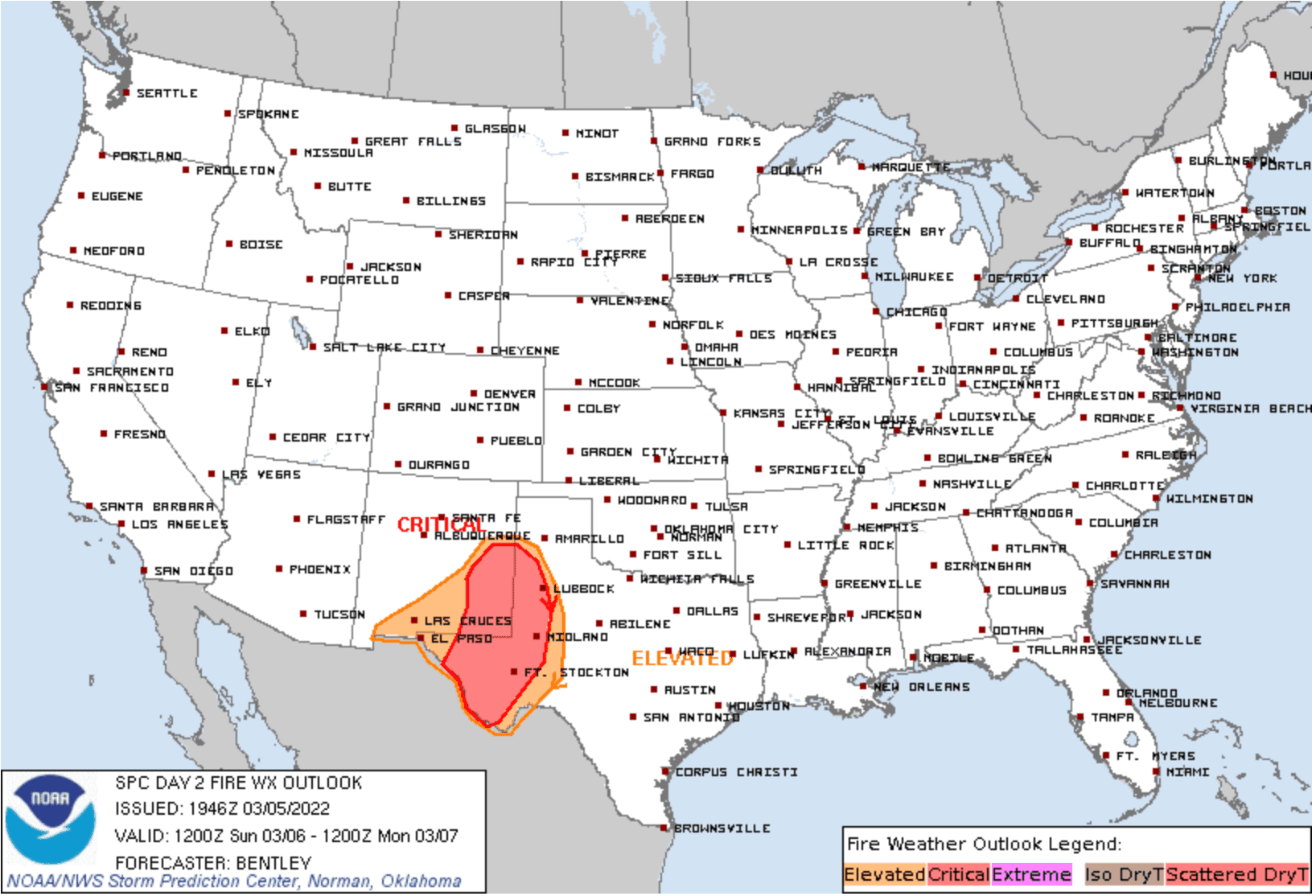
Elevated to Critical fire weather conditions will exist across a large portion of far western Texas tomorrow from the Trans-Pecos region up into the Texas South Plains. Relative humidity values in the single digits with winds 20 to 30 mph across this extremely dry and parched region will be the perfect conditions for grass fires to develop and spread quickly. As always, please be extra cautious to avoid any activity that could cause a spark or flame…and please do not toss cigarette butts out of vehicle windows!
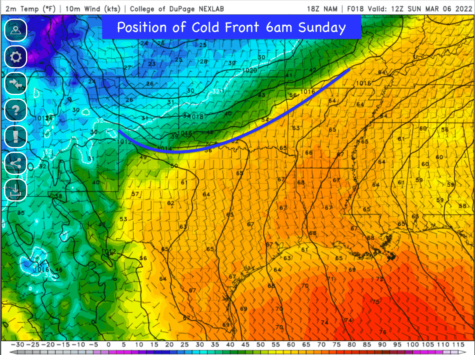
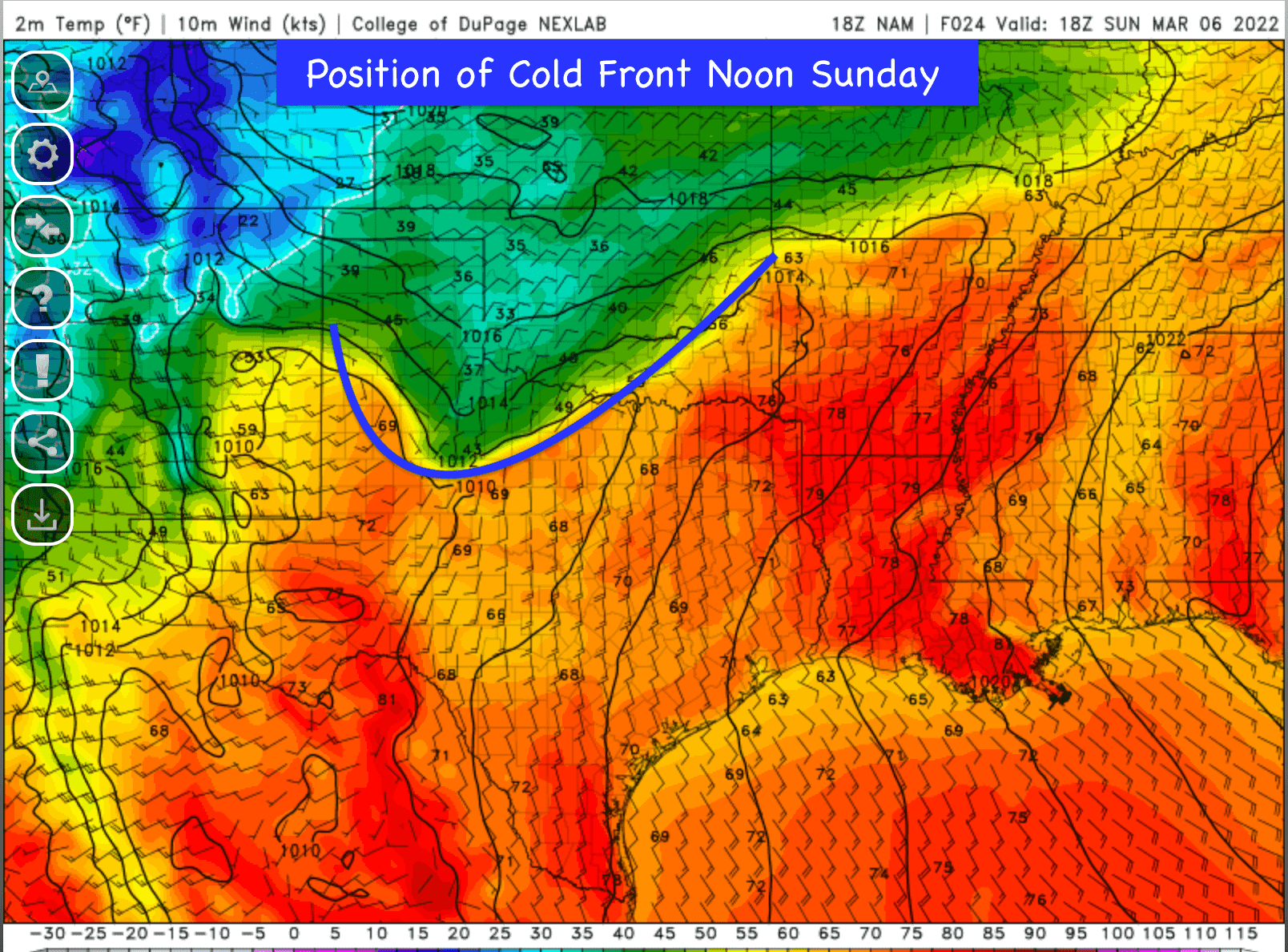
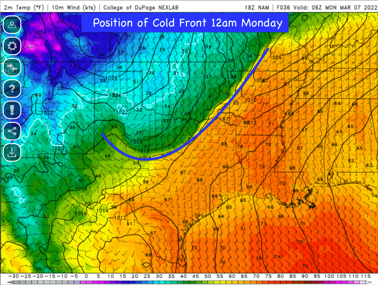
Our Next Cold Front
Our next cold front will take its time making it south across the state. It will ooze into the northern Texas panhandle overnight tonight and stall out across the rolling plains of western north Texas by early Sunday morning. There it will stay relatively in place until it gets a shove from another piece of upper level energy expected to arrive late Sunday evening. From there, it will dive southeast into north central Texas by around midnight, central Texas by Monday morning, the central and upper gulf coast by around Noon, and into the Rio Grande Valley region by late afternoon. This will knock temperatures back down below seasonal averages for the start of our next work week.


0 Comments