
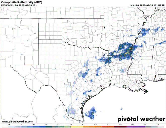
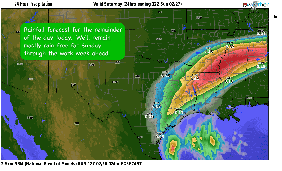
Happy Saturday everyone! A chilly and drizzly morning continues across parts of central, east and southeast Texas this morning. Unfortunately, this unpleasant weather will hang around for most of the day before it finally moves east and out of the state by early Sunday morning. All the rainfall will remain light, drizzly and annoying, but no major impacts are expected today other than the typical damp roads. Thankfully overnight, temperatures across the areas where drizzle and rain is expected to continue will remain mostly above freezing, so ice on roadways should not pose much of a threat. The radar loop forecast below will give you a good idea of how rainfall will be trending today into early Sunday morning.
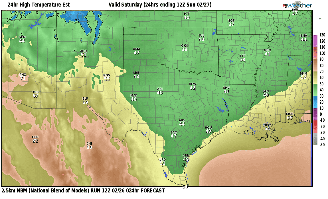
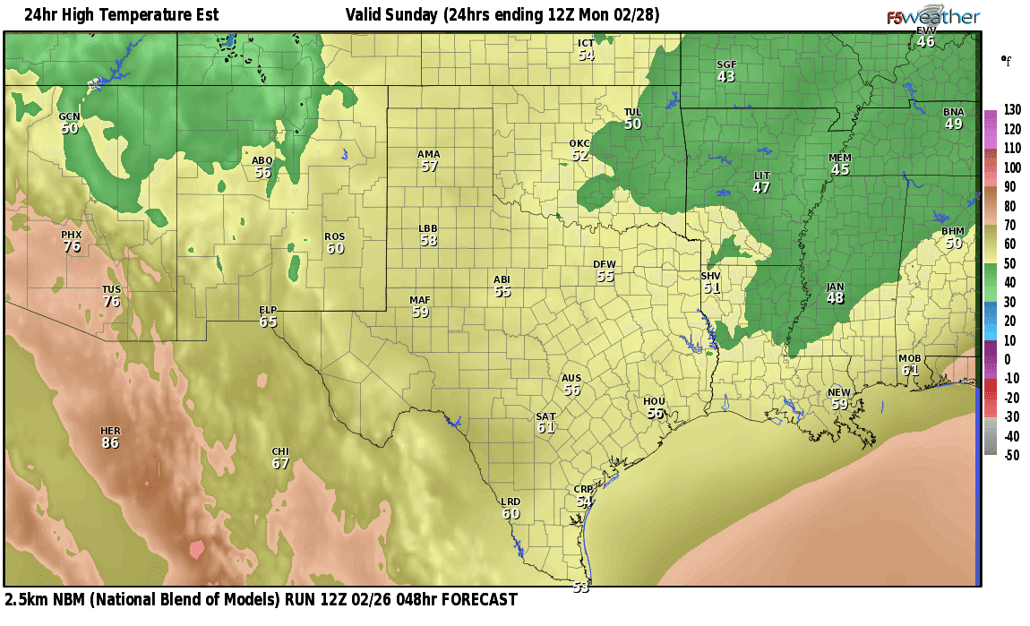
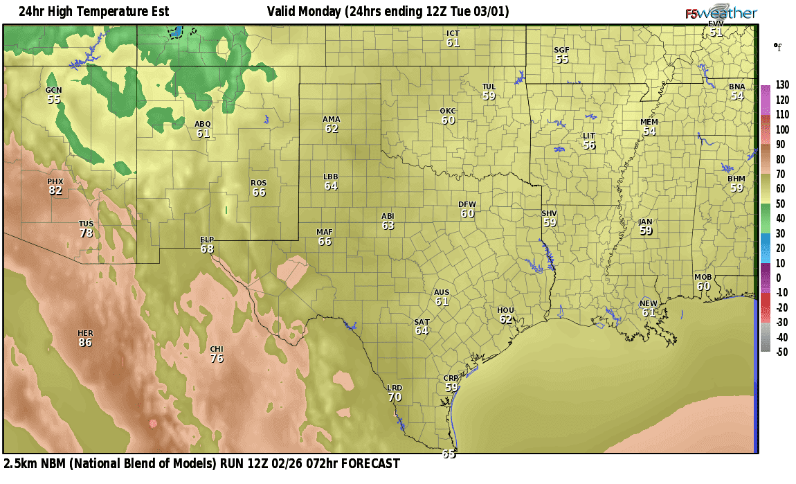
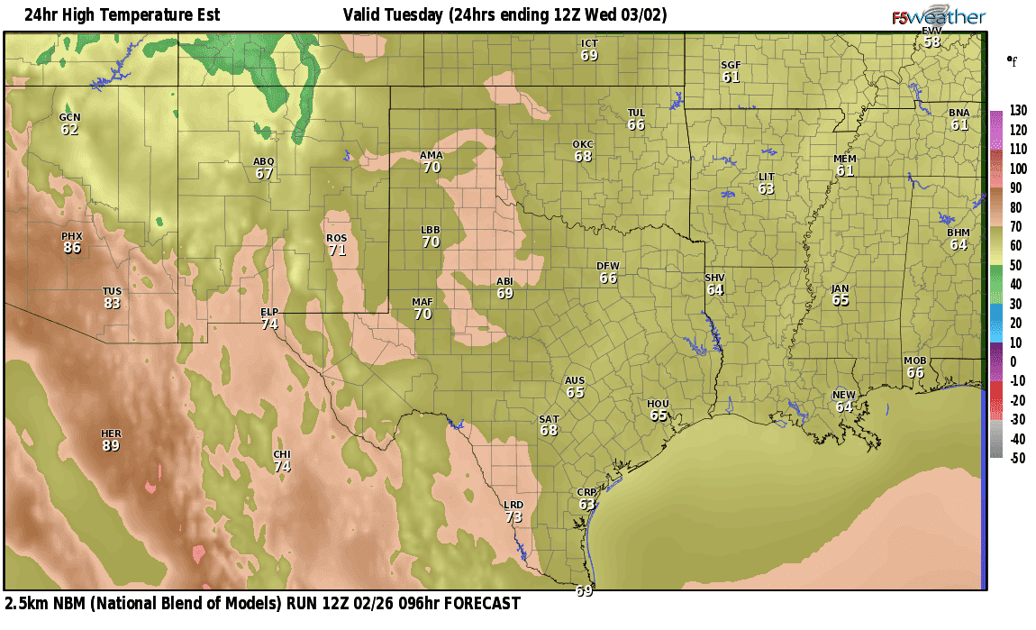
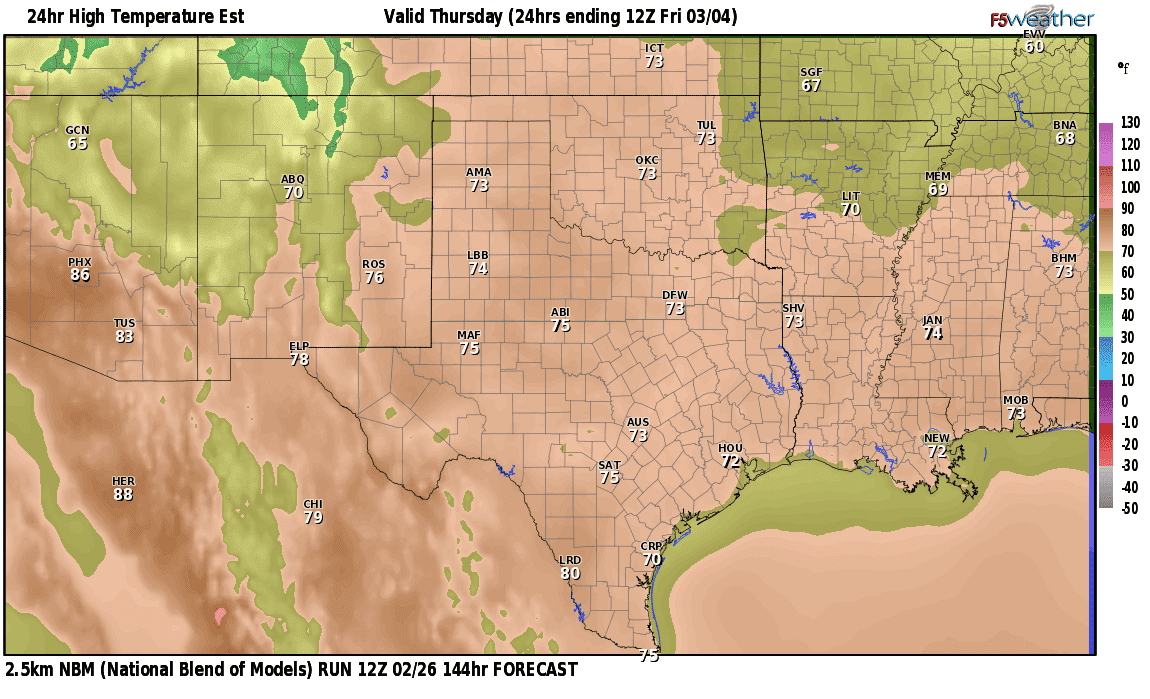
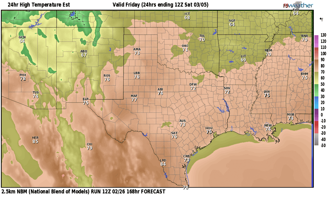
Temps across the areas currently receiving rainfall are finally above freezing, so the previous Winter Weather Advisory has now been cancelled. The good news is…we’ll be rain-free starting early tomorrow and remain that way through most of the work week ahead! In addition to being rain-free, we’ll see a nice warming trend that will have our daily forecast high temperatures back above normal by the end of the work week ahead. The display of daily forecast highs below should certainly bring a smile to your face! One other note, mid-March and our typical last frost/freeze dates are quickly approaching, so fingers crossed we’ll be done with sub freezing weather, sleet and ice threats very soon!
Today’s Forecast Highs

Sunday’s Forecast Highs
Monday’s Forecast Highs
Tuesday’s Forecast Highs
Wednesday’s Forecast Highs
Thursday’s Forecast Highs
Friday’s Forecast Highs


0 Comments