
Texas is a state divided this afternoon. A strong cold front extends from near Lubbock to Brownwood to Denton to Denison. Temperatures north of the cold front are in the 30s and 40s. Everyone else is enjoying spring-like weather with temperatures in the 70s and 80s. Normally in March, we’d be concerned about severe thunderstorm chances with such an abrupt airmass change. Fortunately, a majority of the upper-level energy associated with the cold front is remaining northeast of Texas.
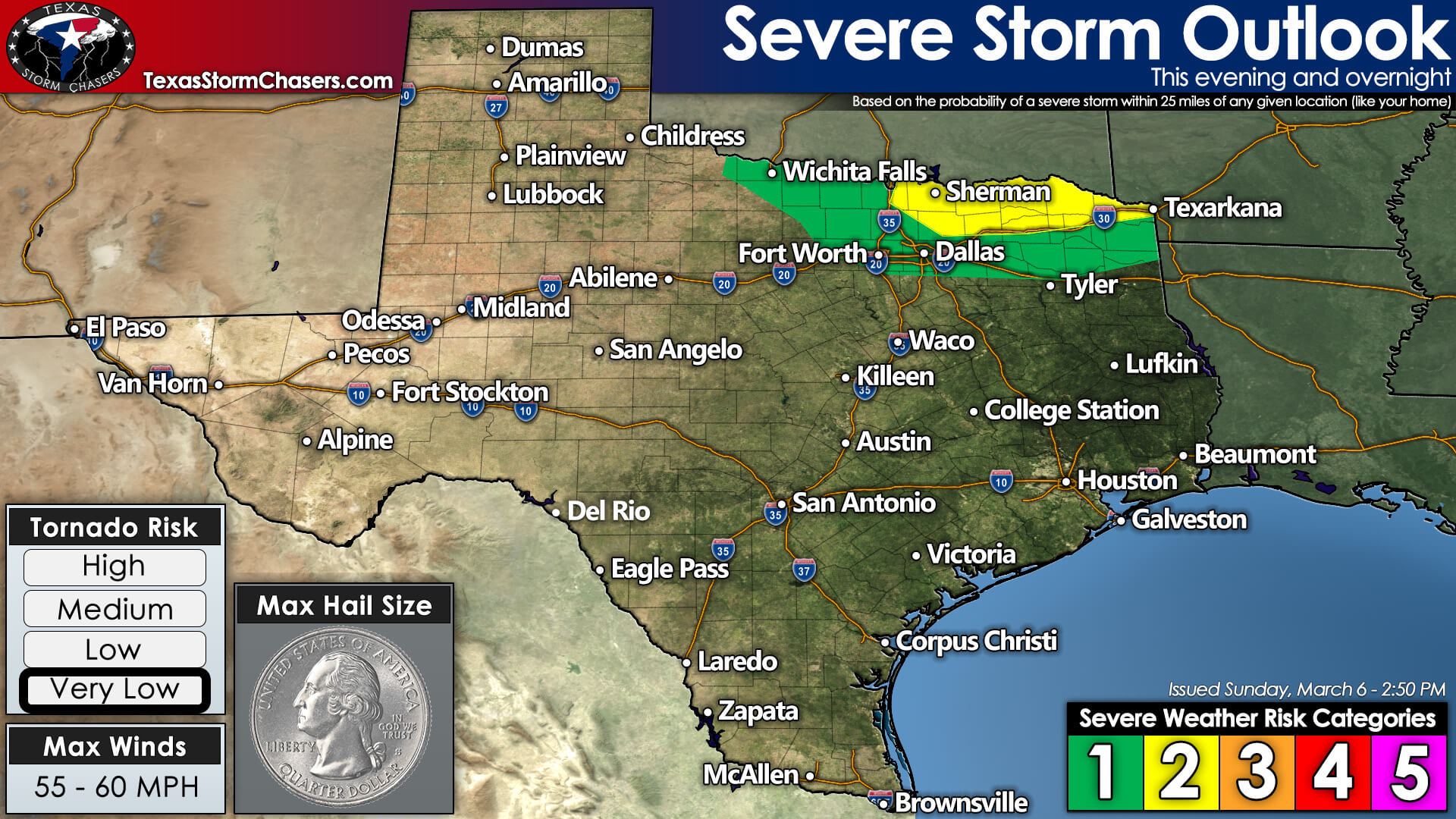
There is a level one risk of severe weather tonight across Texoma and Northeast Texas. Technically, we have a level two risk across Northeast Texas, but I’m hopeful we’ll be able to scrape by without any major issues tonight. Should we end up having a few severe storms, they could produce localized damaging wind gusts over 55 miles per hour and pocket-change size hail. I generally define pocket-change size hail as anything from a dime up to a quarter or half-dollar. We are expecting plenty of showers and thunderstorms tonight along and behind the cold front, but most, if not nearly all of those, will behave themselves.
Timing into Monday Morning
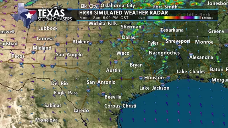
Most precipitation tonight will occur behind the cold front. While the front itself has mostly sat still today, we’ll see it start cranking southeast tonight as a reinforcing shot of colder air helps push it south. Showers and thunderstorms will become scattered to numerous overnight into Monday morning for a few hours ‘behind’ the front (as it pushes south). Small hail, gusty winds, and brief heavy rain are likely with the thunderstorms. We’re not expecting much rain and certainly nothing that’ll put a dent in the drought. Gusty northwest winds and a sharp drop in temperatures will occur as the front arrives at your location. The cold front should be pushing off the Middle and Upper Texas coast by sunrise tomorrow.


0 Comments