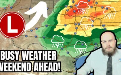
Happy New Year from all of us at the Texas Storm Chasers! We hope you’ve had an enjoyable holiday. We’ll be starting off 2024 on the upper-level storm train. We’ll be going through upper-level storm systems every two to three days. Freezing fog this morning in the Panhandle and West Texas should burn off by late morning, but be mindful of spotty slick spots. Dense fog across the southern third of Texas will also burn off by late morning.
System #1
Our first upper-level storm system will arrive in Texas on Tuesday. Numerous showers are expected across the eastern two-thirds of Texas from Tuesday through Wednesday afternoon. Moderate rainfall will be the most common, but some heavier downpours are probable. Tomorrow’s system will be a quick hitter and should move east of Texas by Wednesday afternoon. Significant winter weather is unlikely in Texas.
One inch of rain is expected as an average across the eastern third of Texas, generally east of Interstate 45 from Shreveport down toward the eastern Brazos Valley and Southeast Texas. Projected rainfall amounts suggest widespread flooding is unlikely. One-tenth to one-half inch of rain, perhaps a bit more in the lucky spots, will be possible back west to Interstate 35 and into the Hill Country, Central Texas, and North Texas. Severe thunderstorms are not expected.
System #2
Wednesday afternoon through Thursday morning should be mostly dry across Texas. Our second upper-level storm system arrives Thursday afternoon and will stick around through Saturday morning. This second system could be stronger with an intensifying surface low pressure as it moves east across Texas. The specific path of this surface low will be important in determining if we’ll have snow in Texas later this week. As it stands now, the relative highest potential for up to one inch of snow is in the Panhandle east across Oklahoma. I say relative highest because it’s only about a 30% chance. Another round of rain is expected across the eastern half of Texas, with one to two inches of rain possible across East Texas. We may also see some windy conditions, but we’ll dodge severe storm potential. We’ll keep an eye on this second system as we start to get past tomorrow’s rain.
System #3
Another strong upper-level storm system will move across our region on Monday and Tuesday next week. That one has been showing up in long-range weather model guidance for over a week. Specifics are unknown, but it will likely produce thunderstorms in the warm sector and an all-out blizzard on the cold side across the Central Plains up into the Great Lakes. Like our late-week system, the track of system #3 will determine any ‘rain-snow’ line and who may also have some severe thunderstorm threat. That’s way down the road, and we need to get past our first two systems. It’s finally starting to act like an El Nino winter ’round these parts.
Baldy-in-chiefisms
Temperatures across the northern two-thirds of Texas will remain cool most of this week, with brief warm-ups before cooler weather returns. The southern third of Texas will remain pleasantly warm, with high afternoon temperatures in the 70s for most of this week.
No, that doesn’t mean we’ll have an extreme polar vortex plunge the state into sub-zero temperatures in mid-January – contrary to what some weather influencer accounts have been spewing. Remember – if it looks attention-grabbing and is for 7+ days, it probably is. It’s always a good idea to check multiple weather forecasts and follow trustworthy sources.


Happy New Year and yay!
Happy New Year
Happy New Year, B-I-C!
Hope you are right about no crazy polar vortex!!
Thanks for what you do!
Am moving south, souther.
Happy New Year! Thank you for what you do!
Happy New Year! And we’ll get nothing from these in El Paso. 😑
Parts of Fort Worth around Azle to Saginaw are pre-treating the roads. Same is true for West out towards Gordon, Palo Pinto, Strawn, Milsap, etc. this was this morning that we saw this happening
Kathy Ury Shelby Woods
Cannon Woods thank you!
Send it, we need the rain.