
Thunderstorms have fired along the dryline which is now approaching Interstate 35 in D/FW and extending northeast toward Sherman. Pre-frontal convection is underway east of Interstate 35 in eastern North Texas extending into Northeast Texas and East Texas. Storms this morning have behaved themselves thus far with the highest wind report at 48 MPH in Sherman earlier. The line of storms along the dryline will continue to develop and quickly move east today. We’ll also see scattered showers and storms fire up ahead of the dryline – which may be a good thing in terms of keeping the severe weather threat more localized.
Severe weather outlook for today
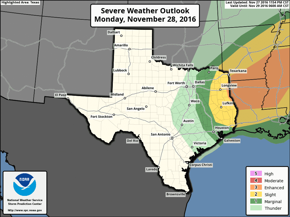
Our primary severe weather window is from now through 2 PM. After sunrise the atmosphere will probably become a tad more unstable, although widespread clouds and showers ahead of the dryline may hinder the destabilization process. Wind shear values are extreme with a powerful jet stream overhead. So far those powerful winds have been knocking updrafts over before they can become too organized. We’ll have to see if that changes later this morning when we have some daytime heating. A category 1 risk of severe weather is in place this morning along and east of the dryline. A category 2 risk includes most of East Texas, and a category 3 risk starts on the Texas/Louisiana border and points east. A few severe wind reports up to 65 MPH are possible with the squall line this morning as it moves east. A very conditional tornado risk may develop if any storm can organize enough to take advantage of strong wind shear. The conditional supercell risk is relatively highest closer to the Texas/Louisiana border. I don’t anticipate widespread severe weather issues in Texas today.
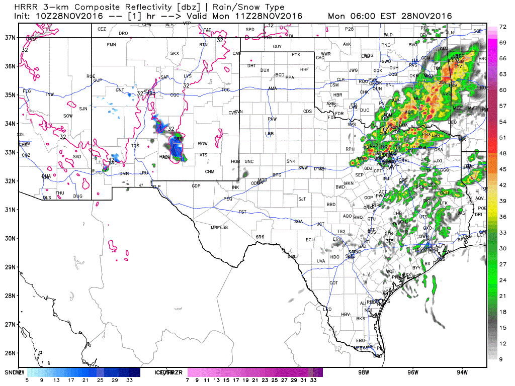
The dryline will be moving at a decent pace and it looks like our best chance of storms along and east of Interstate 35 will be through the early afternoon hours. Storm chances rapidly drop to zero just west of the dryline. We should see most storms moving east of Texas by 1-2 PM.
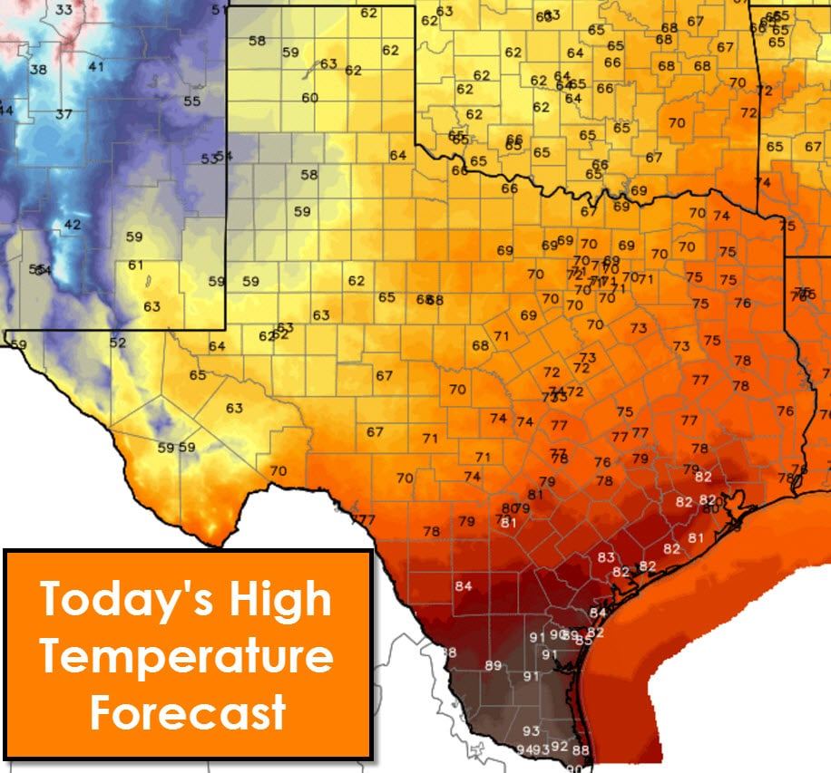
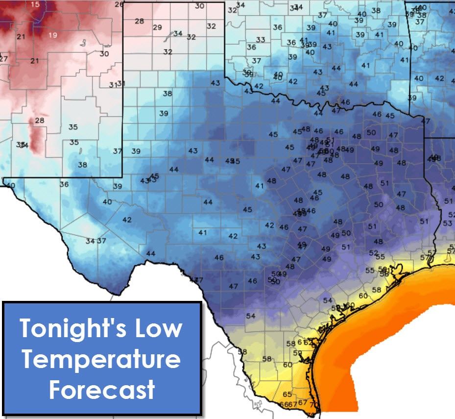
Temperatures won’t be much cooler behind the dryline today. In fact several cities will be above-average this afternoon. We’ll notice temperatures lower tonight thanks to radiational cooling and a drier airmass moving in. Our next big rain maker looks to be at the end of the week and the weekend. Temperatures should be noticeably cooler and it’ll actually feel like a late fall rain event. Based on potential temperature profiles there may be snow or a rain/snow mix in parts of West Texas.


0 Comments