
Spring-like weather will continue across Texas through the remainder of the work week. A decent cold front will arrive on Friday. Temperatures on Saturday will be knocked down toward February averages, with high temperatures in the 40s across the northern half of Texas and 50s and 60s across the south. A freeze is expected across the northwestern half of Texas on Saturday morning.
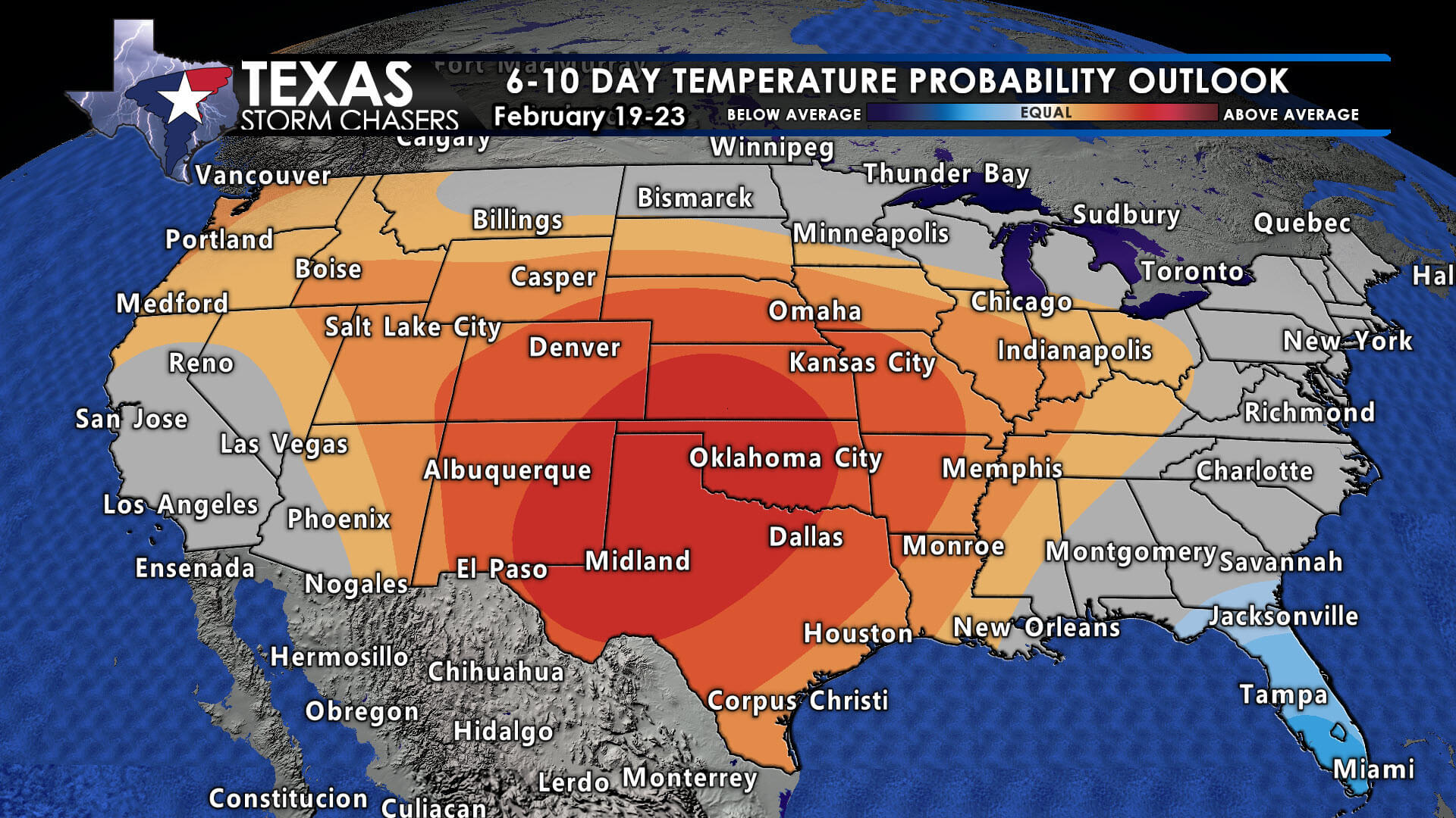
By Sunday morning, efficient radiational cooling may result in a freeze across the northern two-thirds of Texas, especially in sheltered areas. Our cooldown will be brief and not of arctic origin. High temperatures will begin climbing the temperature roller-coaster on Sunday. Next week looks warm, dry, and spring-like.
Rain chances will increase tomorrow afternoon and continue through Saturday morning across the Rio Grande Valley, Rio Grande Plains, South Texas, the Edwards Plateau, Coastal Bend, Coastal Plains, Southeast Texas, Golden Triangle, with some rain chances into South-Central Texas, the Hill Country, Brazos Valley, and East Texas.
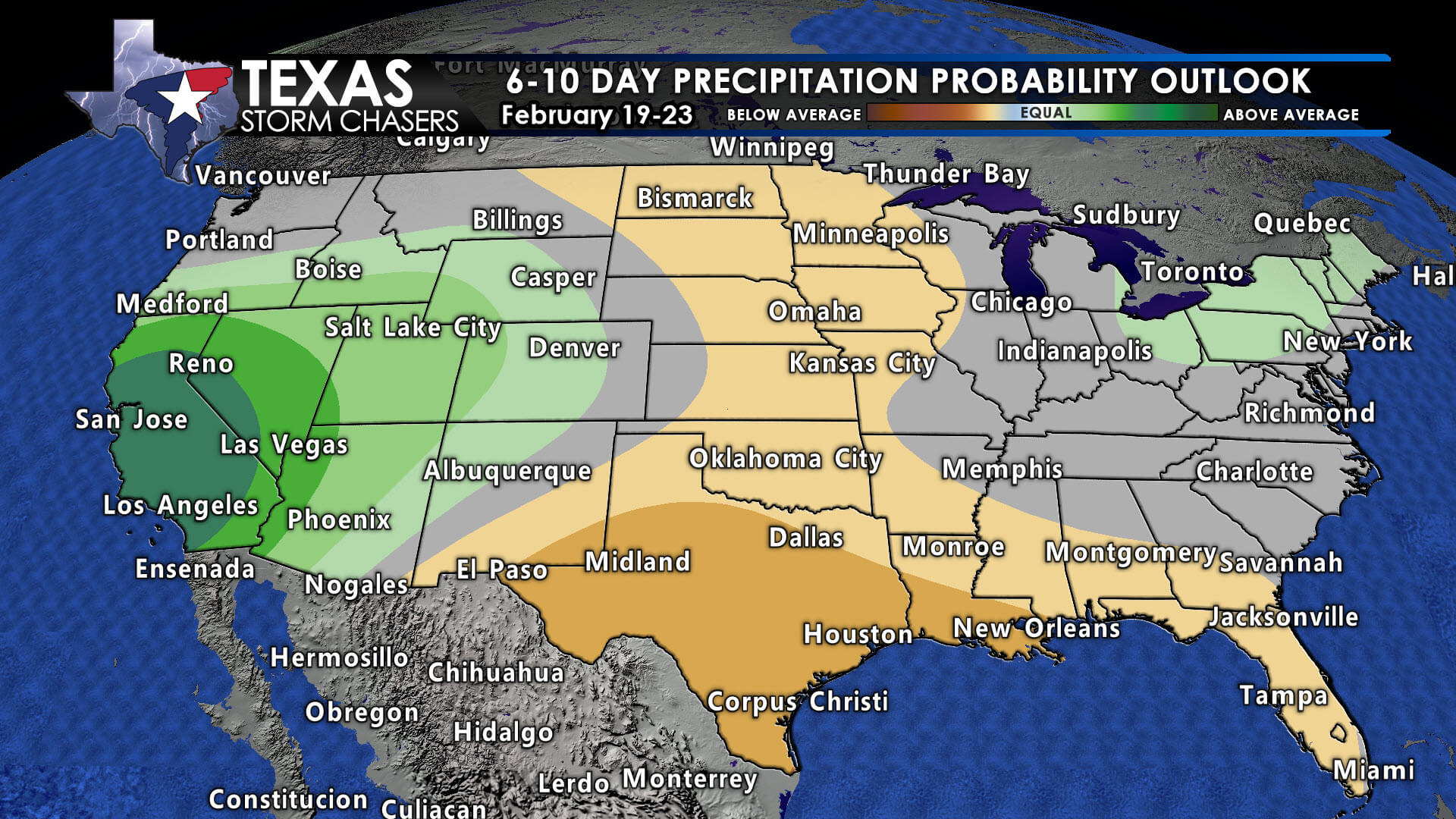
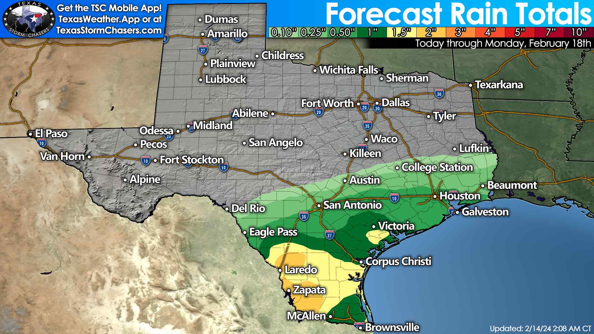 Rain chances decrease north of Interstate 10 in the Hill Country and generally get lower the further north you go in the Brazos Valley and East Texas. Severe thunderstorms are not likely; neither is widespread flooding. The cold front brings drier air on Saturday so that rain will be pushed off the Texas Gulf Coast. Most of next week looks dry, so this may be the last rain for at least seven days. There will be no big crashy the cold fronts after this weekend for a while, with spring looking like it’ll stick around through the final week of February.

I’m soooo glad we didn’t have a snowmageddon 🤣 like farmers almanac and the other weather guy says we are going to have 🥶 bring on the 100* days!!
I saw some high altitude geese flying north yesterday
No solar vortex scheduled?
We’re gonna be in the freakin 80s next week. I’m not ready for summer
Thanks for keeping us in the know.
Doesn’t hurt my feelings one bit.
Is it because we named them Crashy? Do cold fronts get offended? Have we been canceled?? I have so many questions, but mostly I just want to know where our Winter is!!??
Is it because we named them Crashy? Do cold fronts get offended? Have we been canceled?? I have so many questions, but mostly I just want to know where our Winter is!!??
I want an Arrtic Blast
I want an Arrtic Blast
Enjoying it while it’s here, but I suspect we have at least one humdinger coming before real spring arrives. Underground springs throughout the Back 40 are active. Both ponds are over full. Hoping several sunny days will do some drying out.