
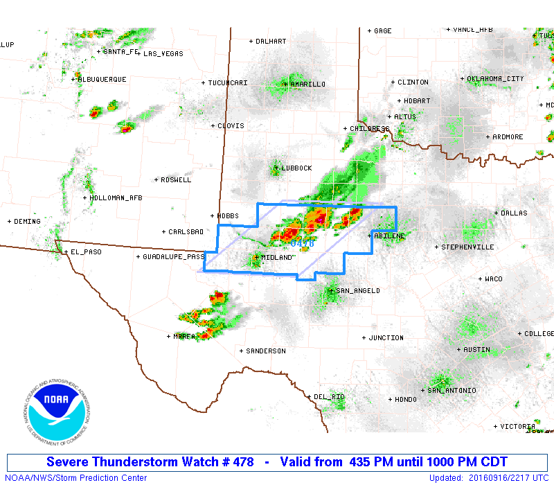
A Severe Thunderstorm WATCH is in place for western Texas until 10pm this evening. The Watch area includes the cities of Albany, Anson, Sweetwater, Snyder, Colorado City, Big Spring, Sterling City, Midland/Odessa, Andrews and surrounding towns. Strong winds gusting up to 70mph and large hail are the primary threats, with a lower-end threat of a quick tornado spin-up. Reports from storms currently in the area have wind gusts around 69mph and 1 inch hail near Snyder. Storms are expected to spread in coverage as the evening progresses with the continued threat of hail, wind, very heavy downpours with localized flood threats and dangerous lightning into the late evening hours.
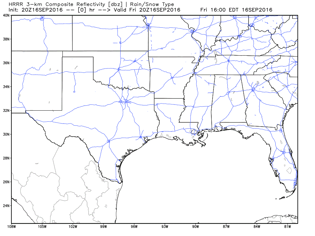
Simulated short-term model forecast animation through the evening and overnight:
URGENT - IMMEDIATE BROADCAST REQUESTED
   SEVERE THUNDERSTORM WATCH NUMBER 478
   NWS STORM PREDICTION CENTER NORMAN OK
   435 PM CDT FRI SEP 16 2016

   THE NWS STORM PREDICTION CENTER HAS ISSUED A

   * SEVERE THUNDERSTORM WATCH FOR PORTIONS OF
     PORTIONS OF NORTHWEST TEXAS

   * EFFECTIVE THIS FRIDAY AFTERNOON AND EVENING FROM 435 PM UNTIL
     1000 PM CDT.

   * PRIMARY THREATS INCLUDE...
     ISOLATED VERY LARGE HAIL EVENTS TO 2 INCHES IN DIAMETER POSSIBLE
     ISOLATED DAMAGING WIND GUSTS TO 70 MPH POSSIBLE
     A TORNADO OR TWO POSSIBLE

   SUMMARY...THUNDERSTORM CLUSTERS ARE EXPECTED TO EXPAND IN AREAL
   COVERAGE AS THEY MOVE SOUTHEAST ACROSS NORTHWEST TEXAS THIS EVENING.
   LARGE HAIL IS THE PRIMARY RISK...THOUGH LOCALLY DAMAGING WINDS ARE
   ALSO POSSIBLE.


0 Comments