
Isolated severe thunderstorm chances return to western portions of Texas today. On Wednesday and Thursday, thunderstorm chances and the threat of severe weather and heavy rainfall will increase. We expect to remain active weather-wise through the first week of May, at least.
The dryline will come alive again late this afternoon through the mid-evening hours from Northwest Texas, Texoma, south through the Big Country, eastern Permian Basin, and the Concho Valley. Today, wind shear values are not overly impressive, and this, combined with less upper-level lift, should keep thunderstorms smaller in number and localized in their impact. Storms that do form will slowly move east with the threat of large hail and localized damaging wind gusts. Thunderstorms should weaken a few hours after sunset – with a quiet night across Texas.
Storm chances increase Tomorrow
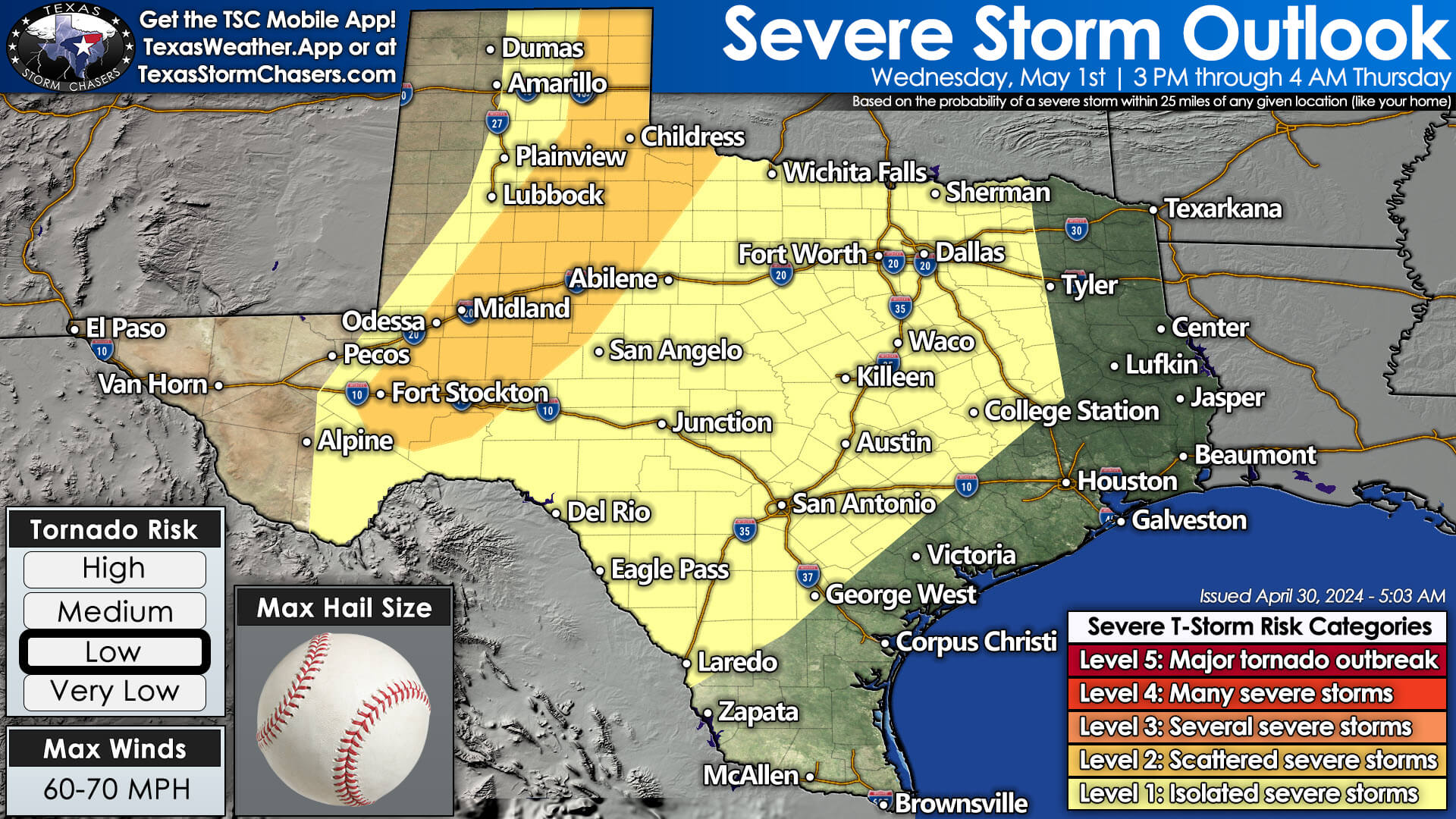
Wednesday is looking more active, with increasing thunderstorm chances along the dryline in western Texas and perhaps thunderstorm chances farther east toward Interstate 35. Scattered severe thunderstorms are possible after 3 PM Wednesday through the evening hours across the eastern Texas Panhandle, West Texas, the Permian Basin, and south into the Big Bend. The most intense storms may produce very large hail, localized damaging wind gusts, and perhaps a tornado. There may also be isolated severe storms Wednesday afternoon farther east in the Hill Country, Central Texas, and perhaps the Brazos Valley. We’ll refine tomorrow’s thunderstorm forecast as higher-resolution weather model data arrives today.

Wednesday Night into Thursday is expected to feature scattered to numerous thunderstorms across the eastern half to the eastern two-thirds of Texas. Some of the thunderstorms may be strong to severe, with localized damaging wind gusts, hail, and heavy rainfall. Several inches of rain may fall across portions of Texoma, North Texas, Central Texas, the Brazos Valley, Northeast Texas, and East Texas. Given the saturated soils from prior heavy rains last week, additional flooding is likely on at least a localized scale.
High Wildfire Danger for western third of Texas

On the opposite side of the dryline, the western third of Texas will face increasing wildfire danger through the late week.
First week of May looking active in the storm department
The long-range weather pattern looks fairly active into next week, so we’ll likely be talking about more thunderstorm chances. It’s also looking like a decent warm-up next week – as one might expect for May.
Helpful Links
Check out our LIVE STREAM: https://texasweather.video/
Our FREE WEATHER APP: https://texasweather.app/
Our WEBSITE/RADAR: https://www.texasstormchasers.com
Our SOCIAL PLATFORMS: https://linktr.ee/texasstormchasers
0 Comments