
Happy Memorial Day, and thank you to all those in the armed forces for your service. We wouldn’t be storm chasing if not for our armed service members. Adam, Alex, Chelsea, and Stephen are chasing in the land of 10,000 lakes up in Minnesota today. Our focus on severe thunderstorm potential will return to Texas tomorrow and Wednesday.
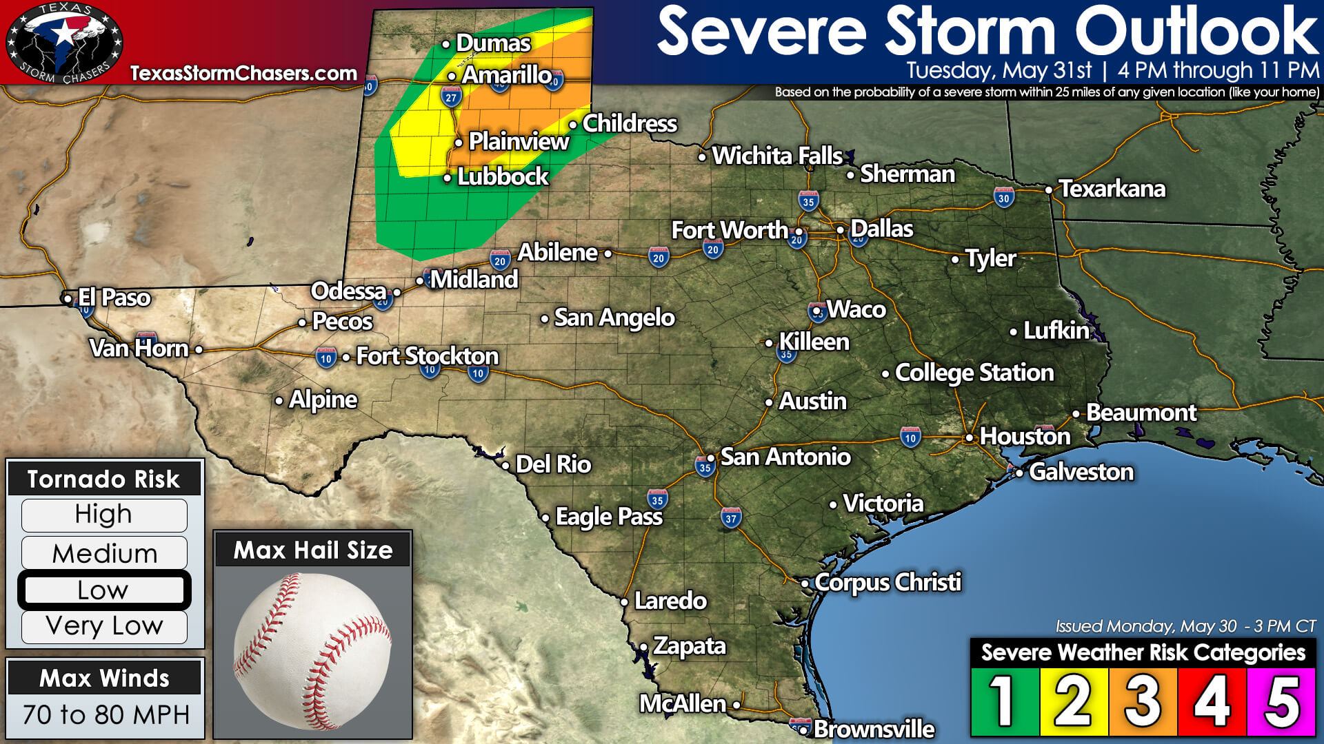
For Tuesday, we’re expecting several to numerous severe thunderstorms across the eastern Texas Panhandle south into the Rolling Plains of West Texas. The Storm Prediction Center has hoisted a level 3 (out of 5) risk for severe storms. The primary storm mode late tomorrow afternoon into the mid-evening will likely be supercelluar. Our most intense supercells may produce very large hail larger than the size of a baseball, localized damaging winds up to 80 miles per hour, and perhaps a few tornadoes. While there may be some tornado threat tomorrow, it would likely be concentrated between 6:30 PM and 10 PM in the southeastern Texas Panhandle.
Tomorrow’s first storms of the day will probably form after 4 PM in the eastern Texas Panhandle, perhaps back southwest to Interstate 27 from Plainview to Lubbock. We’ll have to see where the dryline specifically sets up – since if it sets up further west, that would also bring the threat of severe storms back west.
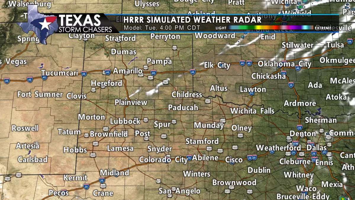
Once storms begin developing, we expect rapid intensification with a very unstable airmass. Typical for the late spring months, we’ll deal with a high instability-modest wind shear environment. Storms will be slow-moving, likely moving east/southeast around 15-20 miles per hour (less at times). Large to giant hail and damaging straight-line winds will be the primary concern with late-afternoon storms. As we progress toward sunset, we may see the threat of a few tornadoes increase in the eastern/southeastern Texas Panhandle.
A supercelluar storm mode may continue into the mid-evening hours. Still, we may also see an upscale growth into a small cluster in the eastern Texas Panhandle. Hurricane-force straight-line winds, wind-driven hail, and perhaps a tornado would be the concerns with any ‘upscale’ growth. Additional thunderstorms may also continue forming tomorrow night in the Texas Panhandle with a threat for large hail.
We are not expecting too much southward progression tomorrow night with the storms. So it should mostly be a Texas Panhandle, West Texas, and Oklahoma issue through late Tuesday night.


0 Comments