
Today’s Severe Weather Outlook
Severe weather outlooks issued by the Storm Prediction Center utilize a five-level risk scale. Each risk level is based on the probability of severe storms within twenty-five miles of any given point, such as your location. A level one risk is the lowest and means isolated/short-lived severe storms are possible. A level five risk is the highest, is quite rare, and indicates a significant tornado outbreak or derecho is likely. Being in or near any risk zone means you may have stronger storms in your vicinity. View the latest Texas severe weather outlooks here.
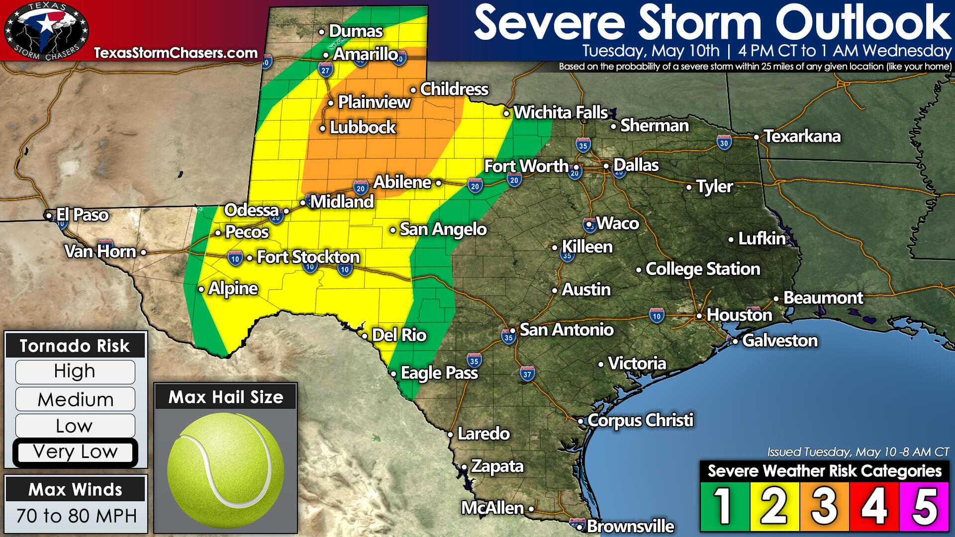
A level 3 (out of 5) risk for severe storms encompasses the southeastern Texas Panhandle, the Caprock, West-Central Texas, into the western Big Country, and the eastern Permian Basin. The standard level 2 (out of 5) risk of severe storms includes the southeastern half of the Texas Panhandle, West Texas, the Permian Basin, the Trans-Pecos Valley, the Davis Mountains, the Concho Valley, the Edwards Plateau, and portions of Northwest Texas. A level 1 (out of 5) risk for severe storms surrounds the higher risk zones.
The aforementioned risk zones include Amarillo, Canadian, Shamrock, Childress, Tulia, Lubbock, Midland, Snyder, Abilene, Vernon, Wichita Falls, San Angelo, Fort Stockton, Sanderson, and Del Rio.
Hazards
Scattered to numerous severe thunderstorms are expected this afternoon into this evening. This afternoon’s strongest storms could produce very large hail up to the size of tennis balls. Localized damaging wind gusts over 70 miles per hour are possible. Once storms grow upscale into clusters or line segments this evening, we could see a few hurricane-force wind gusts up to 80 miles per hour.
After several days of summer-like weather, we begin our return to a more late-spring weather pattern. Today’s severe weather chances will mainly be confined to large hail and damaging straight-line wind gusts. Downright hot surface temperatures and modest low-level winds will keep today’s tornado threat very low.
Timing & Details
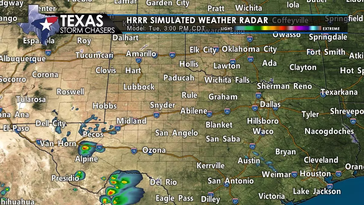
Thunderstorms will develop early this afternoon across the Trans-Pecos Valley and in the Davis Mountains. That activity will move northeast into the Permian Basin. Additional thunderstorms will develop during the late afternoon near the Texas-New Mexico border and move east. We’re expecting a relatively quick transition over into multiple squall lines or clusters of thunderstorms. Those storms will continue moving east across the Panhandle, West Texas, and Permian Basin.
Tonight, storms will move toward Northwest Texas, the Big Country, Concho Valley, and Edwards Plateau. Storms will begin weakening several hours after sunset. Some storms may continue past midnight with strong winds.
While not ‘severe,’ we may also see a few heat bursts as storms start weakening late tonight. Those heat bursts could produce brief gusty winds and brief ten to twenty-degree spikes in temperatures.


0 Comments