
Happy Saturday and 🌺 Happy Mother’s Day Weekend 🌺 to all the Moms out there!
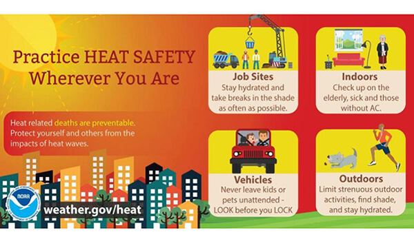
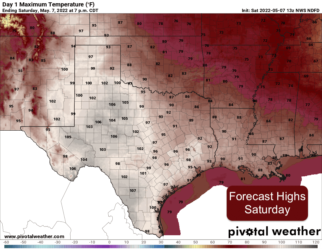
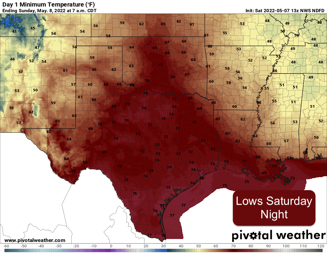
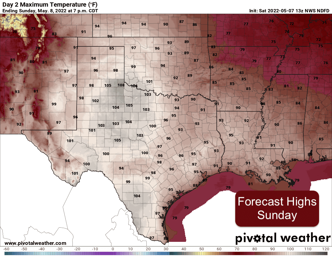
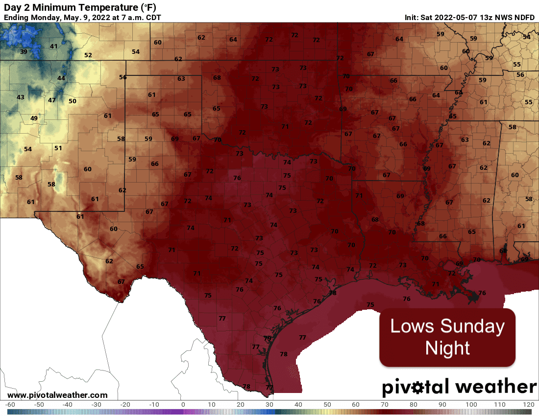
Summer-like weather arrives in full force this weekend with record to near-record heat expected both Saturday and Sunday across a large portion of our state. Highs in the 90s to low 100s are expected mainly west of the I-35 corridor today and again tomorrow. East of the dryline where humidity plays a major role, we’ll see heat index values between 105 and 111, especially across portions of deep south Texas. This will lead to dangerous heat both Saturday and Sunday. With it being so early in the season, we’re not used to this, so we’ll be extra sensitive to heat related illness. That said, take extra precautions this afternoon and again tomorrow afternoon if you have outdoor plans. Start hydrating now…or make plans to take a break indoors during peak daytime heating.
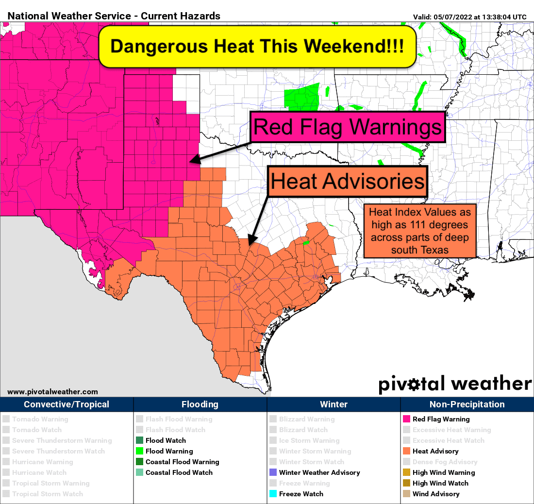
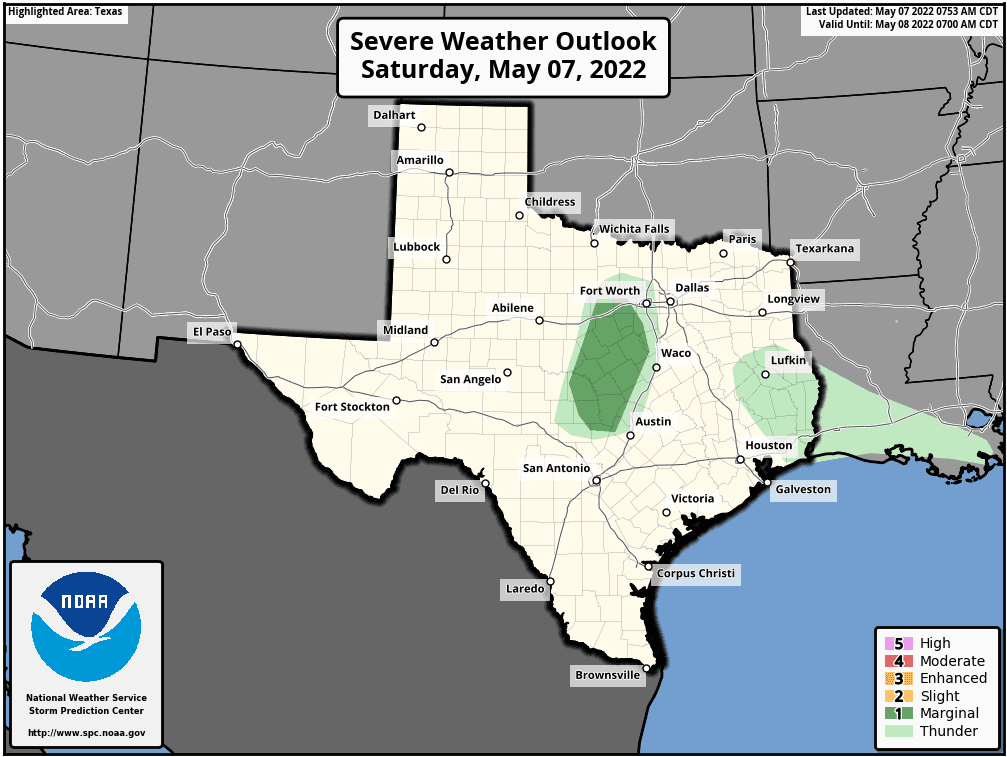
Rain chances will be pretty much nil except for a just south/southwest of the DFW metroplex this afternoon, near the dryline, where there is a small (20%) chance of seeing a few isolated strong to severe storms pop up later this afternoon simply as a result of high instability in areas where both surface temperatures and dewpoint temperatures are also quite high. The Storm Prediction Center has issued a Slight Risk (Level 1) to address this concern for today. If storms are able to develop, large hail and damaging winds will be the main threat. That’s about it for this weekend’s weather highlights. Stay SAFE everyone and stay COOL!
Severe Weather Threats Today
Forecast Highs and Lows Saturday and Sunday


0 Comments