
Good afternoon and welcome back to another episode of winter in Texas. It’s a cold day across the northern seventy-five percent of Texas. Temperatures at the lunch-time hour are in the teens across Western Texas east into Texoma. The freezing line extends south into the Hill Country, Central Texas, the Brazos Valley, and Northeast Texas.
For our precipitation chances tonight, the freezing line’s position will be vital in determining who may be dealing with a few icy bridges and overpasses. We’ll also see a slight warming trend late tonight as warm-air advection pumps more moisture inland. Some fluctuations are likely after 3 AM with the eastern and southern edge of the freezing line. However, we do not anticipate a significant change (either falling or rising).
Freezing drizzle is ongoing this afternoon in portions of the D/FW Metroplex south into the Hill Country. The drizzle is very light but maybe enough to produce some icy spots on bridges and overpasses. We may see some more prominent drizzle or light freezing rain showers by late afternoon in North Texas. Some degradation in road conditions is expected after 4-5 PM in the D/FW Metroplex north to the Red River.
Round #2 Begins This Evening and Overnight
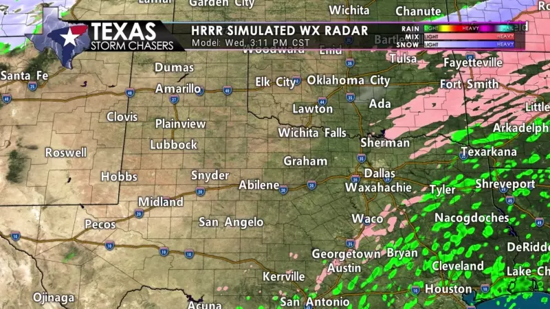
Precipitation chances will increase this evening as our next wave of upper-level energy arrives from the west. Like this morning in Northwest Texas and Texoma, we anticipate a convective-like structure to the precipitation. That means we could see ‘thunderstorms’ – except they’ll be producing heavy sleet in areas below freezing. Light freezing rain will become more widespread from the Hill Country and Central Texas north into the Big Country, Northwest Texas, North Texas, Texoma, and Northeast Texas late tonight and Thursday morning. Precipitation will begin ending from west to east late Thursday morning into the mid-afternoon hours.
Forecast Ice & Sleet Totals Tonight – Thursday
Overall precipitation accumulations, if we’re talking purely liquid, are not expected to be overly significant. Most areas will receive a few hundredths to two-tenths of an inch of ‘rain’ once everything melts down. For those who receive that precipitation as freezing rain, that’ll be more than enough to cause hazardous road conditions.
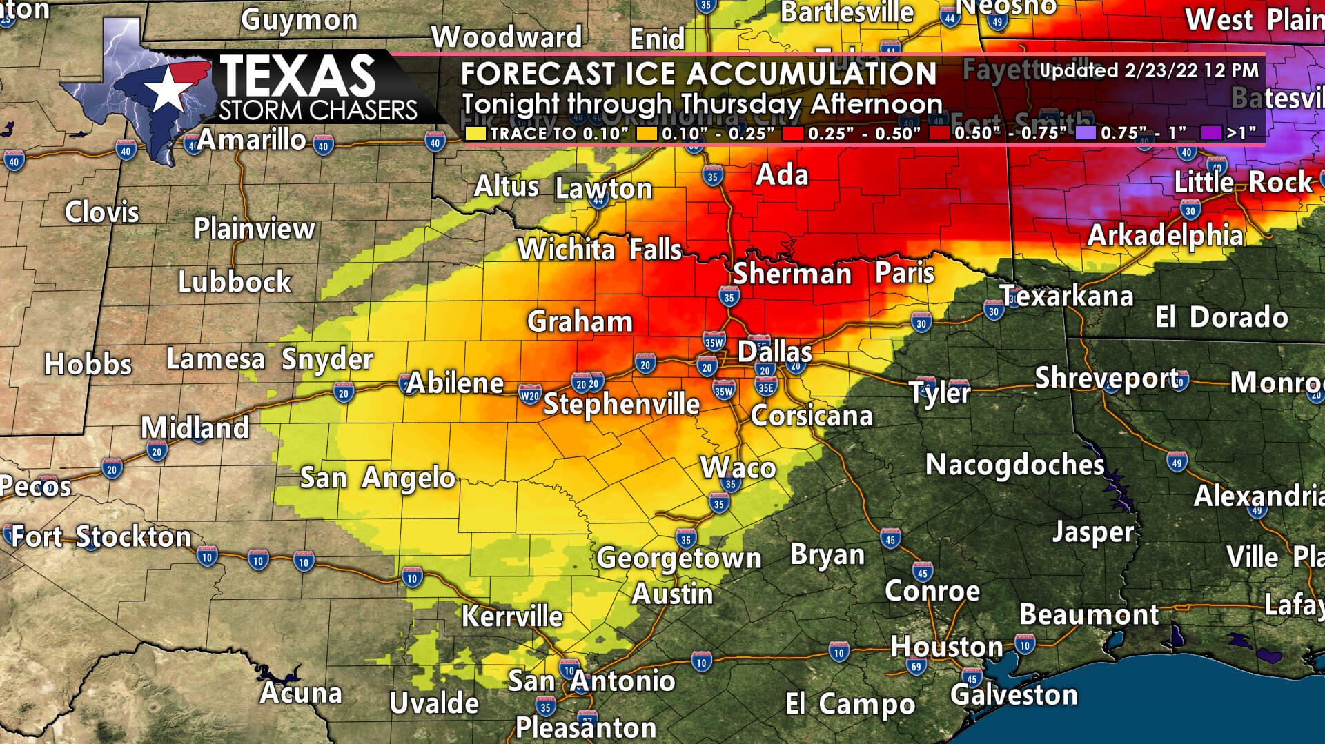
Where surface temperatures range from 30 to 32 degrees, we’ll be more concerned about bridges, overpasses, and elevated roadways. For those with temperatures below 28-29 degrees, surface roads will also experience slick conditions. Freezing rain will also accumulate on power lines and trees, which may cause isolated power outages. In areas with more cold air aloft or under ‘thunderstorms,’ sleet will likely be the primary precipitation type. Rapid deterioration of roads will result in areas where heavy sleet falls.
Melting will begin tomorrow afternoon after precipitation concludes – whether through evaporation or sublimation. However, any wet roads tomorrow night will refreeze as temperatures fall into Friday morning. Folks who get ‘sleet piles’ piled up against their home or fences will see those stick around for at least a week.


0 Comments