
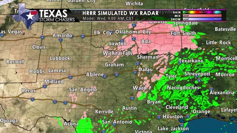
Thunderstorms are quickly moving northeast across West-Central Texas, Northwest Texas, into Texoma this morning. Temperatures in Childress to Wichita Falls are in the teens, with the middle twenties east along Highway 82 to Gainesville and Sherman. Precipitation falling is either sleet or freezing rain. Both precipitation types will accumulate on all surfaces and result in slick roads.
Further south in the D/FW Metroplex, temperatures are in the upper twenties to right around thirty degrees. Surface roads are *mostly* wet but assume bridges and overpasses are icy. Temperatures in the D/FW Metroplex are falling thanks to the wind helping to evaporate some water on the roads. That evaporation process is actually helping cool near-surface temperatures – setting the stage for freezing drizzle.
For Texas Road Conditions, visit DriveTexas.org.
A relative lull in heavier precipitation is expected later this morning through the mid-afternoon hours. However, freezing drizzle or light freezing rain may continue across the Permian Basin, Concho Valley, Big Country, North Texas, and Texoma. Travel difficulties are probable, especially on elevated surfaces. Any precipitation falling where temperatures are in the teens up to the middle twenties will likely accumulate on all surfaces, including roads! From about 29 degrees to 32 degrees, we tend to be more worried about bridges and overpasses. Rain will occur across South-Central Texas, the Coastal Plains, the Brazos Valley, Southeast Texas, and East Texas, where temperatures will remain above freezing. It’ll be cold and unpleasant, but not icy.
Wave Two Begins Tonight
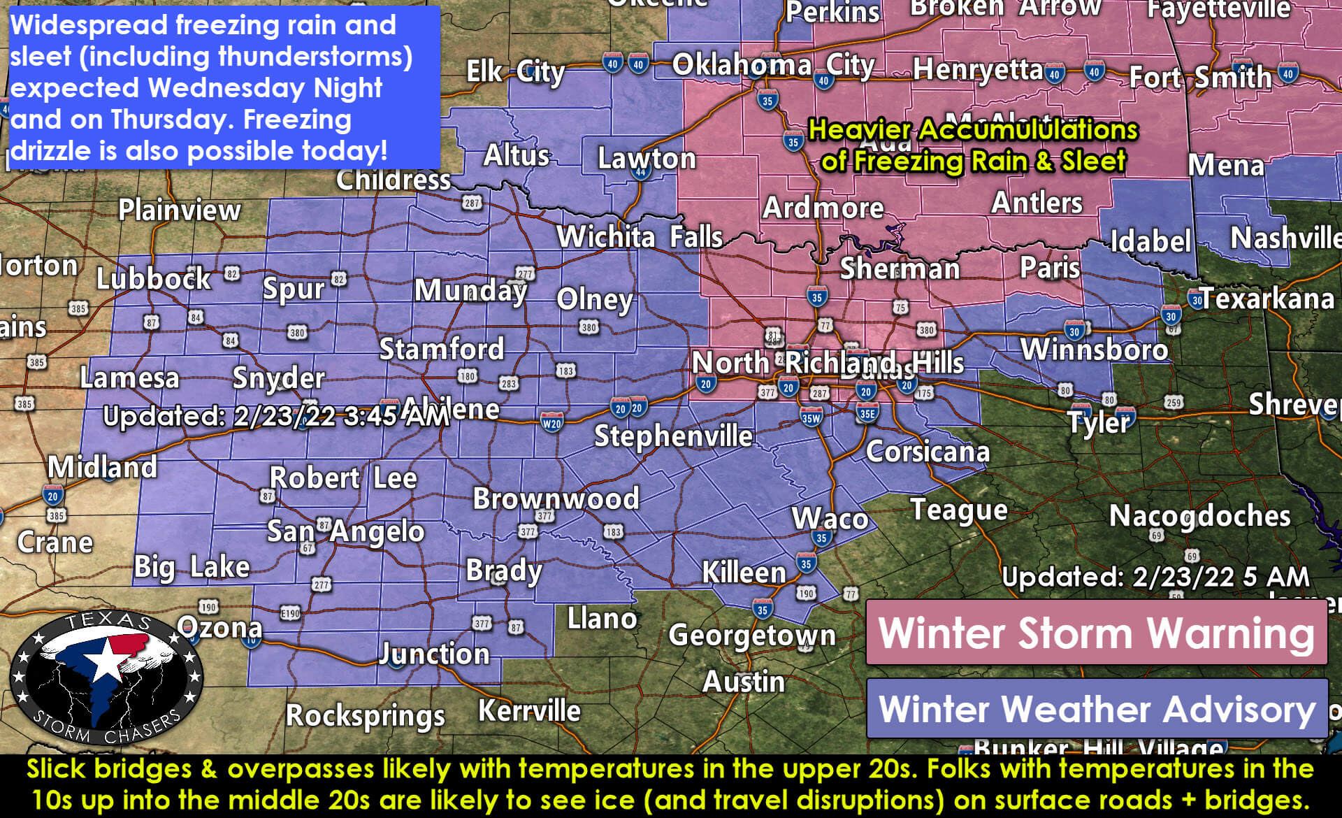
Another piece of upper-level energy will arrive this evening. Widespread freezing rain, sleet, and even thunderstorms (producing sleet and freezing rain) are likely. The most likely regions for tonight’s activity will be in the Big Country, North Texas, Hill Country, North Texas, Texoma, and portions of Northeast Texas. Accumulating ice will likely produce slick and hazardous travel conditions, especially on bridges and overpasses. Temperatures may need to be below 28-29 degrees for surface roads to ice up, but bridges and overpasses are ‘fair game’ below 32 degrees.
Temperatures should start climbing Thursday afternoon as precipitation concludes. We should see road conditions improve tomorrow afternoon significantly for most locations as skies start clearing. Tomorrow evening, water on roads will re-freeze as temperatures drop and a reinforcing shot of cooler air arrives on Friday. Another round of precipitation may occur late Friday or Saturday – but we’re not touching that until we get through today.


0 Comments