
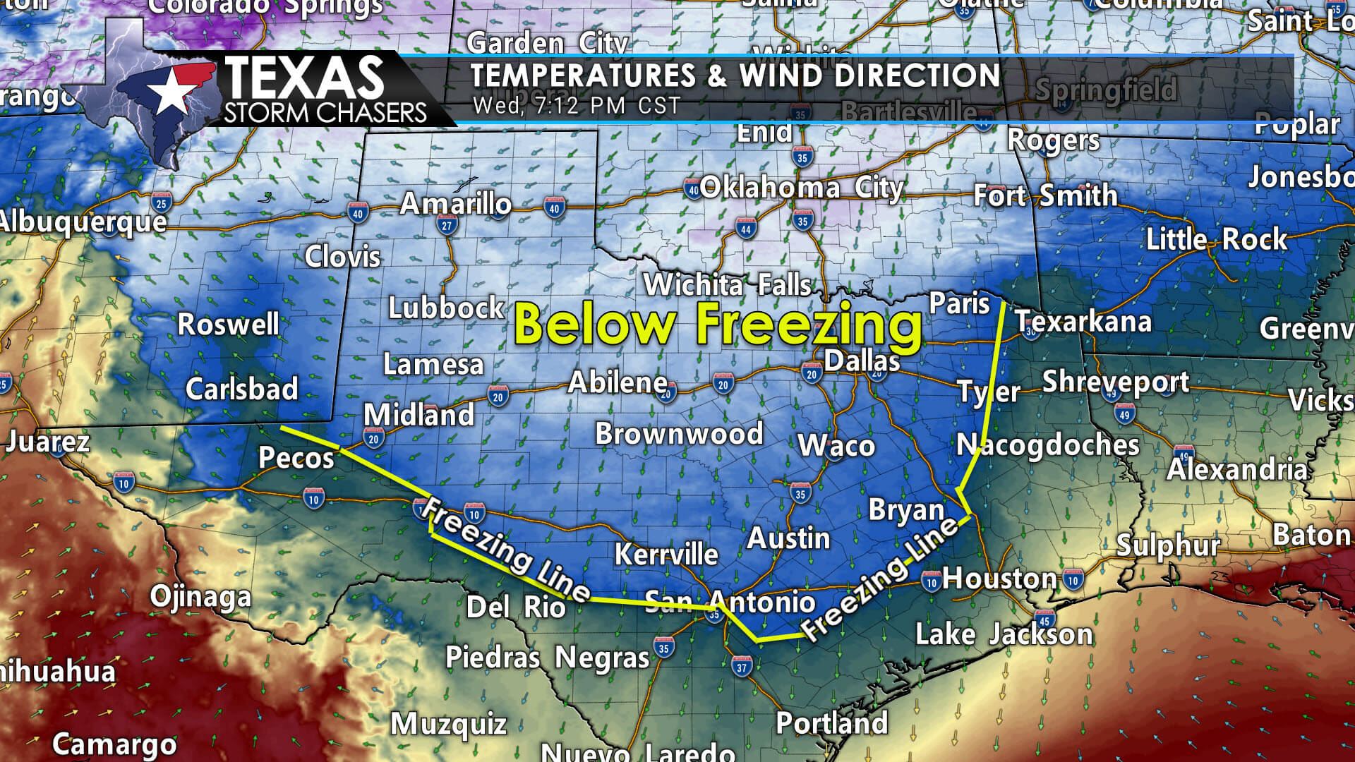
Our next wave of winter weather is beginning. Surface temperatures are now below freezing over the Concho Valley, Hill Country, Central Texas, Brazos Valley, into Eastern North Texas. The freezing line extends from near San Antonio to La Grange to Rusk to De Kalb. This is a bit further south and east than expected, but that is par for the course with these shallow arctic air masses. The freezing line may meander a little north and west later tonight, but we don’t expect many more changes.
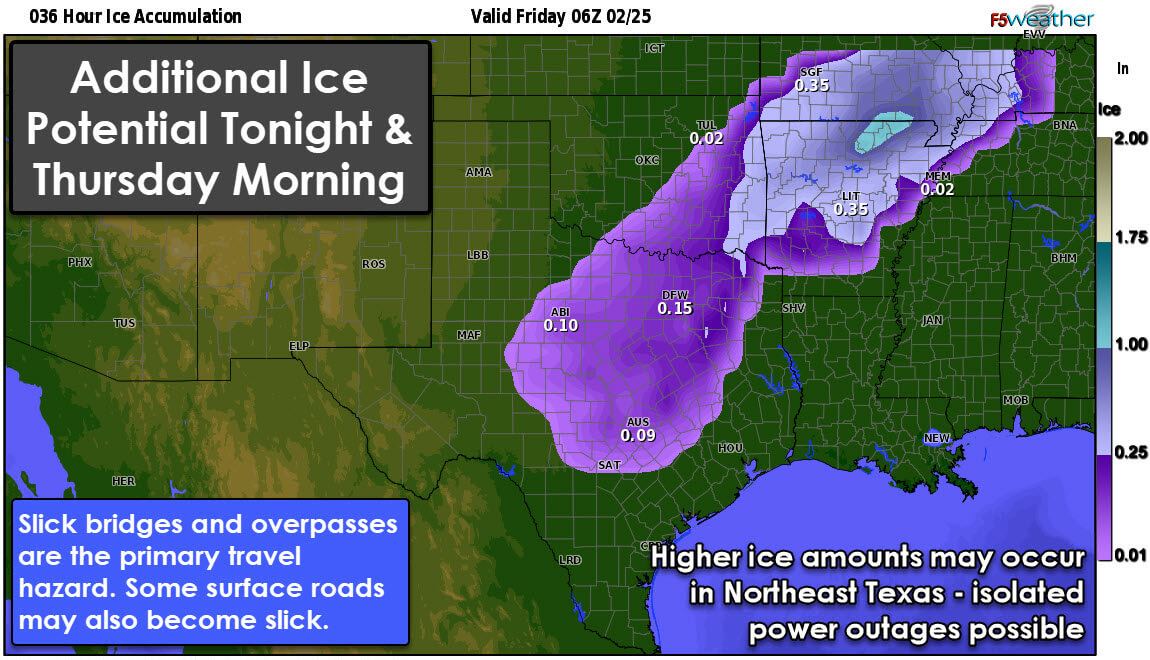
A trace to one-quarter inch of ice will accumulate tonight into Thursday morning in Texoma, the Big Country, Concho Valley, Hill Country, Central Texas, Brazos Valley, North Texas, and Northeast Texas. The highest ice totals are expected to be from the D/FW Metroplex north into Southeastern Oklahoma and Northeast Texas.
Timeline
The freezing drizzle is increasing across Central Texas and the Brazos Valley. Precipitation will be light but enough to coat elevated objects in a thin layer of ice. Bridges and overpasses will likely start to become slick soon. Given the warm ground temperatures, the surface roads in Central Texas and the Brazos Valley may remain wet for a while. However, we also may see things ‘ice up’ quickly as the night goes on. Either way, watch for ice on bridges and overpasses.
Heavier pockets of freezing rain and sleet will likely develop from Texoma south into the Hill Country overnight. Some thunderstorms may also occur – with heavier pockets of sleet and freezing rain. These ‘convectively-driven’ elements will move east/northeast into the Brazos Valley, North Texas, Texoma, and Northeast Texas late tonight and Thursday morning. Accumulating ice is expected, with travel impacts probable. Those with temperatures in the 20s will likely see ice accumulations on surface roads.
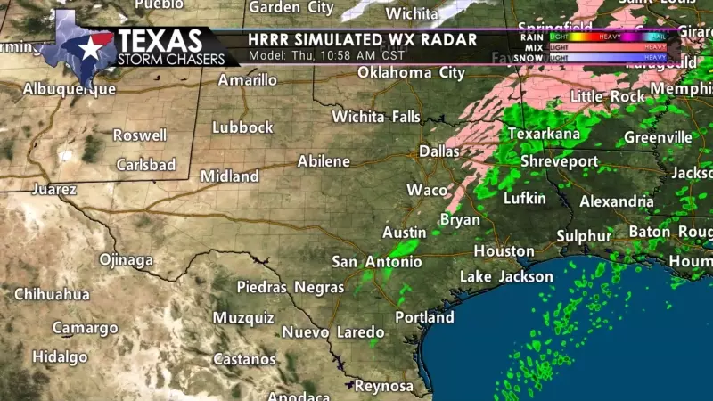
Precipitation coverage and intensity will decrease mid-morning Thursday from west to east. We’ll see precipitation conclude late Thursday morning to early Thursday afternoon for the Interstate 35 corridor (from the Hill Country north into Texoma). It’ll take a few more hours after that for precipitation to exit Northeast Texas. We’ll also see surface temperatures rise above freezing across most regions tomorrow, helping to melt some ice. Even without ‘melting,’ we are likely to see some sublimation occur. Any wet roads after sunset tomorrow are likely to re-freeze into black ice.
The heaviest accumulations of ice tonight and Thursday appear to be most likely from the D/FW Metroplex north into Southern Oklahoma and northeast to Clarksville and Avery. There may be enough ice accumulations on power lines and tree branches to produce isolated power outages. Freezing rain and sleet will turn roads into skating rinks, but at least sleet does not accumulate as much on power lines. I’d hope for sleet.


0 Comments