
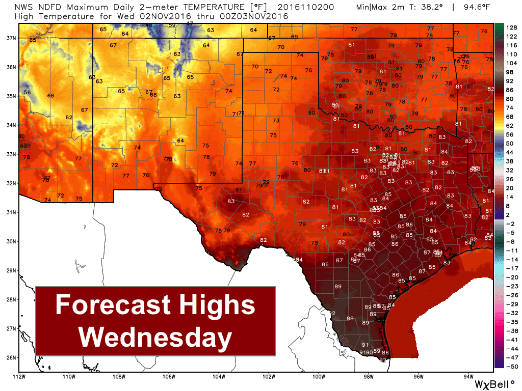
The broken record forecast of abnormally warm and dry weather comes to an end beginning tomorrow afternoon with the arrival of a cold front and chances for rainfall over the next several days. While not everyone will see rainfall from this next system, it will bring at least some beneficial rainfall to a large portion of the state by the weekend. For tomorrow, a cold front will arrive in the panhandle and move through the region during the day. This will help keep temperatures rather seasonal across the area with highs only expected in the low to mid 70s across much of this region. Ahead of the front, we’ll be dealing with one more day of abnormally warm temperatures which will range from the low to mid 80s across the northern half of the state, to the upper 80s across the southern half of the state. The front itself will be a slow mover, but is expected to reach the coastal areas by Friday. We will thankfully see temperatures on the decline with the passage of the front and considerable cloud cover across much of the state over the next several days. Temps will drop back down to within a few degrees of where we should be by this time of the year late week and over the weekend, but we will remain a few degrees above average. Still, cooler and way better than the recent mid to upper 80s we’ve been seeing!
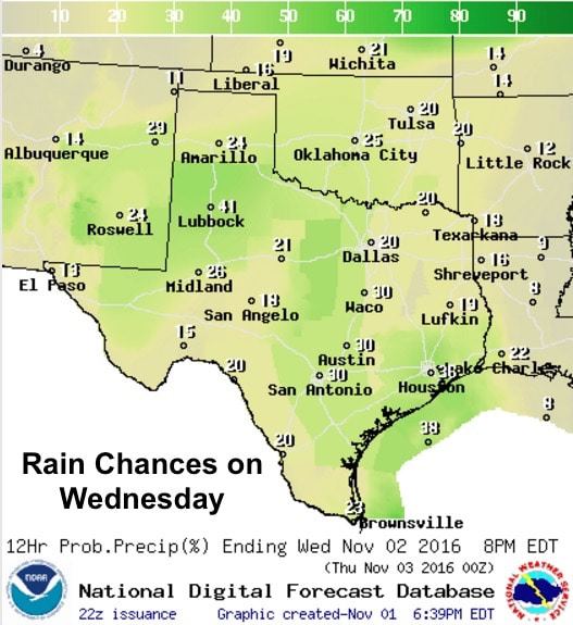
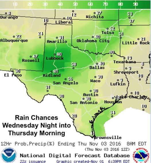
By tomorrow afternoon, scattered rain and storm development is likely along the leading edge of the frontal boundary as it slowly pushes south in conjunction with an upper level trough to our west drawing closer. A few of the storms along and near the frontal boundary could become strong by tomorrow afternoon and evening, but widespread severe weather is not likely. The strongest storms tomorrow afternoon and evening will carry the threat of 50mph winds, hail, frequent lightning and heavy rainfall. Additional widely scattered showers will also be likely in the warm sector out ahead of the front across central and coastal Texas during the early to mid afternoon timeframe. Once we get past peak daytime heating, storms will likely transition over to general rain showers lasting through the night and into early Thursday morning with a majority of the overnight rainfall located across the southern panhandle, rolling plains, northern Permian Basin, and western north Texas.
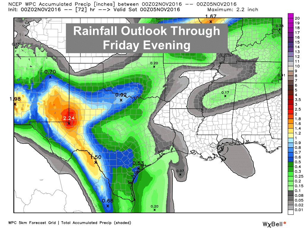
As the upper level system hangs back just to our west for several days, eventually developing into a cutoff low, we will see continued chances for rain through at least Saturday. Most of the rainfall will fall across the western half of the state, closest to the best lift provided by the upper level system out to our west. The outlook below is through Friday evening, and we’ll provide an updated outlook for the weekend ahead as we get a bit closer.


0 Comments