
Welcome to the final month of meteorological fall. It may be the start of November but it’ll still feel like September today. The good news is the ridge aloft responsible for the near record high temperatures is shifting into the southwestern United States. As we get on the eastern periphery of the ridge we’ll start to see temperatures drop a couple of degrees this week. This afternoon should be the warmest day for the next five days with highs in the 80s.
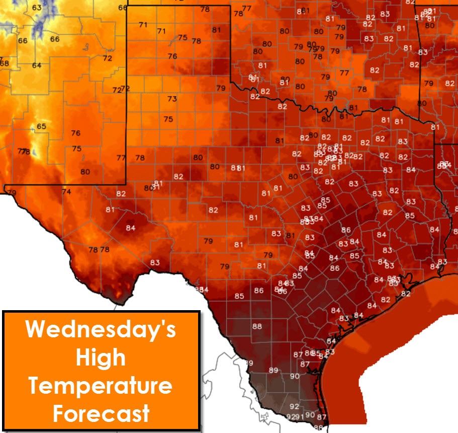
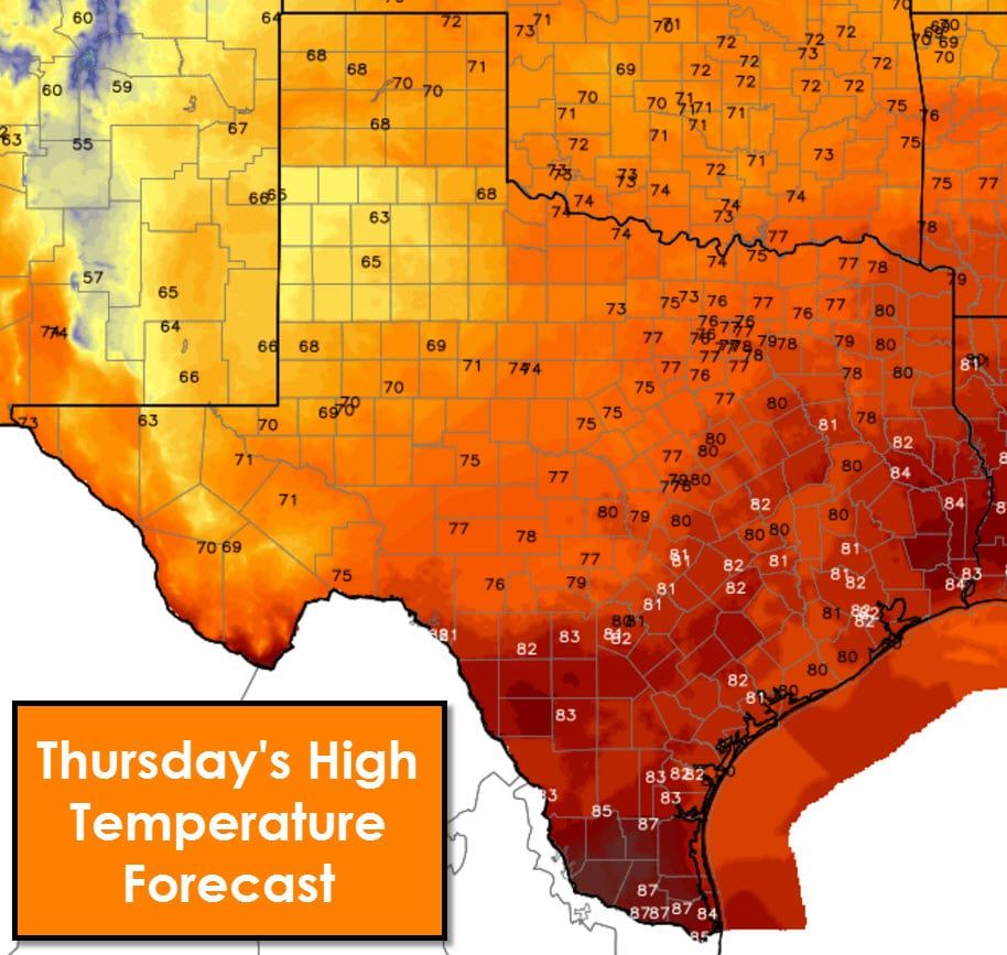
On Wednesday a cool front will start making progress south into Texas. Temperatures behind the cool front will top out in the 70s. Rain chances later this week will help keep temperatures in the 60s across parts of West Texas. Temperatures further east/south will remain in the 70s to lower 80s. Those are still above-average for early November, but better than the upper 80s to lower 90s we dealt with in October.
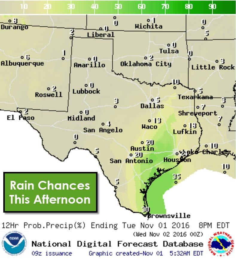
Scattered showers and thunderstorms will be possible today across the Rio Grande Valley, Middle Texas Coast, into the Brazos Valley. Severe weather and flash flooding are not expected. Some folks may pick up a quick quarter inch of rain, but widespread precipitation is unlikely today’s diurnal activity. Most showers/storms will dissipate by early evening.
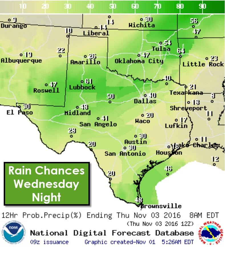
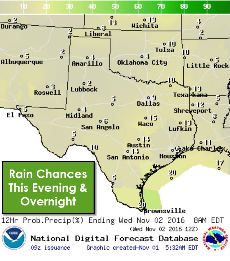
On Wednesday isolated to widely scattered showers and storms will be possible across all of Texas. Severe weather is not expected but I can’t rule out a couple of stronger storms with gusty winds. Some storms may produce brief heavy rain with localized rain totals up to one half inch possible. Scattered to numerous showers and thunderstorms are expected in proximity of a cool front Wednesday Night across the Permian Basin, Big Country, West Texas, Northwest Texas, into the Red River Valley of North Texas (Texoma). Some storms may be strong with gusty winds and localized heavy rain. Severe weather and flash flooding are both unlikely.
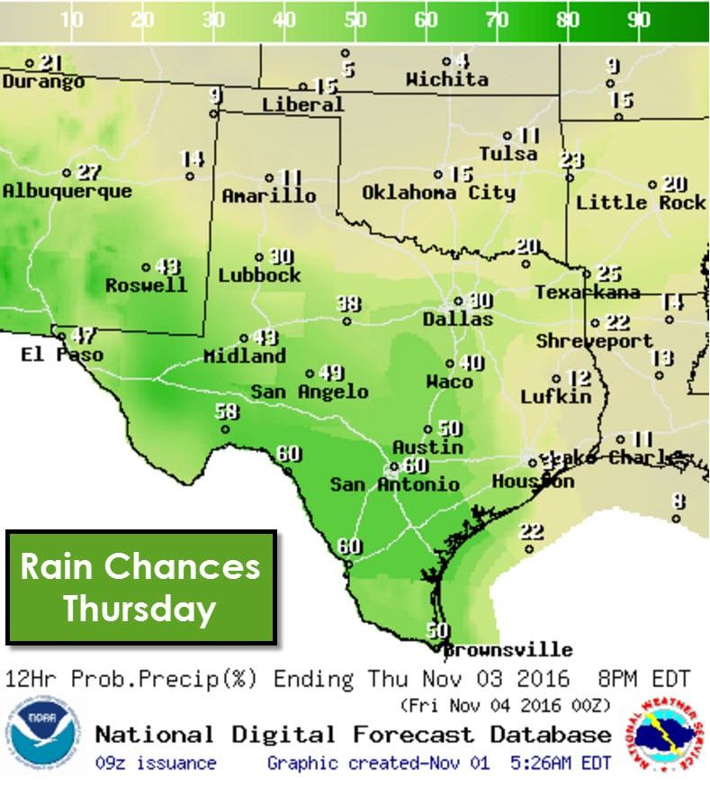
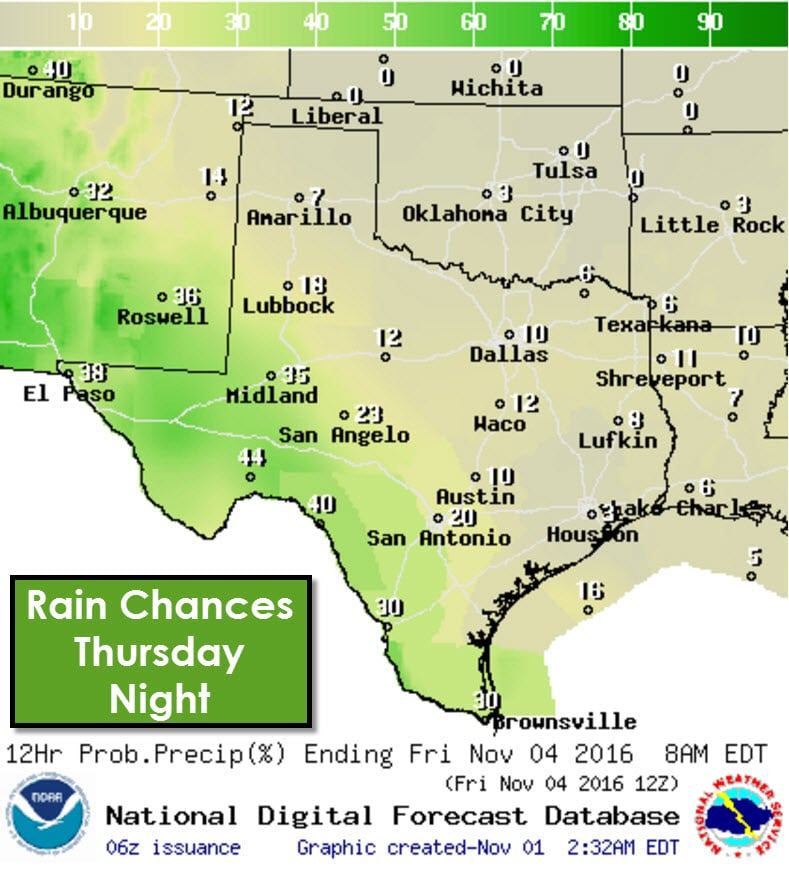
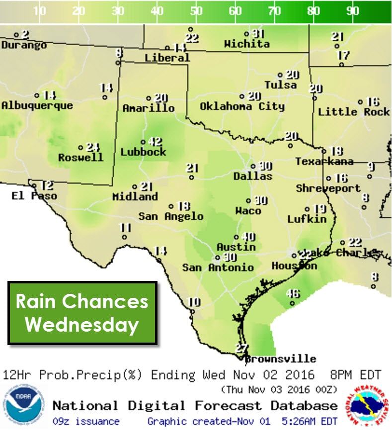
Rain chances will shift south on Thursday as the cool front does the same. The best chance for numerous showers/storms will be in the Borderland, Permian Basin, COncho Valley, Southwest Texas, Central Texas, South Texas, the Rio Grande Valley, into the Middle Texas Coast. Scattered showers will remain possible from West Texas east through the Big Country, North Texas, and Northeast Texas. Some heavy rain will be possible, but widespread flash flooding is not expected.
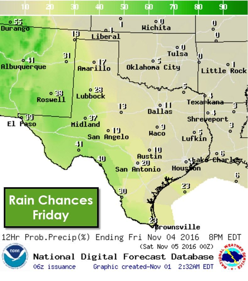
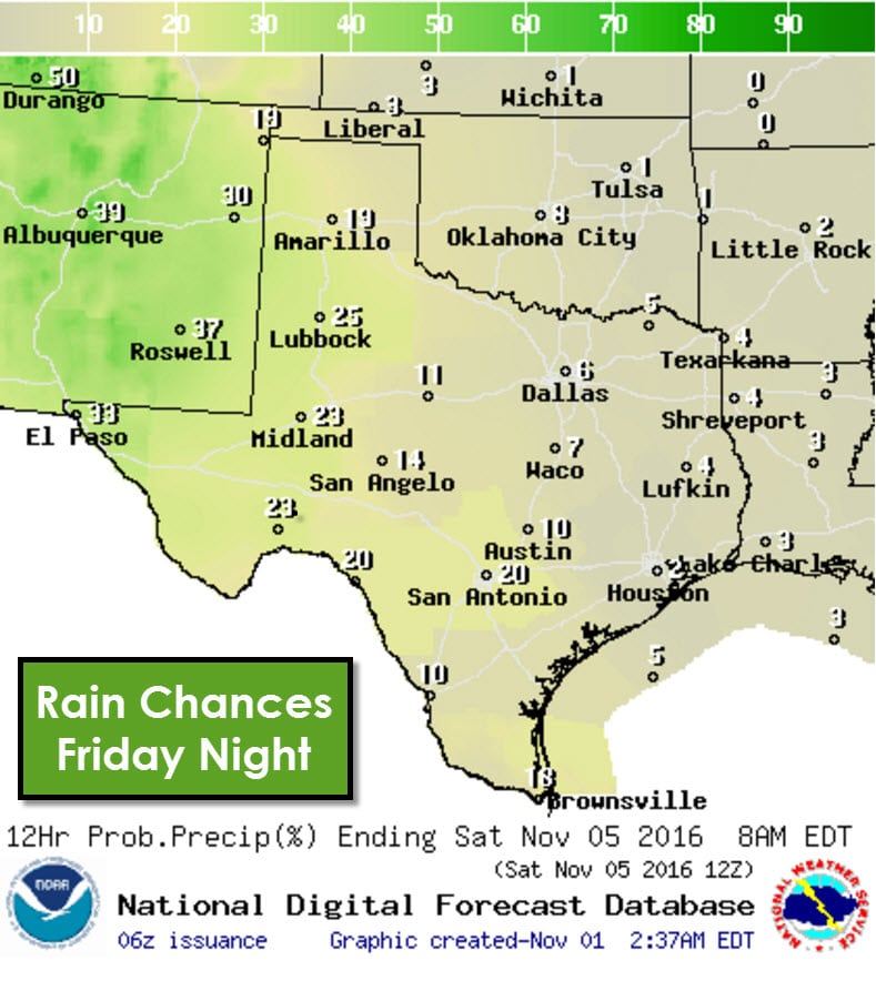
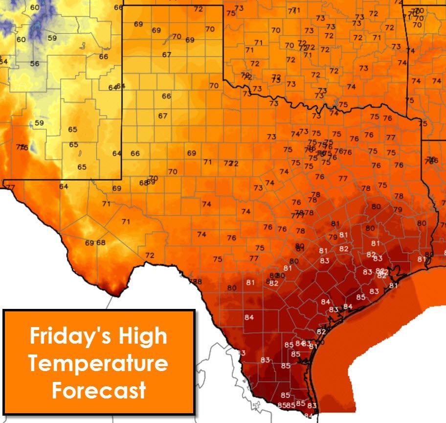
By Friday rain chances will be relegated to western sections of the Texas Panhandle, West Texas, the Permian Basin, Borderland, into Southwest Texas in association with another storm system. This storm system may bring another round of rain to parts of Texas this weekend. We’re too far out to accurately forecast specifics on those possibilities at this time.
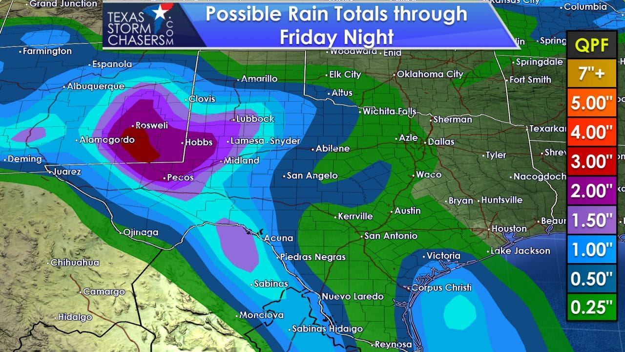
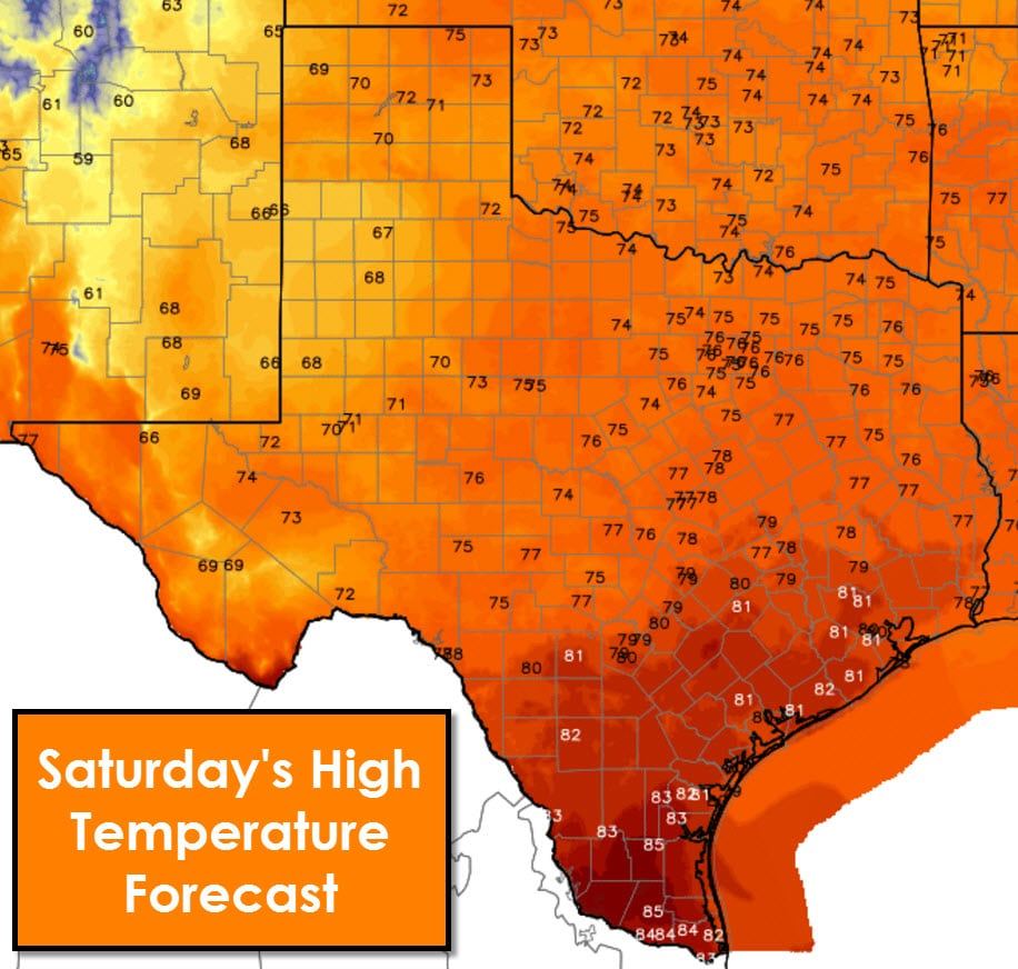
Overall rain amounts over the next five days will be on the lighter end of the spectrum. The heaviest amounts, up to two inches, will be across West Texas into the Permian Basin and Borderland. Additional rain is possible just after this time-period too. The next five to seven days should feature temperatures near or just above average. There will be rain chances, but severe weather and widespread flash flooding do not appear to be threats at this time. We need the rain.


0 Comments