
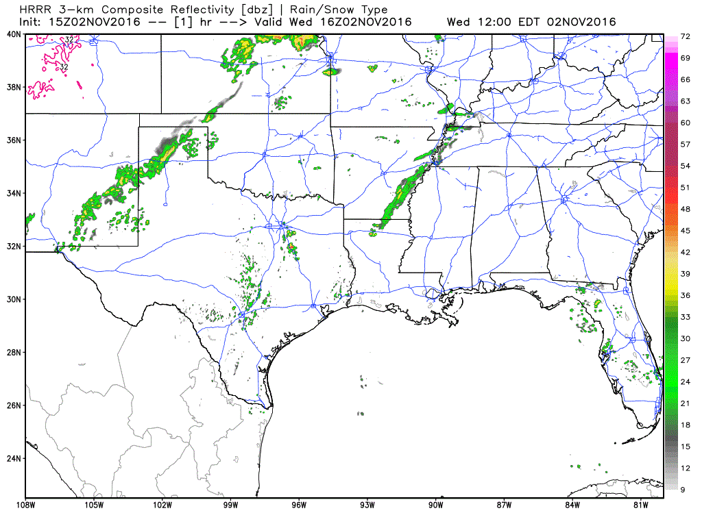
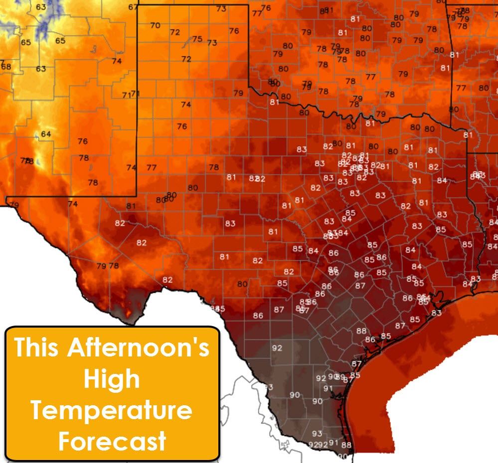
 There is a lot of moisture in place and you can definitely tell when stepping outdoors this morning. Scattered showers and thunderstorms are possible across the entire state today. The highest coverage of activity through the mid-afternoon will be along and east of Highway 281 from the Gulf Coast north to the Red River. These popup storms will be diurnally driven by hot temperatures (for November). Any popup storm may produce brief heavy rain, dangerous cloud to ground lightning, and gusty winds.
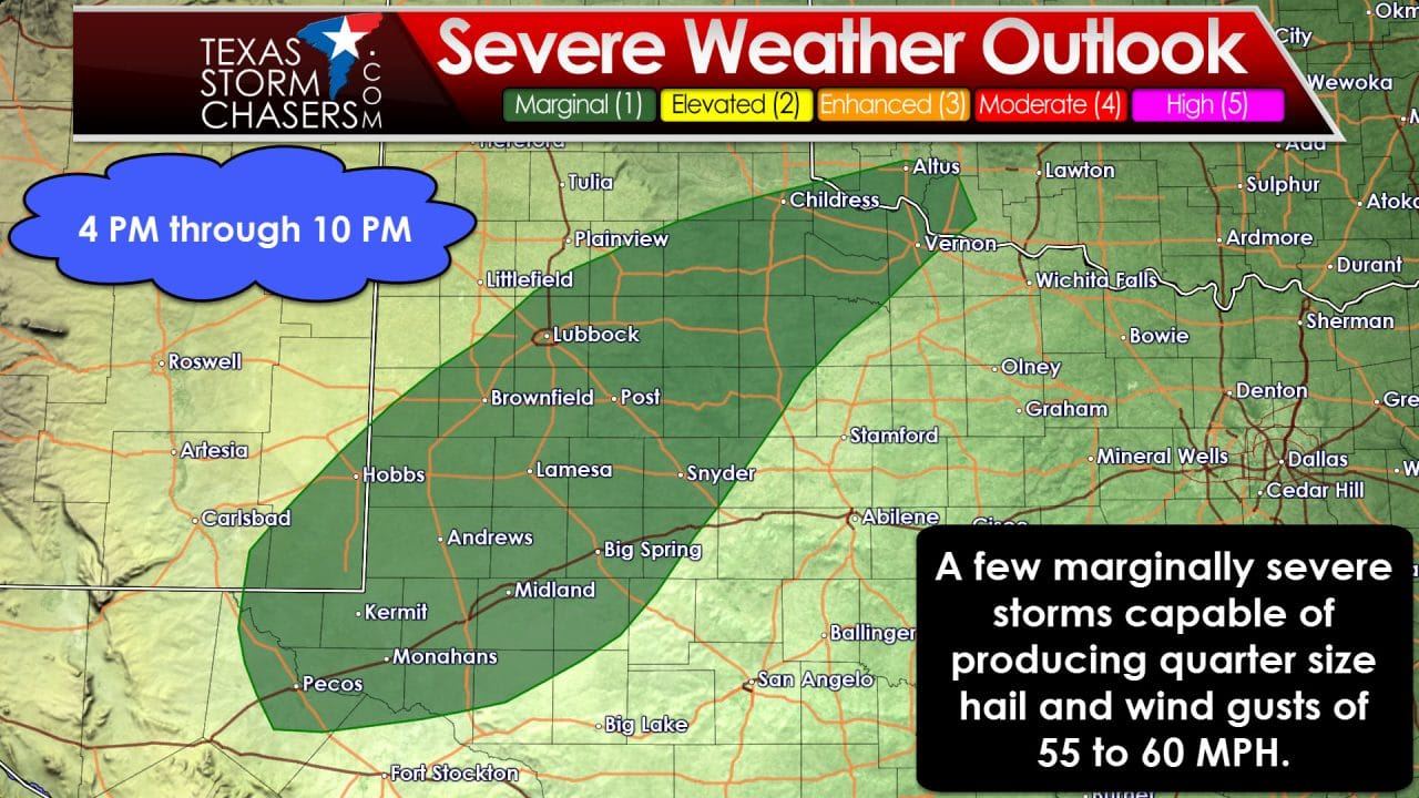
Focus shifts to the Texas Panhandle, West Texas, and Northwest Texas by the late afternoon hours. A cool front and an approaching upper level storm system will aide in thunderstorm development by 3-5 PM. Coverage of precipitation will rapidly increase across the eastern Texas Panhandle, West-Central Texas, Northwest Texas, and the northern Big Country around dinner time. Some storms may be strong to marginally severe during this period. Gusty winds of 50 to 60 MPH and hail up to the size of quarters will be possible with the strongest activity. Widespread severe weather is not anticipated at this time. The marginal risk of severe weather will decrease after 9-10 PM.
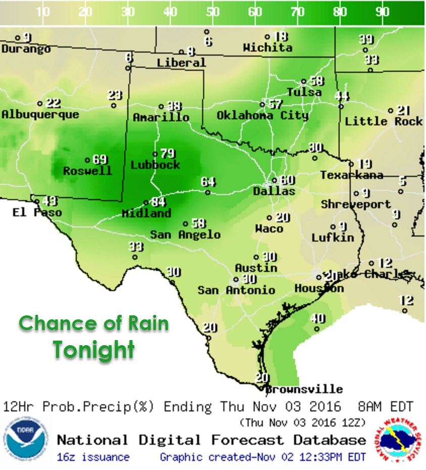
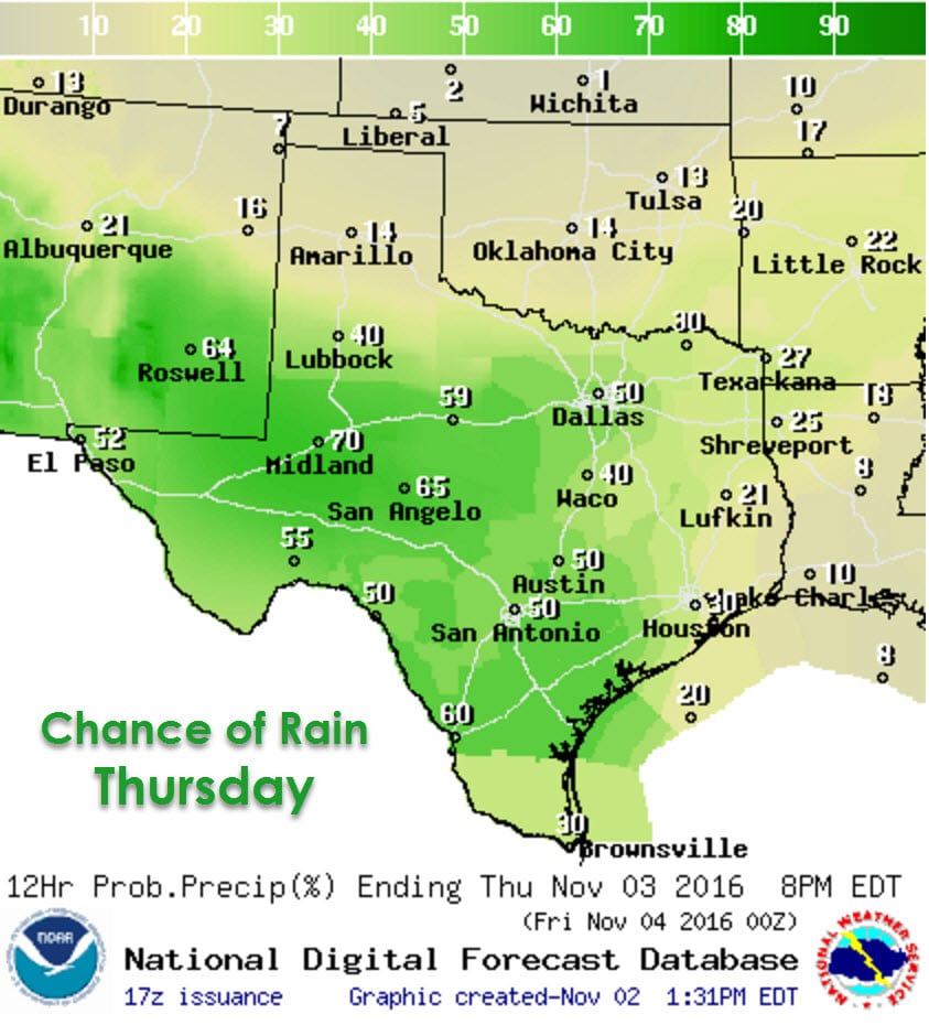
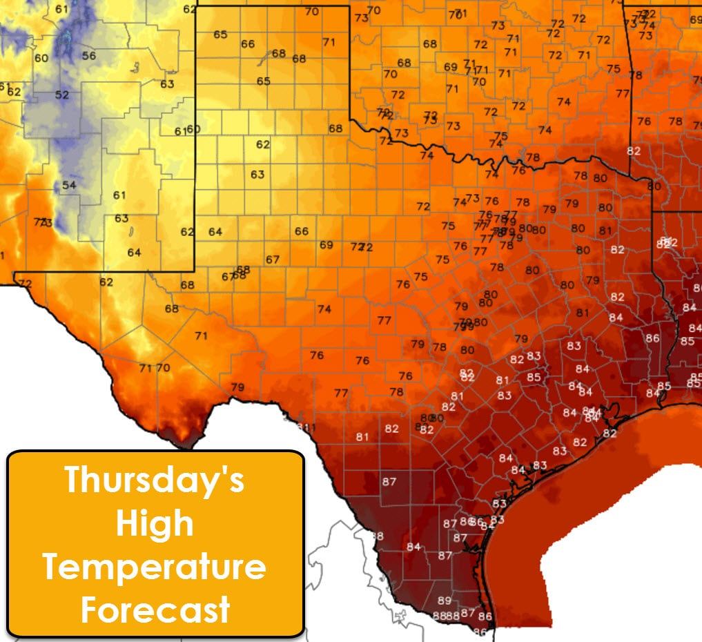
Widespread showers and sub-severe thunderstorms are expected to continue overnight across the southern Texas Panhandle, West Texas, Northwest Texas, the Big Country, spreading into western North Texas and the Permian Basin early Thursday. Severe thunderstorms are not expected during this time-frame. Most convection will occur behind a southward moving cool front. Rain chances will continue through much of Thursday in the Permian Basin, Southwest Texas, South Texas, the Rio Grande Valley, South-Central Texas, the Brazos Valley. Lighter rains will be possible along the Red River from West Texas through Northeast Texas.
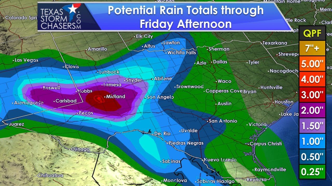
Over the next two days some locations in West Texas, the Permian Basin, into Northwest Texas may receive one to three inches of rain. There will be the possibility of very localized, minor flooding during this timeframe. Rainfall amounts are not expected to become high enough to produce significant or widespread flooding. A trace of rain up to one half inch of rain will be possible from the Rio Grande Valley and Southeast Texas coast north through Central Texas and North Texas.
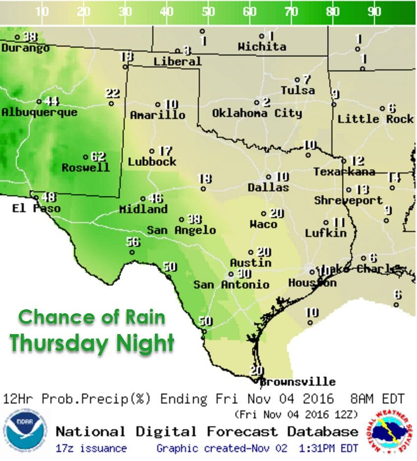
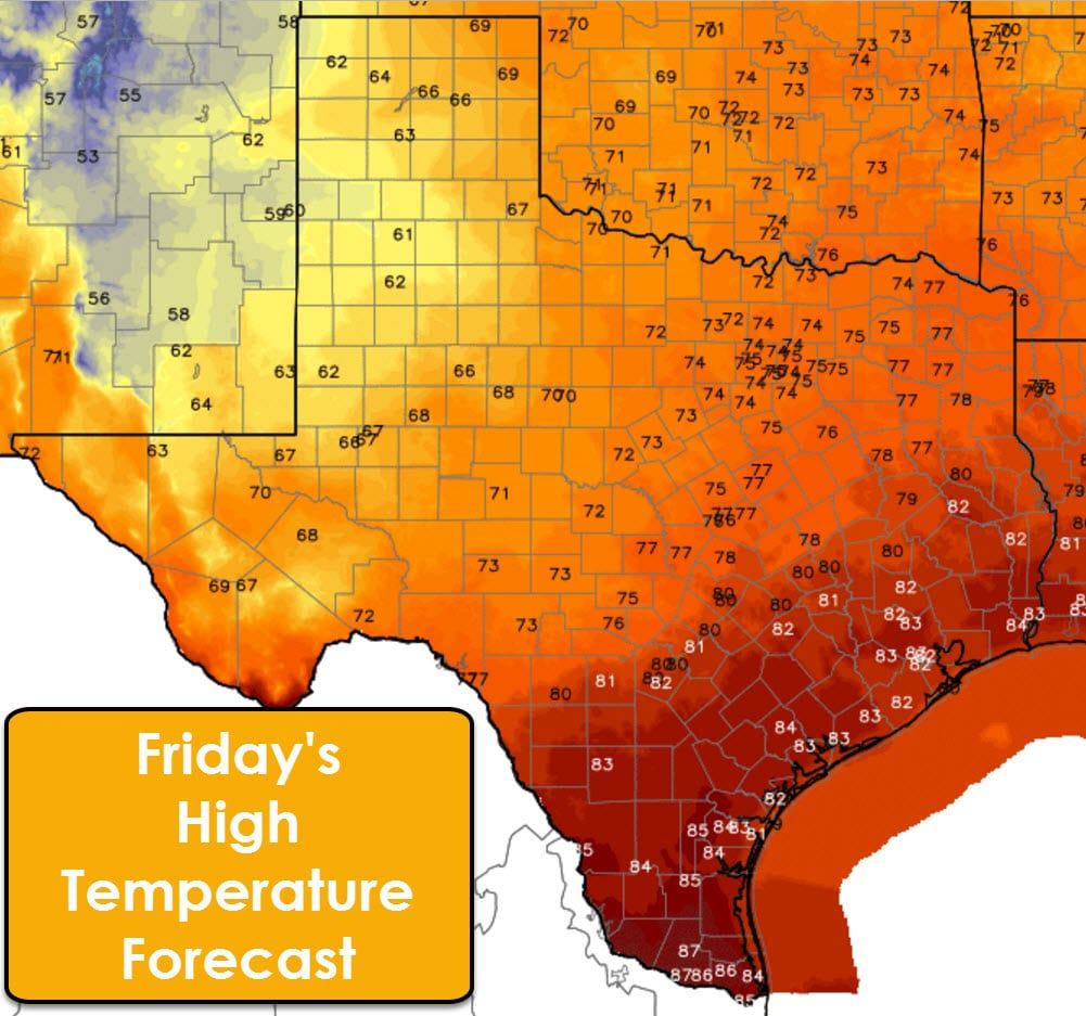
As we continue into the nighttime hours Thursday into Friday the highest rain chances will be in the Borderland, Permian Basin, into Southwest Texas. Some locations may pick up an inch or two of rain during this timeframe. Very localized, minor flooding cannot be ruled out. Widespread flash flooding and severe weather are not anticipated at this time.
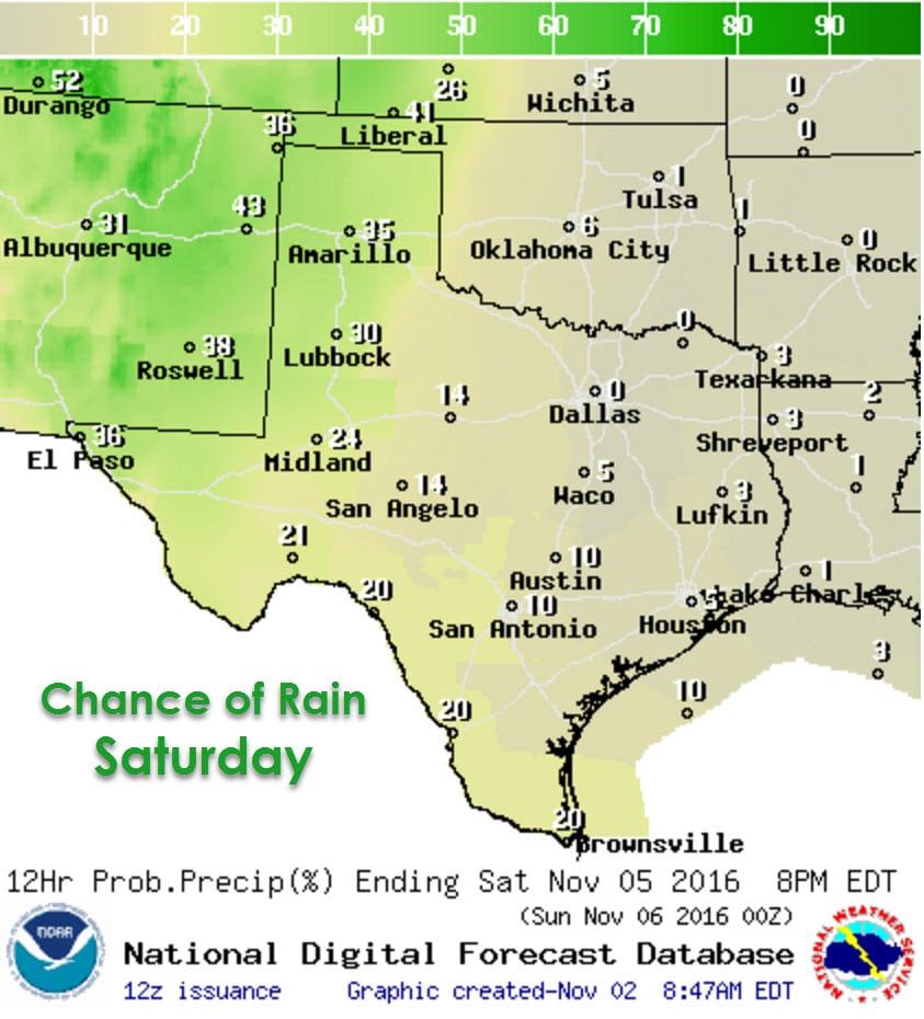
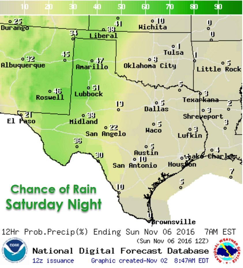
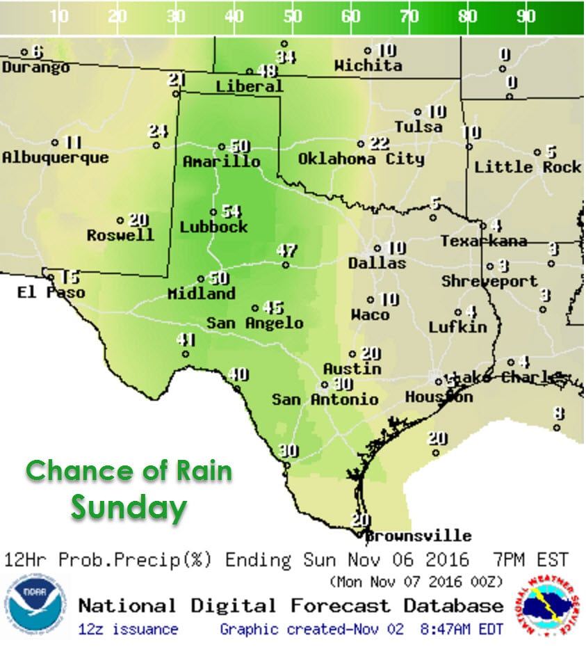
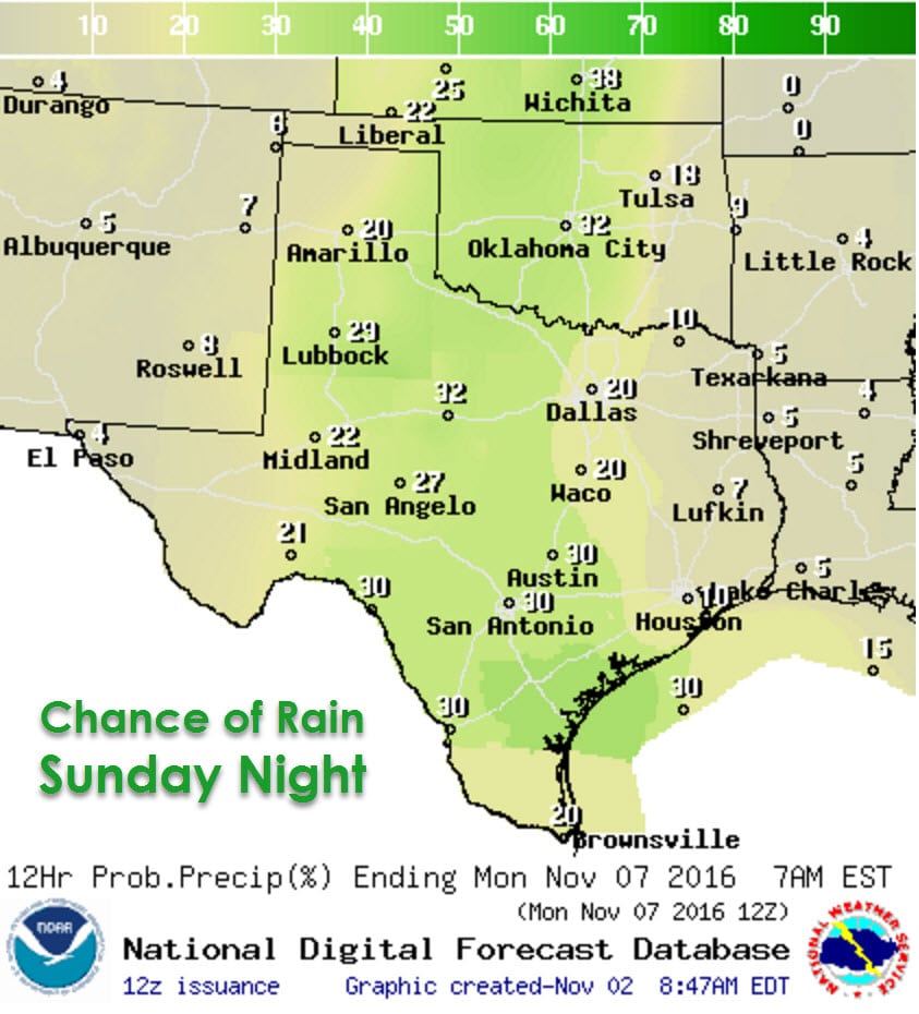
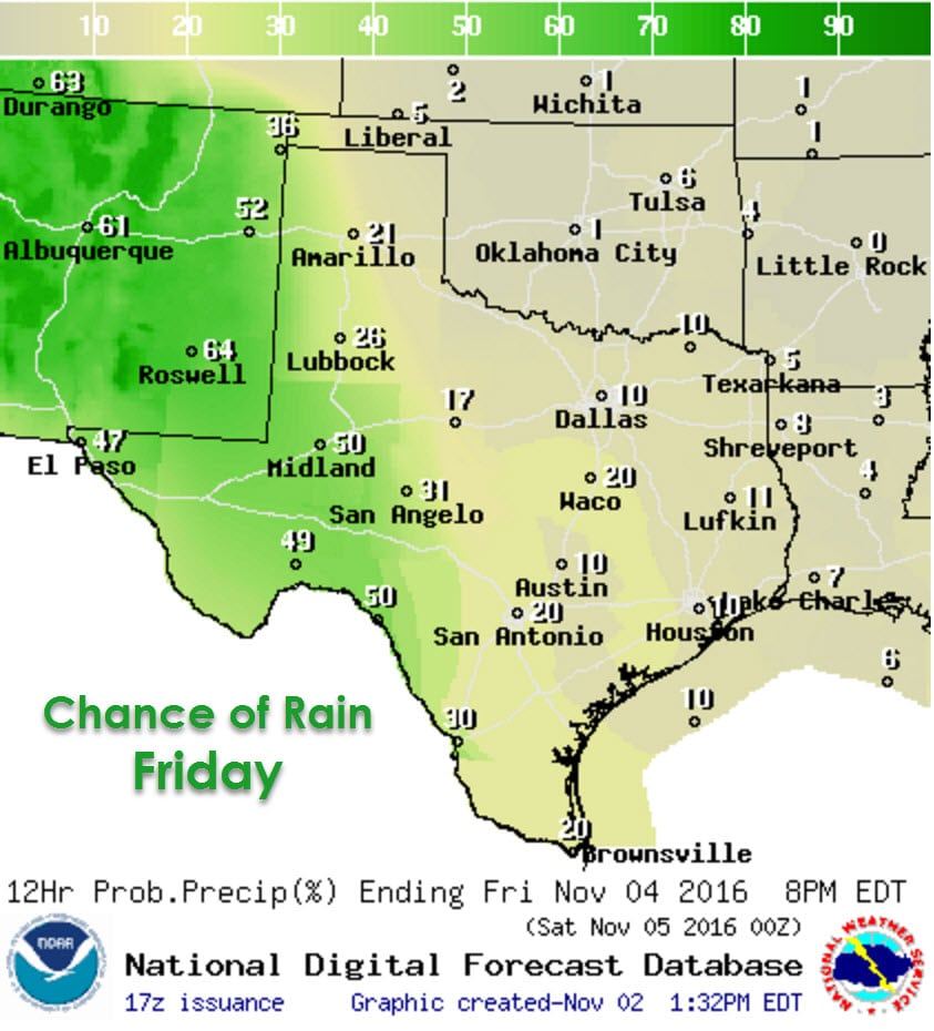
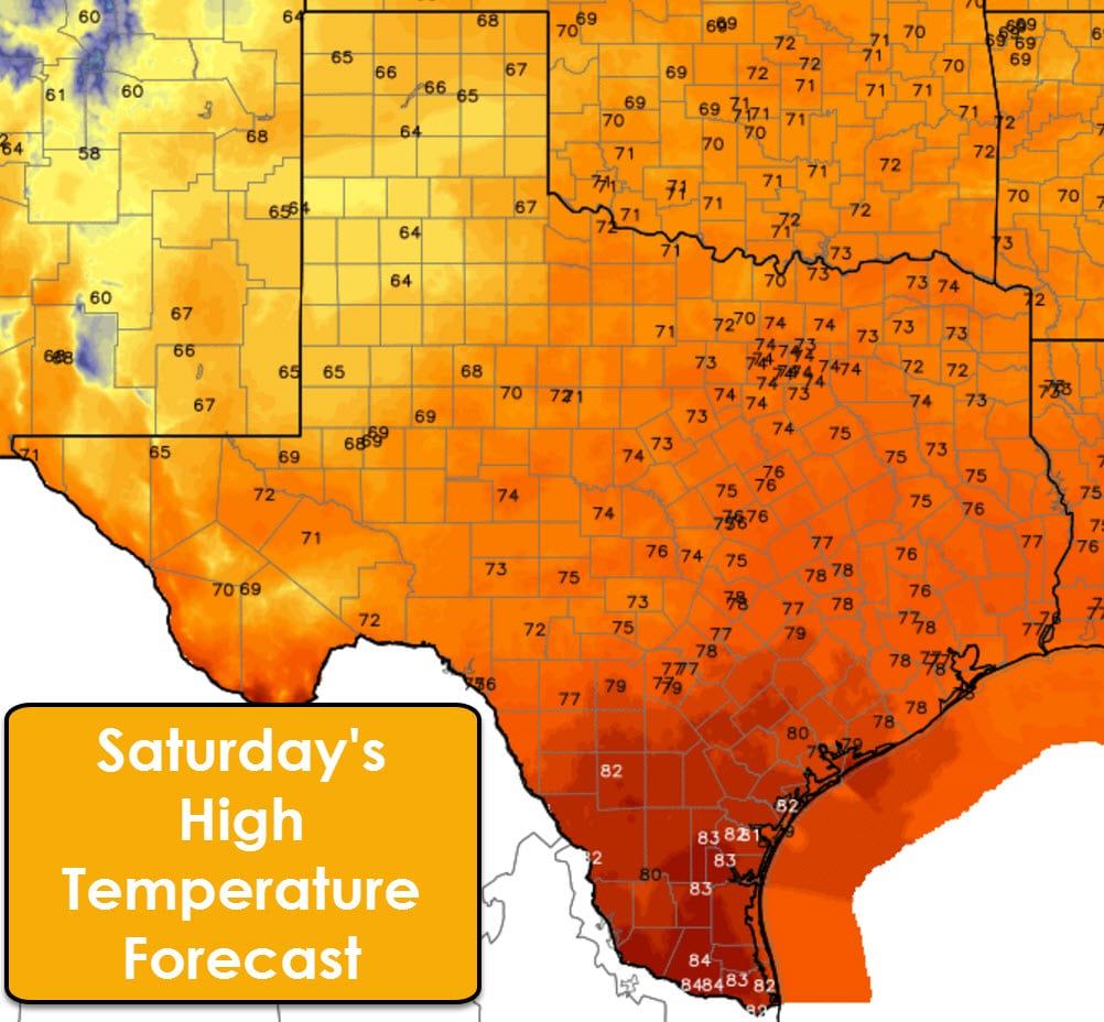
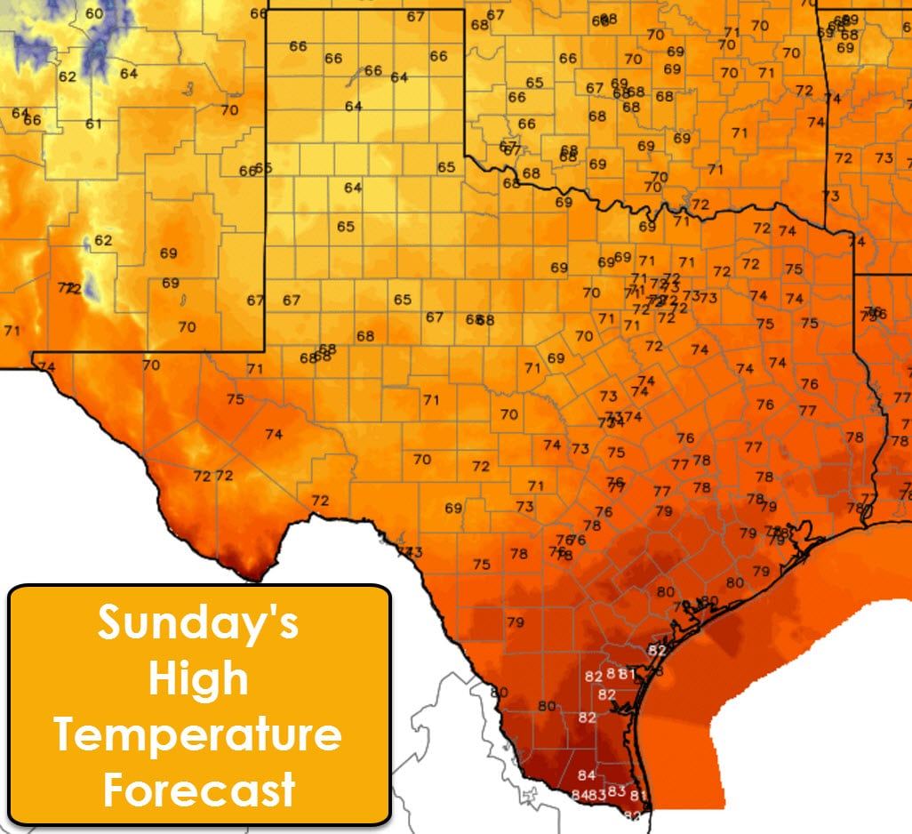
Another upper level storm system will move east into Texas on Saturday. The highest rain chances on Saturday will be across the Texas Panhandle into West Texas, the Permian Basin, and Borderland. Some locally heavy rain will be possible. Rain chances will spread east to Interstate 35 from the Red River to Mexico late Saturday into Sunday. Rain chances will continue through Sunday and into Monday. Another storm system next week could cause rain chances to continue. While widespread flash flooding and severe weather are not anticipated during the next few days some locations will likely get beneficial rainfall. The good news is a general wet pattern looks to continue into next week as well. Temperatures look to remain near average, but not at the record high levels we saw in much of October and will see again today.


0 Comments