
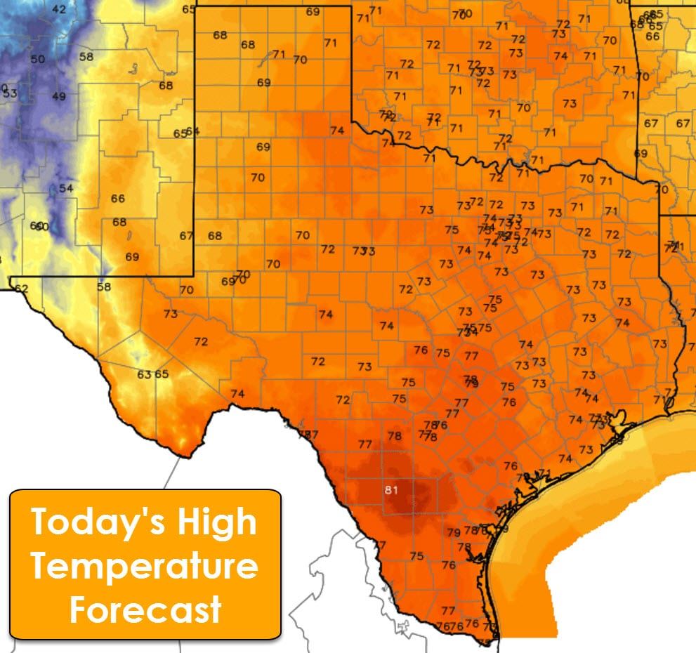
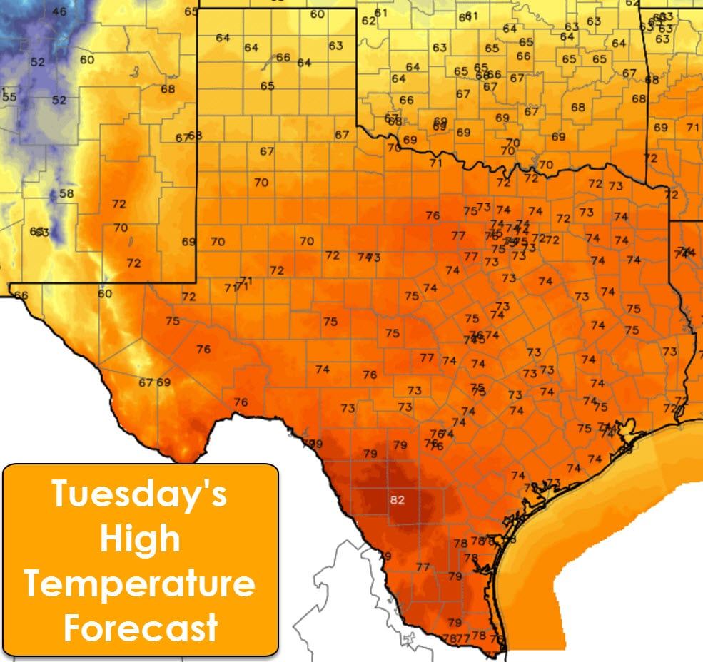
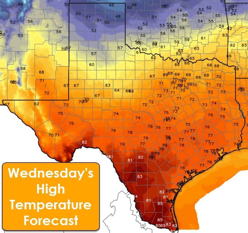
The main weather story for the next couple of days will be the above-average temperatures for January. Highs through Tuesday across Texas will peak in the 60s, 70s, and 80s. Lower humidity values and steady southerly/southwesterly winds will result in elevated potential for rapid wildfire spread. A cool front will start pushing south on Wednesday into parts of Texas. Highs will drop off into the 40s and 50s in the Texas Panhandle with 50s to 60s in West Texas and Northwest Texas. The cooler air will sag south on Thursday and Friday with highs dropping off into the 50s and 60s into West Texas, the Big Country, North Texas, and Northeast Texas. Warm weather will continue across the southern half of Texas during this period as the front stalls out.
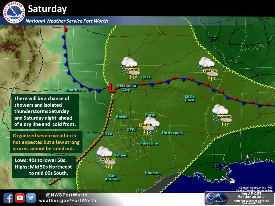
Our next chance for precipitation will arrive later this week into the weekend. The best chance for widespread rain will be in Northeast Texas into adjacent sections of Arkansas, but we should see scattered showers and storm chances across the eastern half of Texas as well. We’ll be able to refine this aspect of the forecast by Wednesday or Thursday. Widespread severe weather doesn’t look probable at this time as widespread clouds should help keep the atmosphere fairly stable. This pattern will also support the cooler temperatures discussed above.


0 Comments