
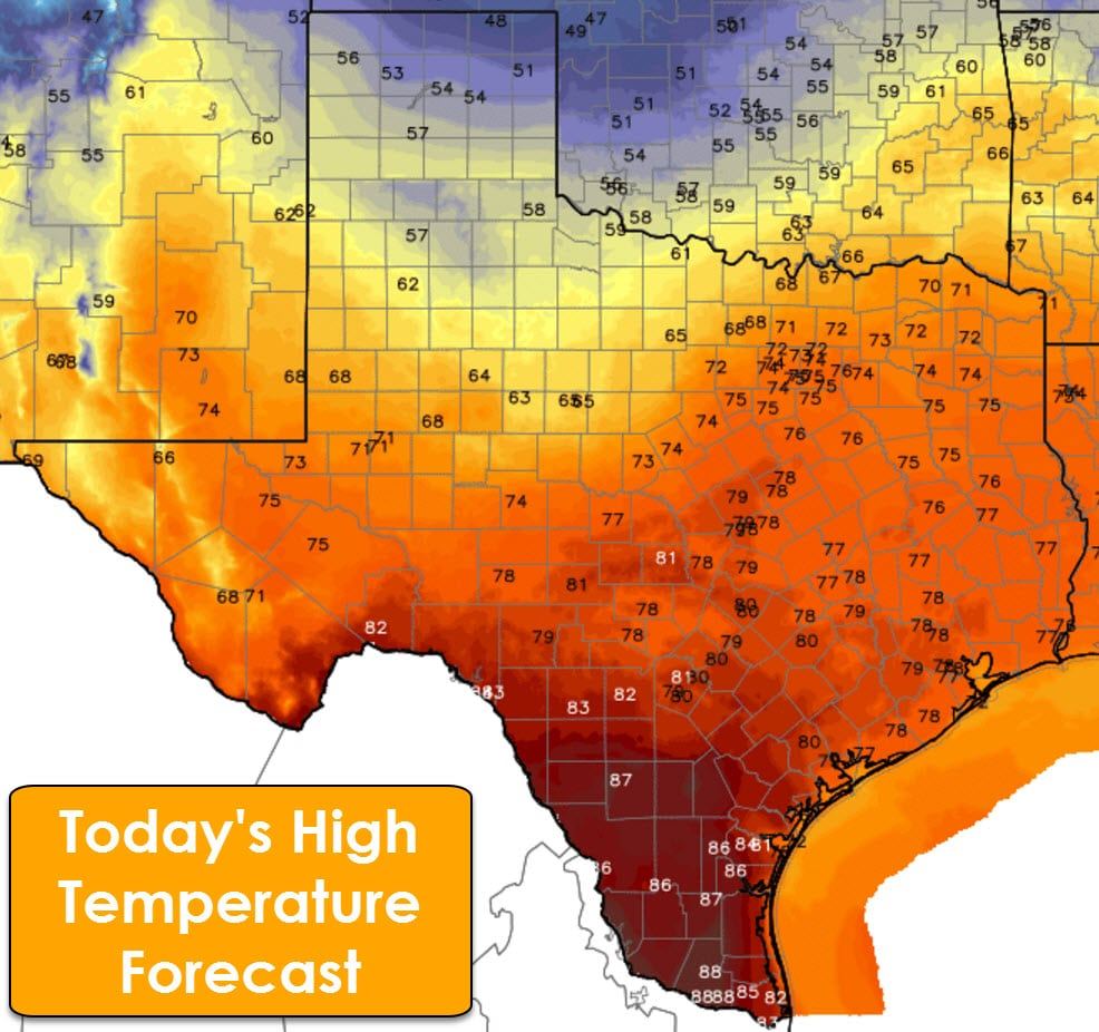
A cool front will move south later today into tonight. This front will stall out in parts of the Permian Basin into the Big Country and Central Texas on Thursday. South of this front temperatures will remain above-average with highs in the 60s, 70s, and 80s. North of the front, temperatures will be significantly colder. Highs on Thursday will be in the 40s in the Texas Panhandle, West Texas, and in Northwest Texas. 50s are expected north of a Midland to Abilene to D/FW to Tyler. Similar temperatures are forecast on Friday with a sharp gradient between the warmer air mass south of the front and cooler conditions north of the front. The cool front will lift back north on Saturday. By Superbowl Sunday we’ll see high temperatures in the upper 70s to lower 80s across all of Texas. Definitely no ice storm for this year’s super bowl in Texas.
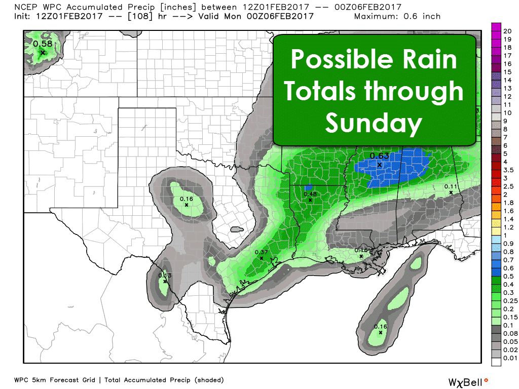
There will be a sporadic chance of light showers through the weekend across the eastern two-thirds of Texas. This activity is not expected to be heavy, significant, or severe. A few spots across Northeast Texas, East Texas, and Southeast Texas may see up to four-tenths of an inch of rain by Sunday. This activity will occur over several days, so the overall scheme of things will be a few rounds of light rain possible. At this point it looks like there will be a low chance for a thunderstorm on Sunday in Houston. Another storm system and cold front could bring a chance of showers and thunderstorms on Monday into Tuesday. We’ll deal with those chances once we get clear of this late-week system.

0 Comments