
Late April is upon us, and it is no surprise we have a couple of opportunities for severe weather over the next week. Severe weather is nothing unusual during April and May in Texas. Frankly, it occurs twelve months out of the year, but the highest concentrations typically involve the spring months. We’ve dealt with hailers and even a stretch of quiet weather.
I don’t believe we have had any confirmed tornadoes in April across Texas, but I doubt we’re able to hold that number over the next seven days. Remember, it only takes one tornado coming down your street to make it a historic day for you. Yet, having a way to receive weather warnings and quickly enacting your severe weather safety plan will keep you and your family in good shape. Don’t fear severe weather days – because we have plenty of them.
Today’s Severe Weather Outlook
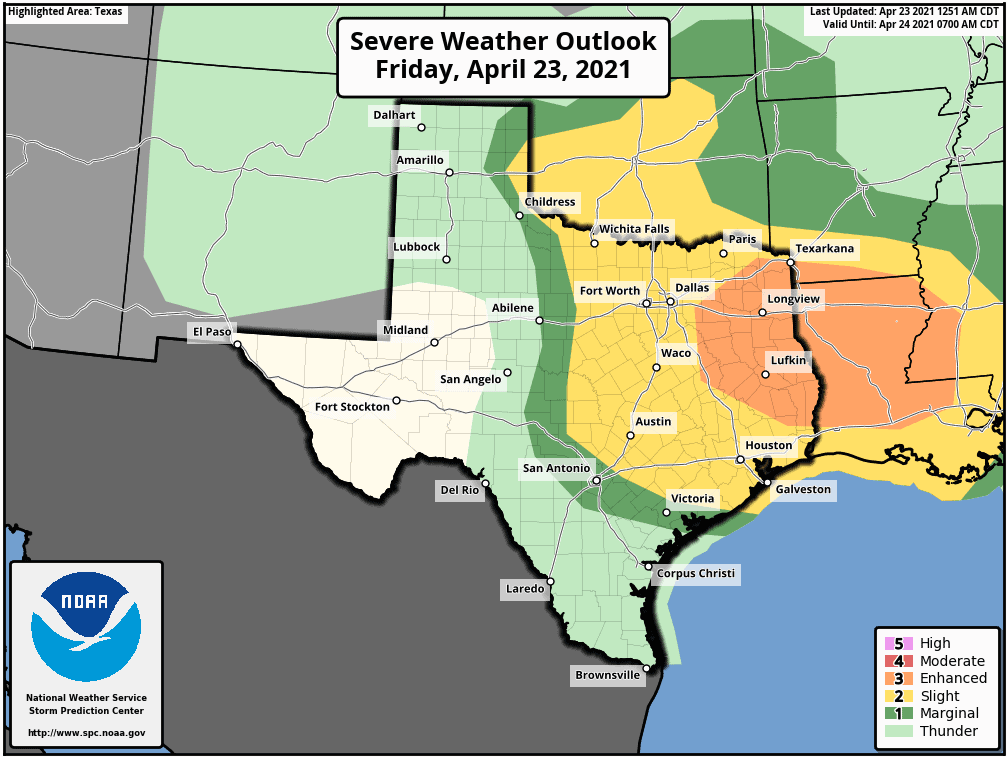
With the latest severe weather outlook, the Storm Prediction Center has upgraded much of East Texas to a coverage level of three out of five on the severe weather risk system. A level three risk means there is a roughly one in three chance of severe weather within your local area (25 miles).
A level two risk includes the far eastern Texas Panhandle, Texoma, North Texas, Central Texas, the Hill Country, the Brazos Valley, Southeast Texas, and Northeast Texas. A level two risk, the standard risk level, means there is a roughly one in six chance of severe weather within your local area (25 miles).
A level one risk runs slightly west/south of the higher risk zones. A level one risk, the lowest on the five-level scale, means there is about a one in twenty chance of severe weather within your local area (25 miles).
Notice how I did not mention specific threats but the chance of severe weather. A severe storm in a level one risk can produce the same hazards as a severe storm in a level three risk. The chances are simply higher (at least, our forecast says so) in higher risk levels. Those within any risk level have a chance of a severe storm in their area today (or any day there is a severe weather risk issued).
You can view the latest severe weather outlooks for Texas by clicking/tapping here.
Threats
Very large hail up to the size of tennis balls and localized damaging wind gusts up to 70 MPH are the primary threats with more intense storms today. A few tornadoes along with localized hurricane-force wind gusts up to 80 MPH are also possible, especially in East Texas, where low-level wind shear will be maximized.
A messy storm mode in East Texas is a limiting factor against a more significant tornado threat this afternoon and early this evening. If storms remained clustered versus more discrete supercelluar, we might also be dealing with quarter to golfball size hail versus 2″+ in diameter.
Isolated supercellular thunderstorms are possible in the eastern Texas Panhandle and Northwest Texas late this afternoon. The most intense storms may produce damaging hail up to the size of baseballs and localized wind gusts up to 75 MPH. A tornado cannot be ruled out. Thunderstorm coverage is expected to remain low, but any storms that get going could be nasty hailers. Those storms will move into western and Central Oklahoma this evening.
Timing
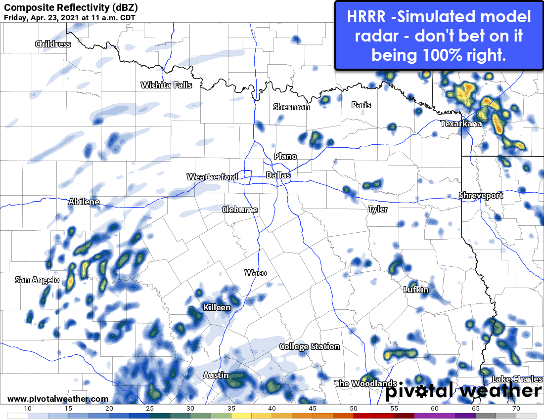
Scattered to numerous showers will likely be underway by mid-morning across the eastern half of Texas. By noon I expected we’ll have an uptick in thunderstorms, along with the potential for hail out of stronger storms, in North Texas south into the Hill Country and Central Texas. Most storms will move northeastward.
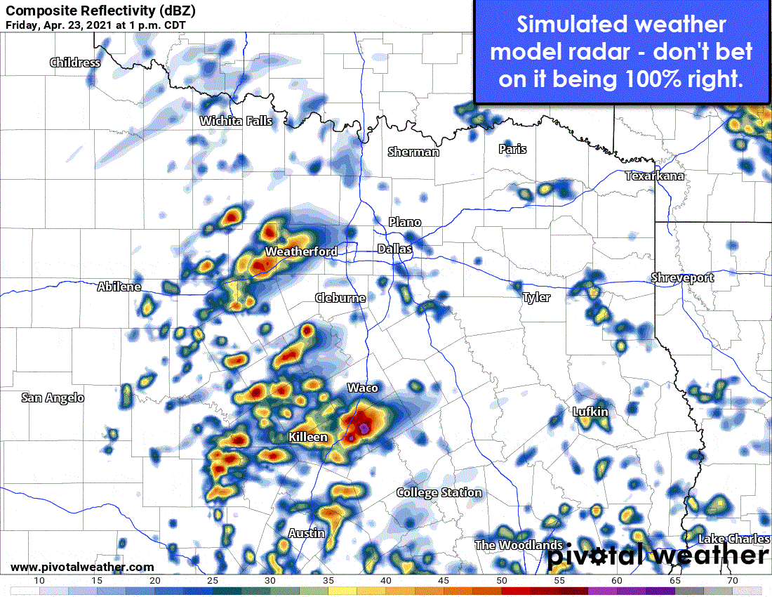
Numerous thunderstorms will break out not long after lunch, or in the early afternoon, across those same regions. Unlike events earlier this month where we had isolated, discrete thunderstorms – today will feature many thunderstorms fighting to dominate. That’s actually a good thing in regards to reducing the threat for higher-end severe weather since most storms will not be out by themselves, although that makes it more difficult for storm chasers.
Not all thunderstorms will be severe or produce hail. As widespread showers and storms move into East Texas by the mid-afternoon, we’ll see the most intense storms producing large hail, damaging straight-line winds, and torrential rainfall. A few rain-wrapped tornadoes cannot be ruled out. Scattered thunderstorms are also expected farther south into the Brazos Valley and Southeast Texas this afternoon and evening – with the same hazards.
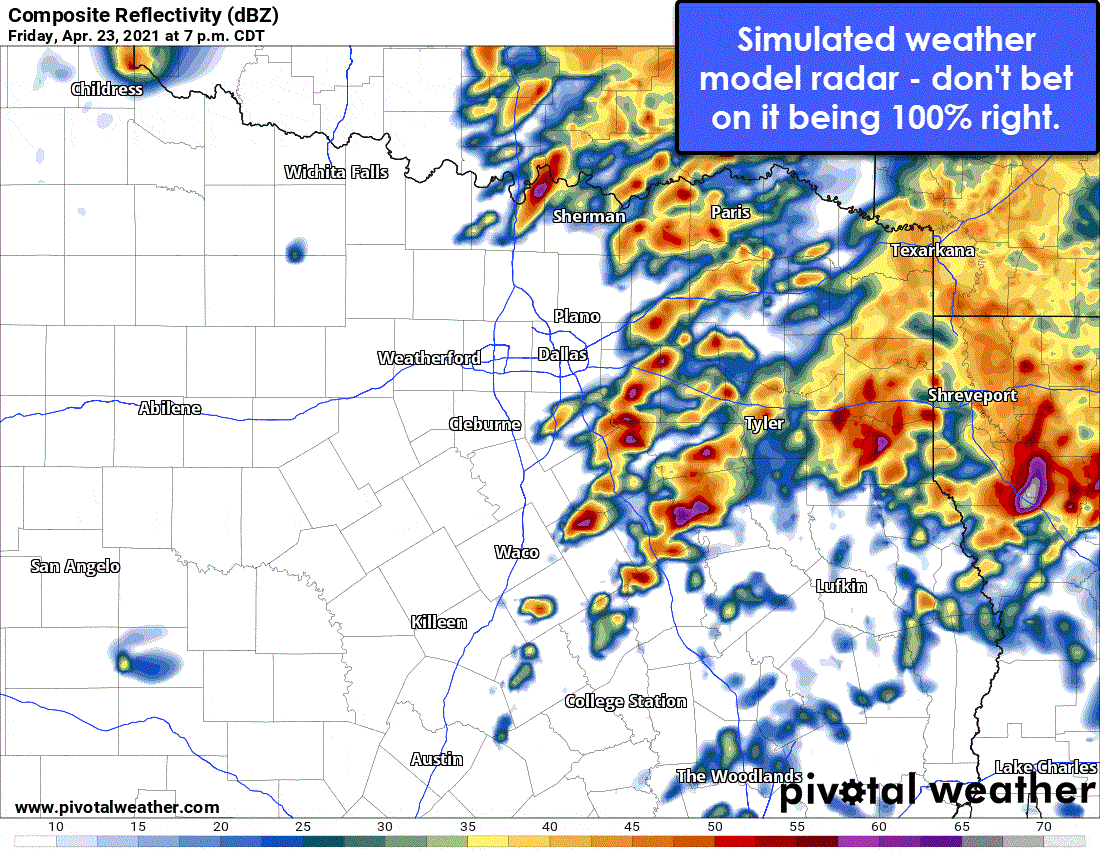
Multiple rounds of storms will continue through the early evening hours in East Texas, with some locations receiving more than one ‘hit’ by a severe thunderstorm. Multiple rounds of storms also increase the threat of localized flash flooding. Thunderstorms will end from west to east this evening across Northeast Texas, East Texas, and with more isolated activity in Southeast Texas. I’m hopeful we’ll have most of the severe weather exiting to our east by 11 PM.
Remember the afternoon storms in the Texas Panhandle that will move into Oklahoma this evening? Those are expected to grow upscale into a squall line. As the squall line becomes more organized, it may turn more southeasterly with a damaging straight-line wind threat.
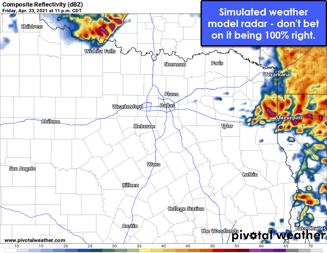
It isn’t guaranteed, but the tail-end of the squall line could impact the Red River this evening and overnight from Gainesville east to Texarkana. That’s going to be more of a wait-and-see scenario, especially since storms earlier in the day may make it difficult for any stronger storms tonight.
Rain chances will end overnight as the upper-level storm system goes off to bring severe weather annoyances to the Southeastern United States tomorrow. Our weekend across Texas is looking beautiful in the weather department with dry conditions and warm temperatures.
A fairly classic-looking spring severe weather setup will arrive on Tuesday. At least the eastern half of Texas looks to be under a ‘risk’ Tuesday afternoon and Tuesday evening. We’ll have to get closer before pinning down specific hazards and timing, but it is late April.
Watch us live later today…
We’ll be around providing severe weather information on our social media platforms along with live storm chasing video from the field on YouTube. Should any tornado warnings be issued, I’ll be on Facebook, YouTube, and here on our website and mobile app with live severe weather coverage.


0 Comments