
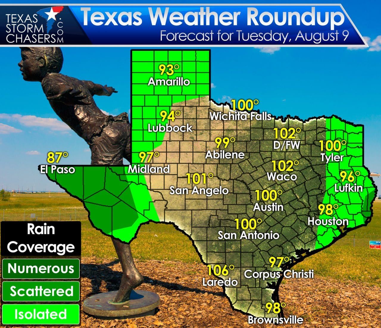
The monsoon has picked up steam over the past couple of days across Far West Texas. Rain is underway in El Paso this morning and several folks in the western Permian Basin saw rain yesterday. These rain chances will continue today with scattered thunderstorms this afternoon into tonight across Far West Texas. Some locations could pick up more than an inch of rain today and a flash flood watch is in effect for Far West Texas. Isolated activity will be possible today and tonight across the Texas Panhandle and West Texas. Isolated afternoon activity will occur in Northeast Texas, East Texas, and Southeast Texas where moisture levels will be relatively higher than near Interstate 35. Coverage of afternoon showers will be highest near the Louisiana border. Look on the bright side – those lucky enough to get rained on will also see their temperatures fall back into the 80s for a bit.
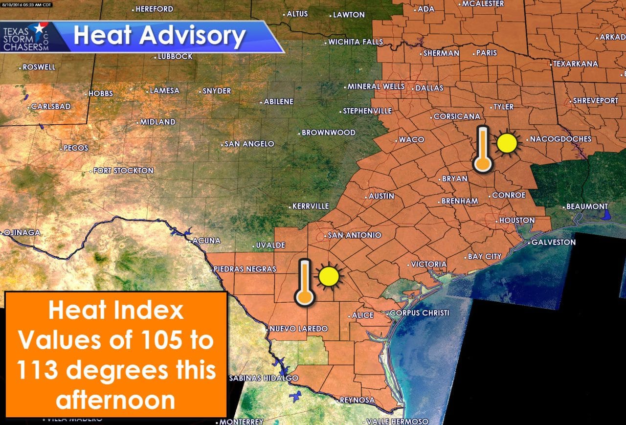
Besides the rain chances today the same old summer story continues. High temperatures will range from the middle 90s to the lower 100s across the state today. El Paso will be an exception with continued rain keeping temperatures back in the 80s. A heat advisory is in effect along and east of Interstate 35 from the Mexico border north to Oklahoma. Heat index values over 105 degrees can be expected in the advisory zone this afternoon. More humid locations will see heat index temperatures near or above 110 degrees for a while today. Combined with low temperatures in the 80s and the August sun it will not take long to stress out our bodies. Please take frequent hydration breaks and book it indoors at the first sign of heat exhaustion.
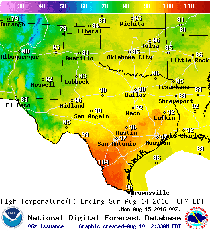
Sunday’s high temperature forecast
Big changes to our weather arrive beginning on Friday. A somewhat rare summer cool front will push south. Moisture from a former tropical storm near Baja California will be advected northeast. Finally we’ll have a series of weak upper level disturbances move overhead on Friday, Saturday, and Sunday. All of those combined mean a decent chance for rain at times this weekend. Temperatures across the western/northern half of Texas will be comparatively cooler. In fact high temperatures look to be below average on Saturday and Sunday. Some won’t get out of the 80s this weekend.
We’ll refine rainfall expectations as we get closer to the weekend. At this time it seems possible that several inches of rain could fall across Far West Texas and in the Permian Basin. Flash flood watches may be required at some point. Some folks further east could also see an inch or two of rain with this upcoming system. Let us get a bit closer in time before we share more specific rain accumulation forecasts.


0 Comments