
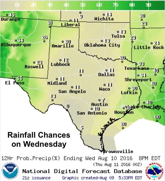
Increasing monsoonal moisture over the western half of the state will continue to drive rain and thunderstorm chances over the next several days across this region. A Flash Flood Watch has been issued for counties in and around El Paso and into southern New Mexico until Thursday morning…and that may be both expanded and extended as additional rain chances arrive over the weekend. Scattered showers and storms currently across this region will continue overnight and through Wednesday with 2-4 inches of rain possible by early Thursday. With that, flash flooding will be a concern within and downstream of wherever the heaviest rainfall sets up across the area over the next several days. By late this week, remnant moisture from Tropical Storm Javier over the Baha will arrive in conjunction with a rare August cold front which will keep rain in the forecast across the western half of the state through the weekend and likely into Monday as well.
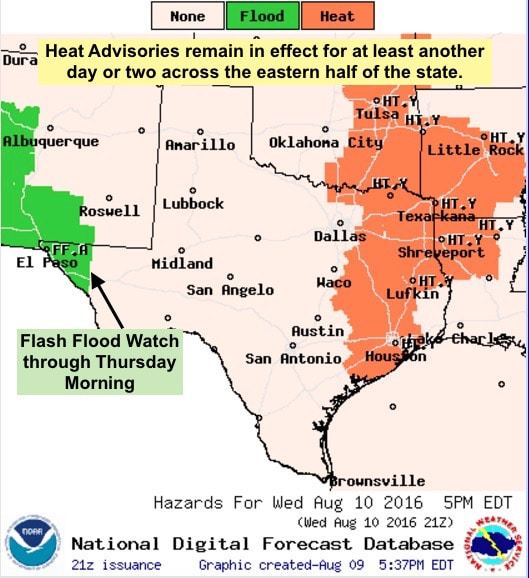
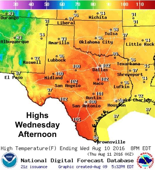
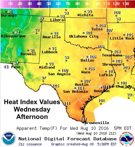
For the eastern half of the state and along the coast, heat will continue to be the main concern with Heat Advisories likely to remain in effect through tomorrow and Thursday as well. Heat Index values exceeding 110 are likely for coastal areas from Beaumont, Houston/Galveston, Corpus Christi to Brownsville by tomorrow afternoon. Further north across east and northeast Texas, values between 105 and 108 will be likely tomorrow. Beyond tomorrow, local forecasters are taking it day by day after that as the daily likelihood of rainfall and cloud cover across the region may help to keep afternoon heat index values below advisory criteria.
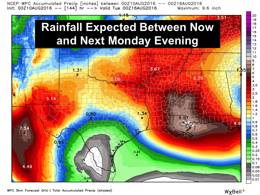
The rare August cold front we’ve been talking about for several days now is still on track to arrive over the weekend. With it, rain chances will increase across north and western Texas over the weekend and we’ll see temps drop down to levels more typical for this time of the year. Highs out in western Texas this weekend may only reach the low 80s, and for northern Texas, highs only in the low 90s! That’s definitely much better than we’ve been dealing with since last week! The rainfall forecast is looking quite nice as well with widespread amounts in excess of 1-2 inches likely and isolated higher rainfall totals possible!


0 Comments