

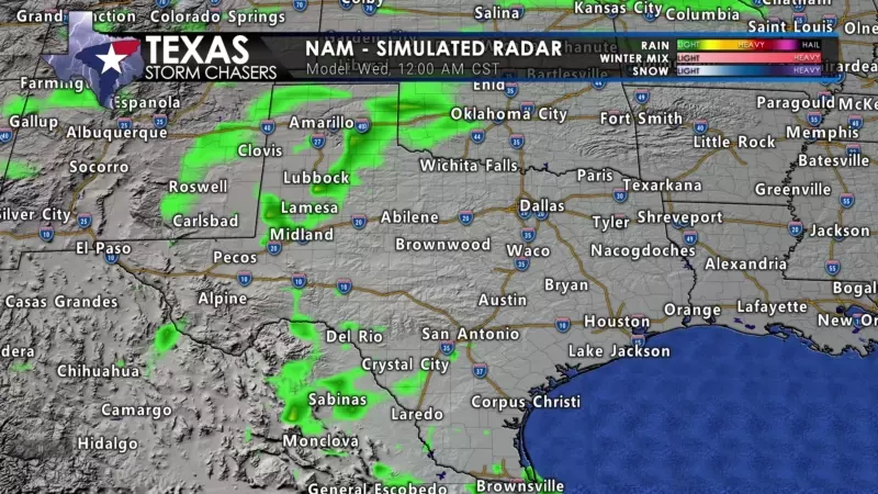
The first rain showers to kick off a multi-day rain event have begun developing in the Permian Basin and West Texas. We’ll see rain coverage increase drastically on Wednesday morning across the Texas Panhandle, West Texas, Permian Basin, and into the Edwards Plateau and Rio Grande Plains. Rain will continue into Thursday and Friday, thanks to an upper-level low pressure around West Texas. That upper-level low will draw in moisture from the Gulf of Mexico and provide large-scale lift to support a large area of rain. The animation below will need to be clicked on by our mobile app users to view it.
It’s a blessing that doesn’t happen too often for western Texas. As we get into Thursday afternoon and Friday, the large area of moderate to locally heavy rainfall will move east across the eastern two-thirds of Texas. Again, no severe storms are expected – but some lightning and thunder are good bets.
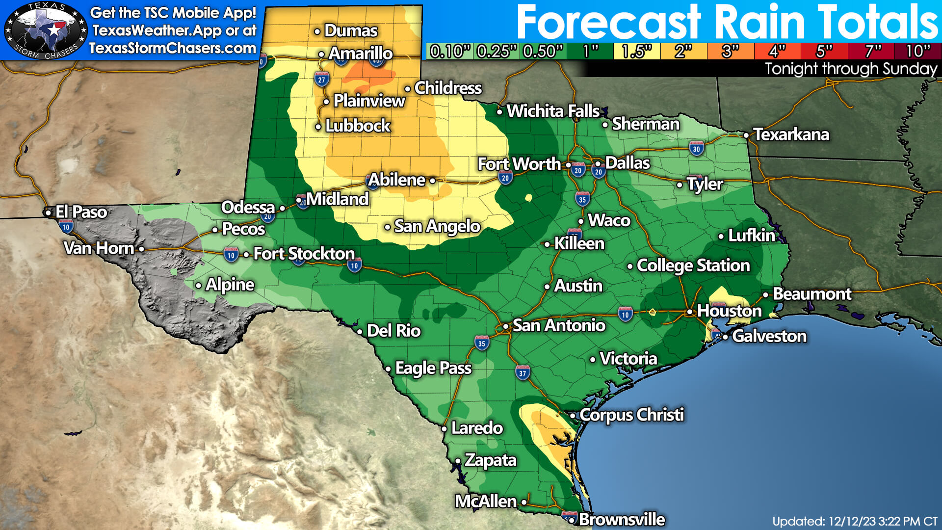
Over the next few days, one to three inches of rainfall is expected for the Texas Panhandle, West Texas, Northwest Texas, and the Big Country. Locally higher rain totals are possible, and it’ll certainly be enough to wash out the gullies. Widespread one-quarter to one-inch rain totals are expected elsewhere across Texas by Saturday if you’re located east of the Guadalupe and Davis Mountains.
In other words, the eastern seventy-five percent of Texas will likely get rained on. Rain chances will be highest across the eastern half of Texas on Friday, including Texoma, North Texas, all the way down through Central and South Texas, into the Ark-La-Tex, East Texas, and Southeast Texas. We’ll see rain chances in South Texas, the Rio Grande Plains, and the Rio Grande Valley over the next few days, with abundant moisture in place.
Snow Accumulation Forecast for the Texas Panhandle
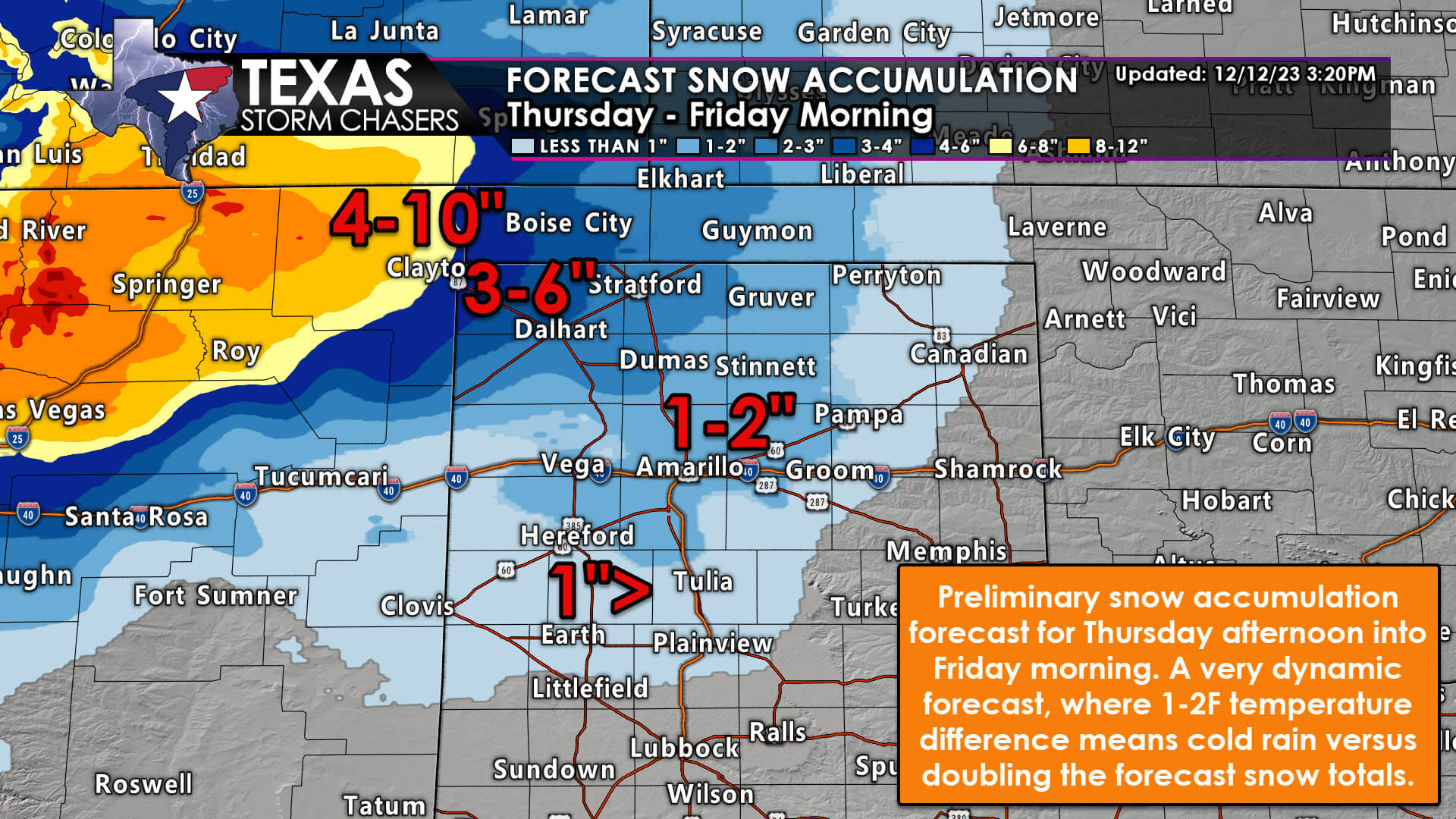
Three to six inches of snow is possible Wednesday night into Thursday across the northwestern Texas Panhandle (Dalhart). One to three inches of snow accumulation is possible farther south and east in the Panhandle, including Amarillo. A dusting to perhaps one-half inch of snow may occur farther south toward Muleshoe, Dimmitt, Plainview, to Clarendon.
Rain is expected to change over to snow Wednesday evening in the northwestern Texas Panhandle (Dalhart area). As this occurs, we’ll likely see heavier, wet snow begin to accumulate on all surfaces. Snowfall rates will likely overcome the melting rate even if surface temperatures are a degree or two above freezing. Several inches of snow are possible.
On Thursday, the rain will likely change over to snow across the northern and western Texas Panhandle, generally north of Interstate 40 and south along Interstate 27 toward Plainview, perhaps as far south as Lubbock. The timing of this changeover to snow will dictate just how much snow can accumulate.
One-half to two inches of snow seems like a reasonable bet for now, but if we end up one to two degrees colder, those accumulation numbers could easily double. This remains a situation where one or two degrees colder or warmer temperatures will make the difference between a cold rain or an impactful winter storm.
We’ll continue to closely monitor data since abundant moisture will be in place regardless of temperatures. If we end up on the colder side with a changeover to snow more quickly, we could easily see the one to four-inch snowfall totals multiply by two or more – especially across the northwestern and northern Panhandle.
Precipitation (rain or snow) will end Thursday evening in the Panhandle and West Texas, though some data suggests light snow may continue in the northern Panhandle into Friday morning. Any water or slush on roads by Thursday night will likely freeze as temperatures fall below freezing.


0 Comments