
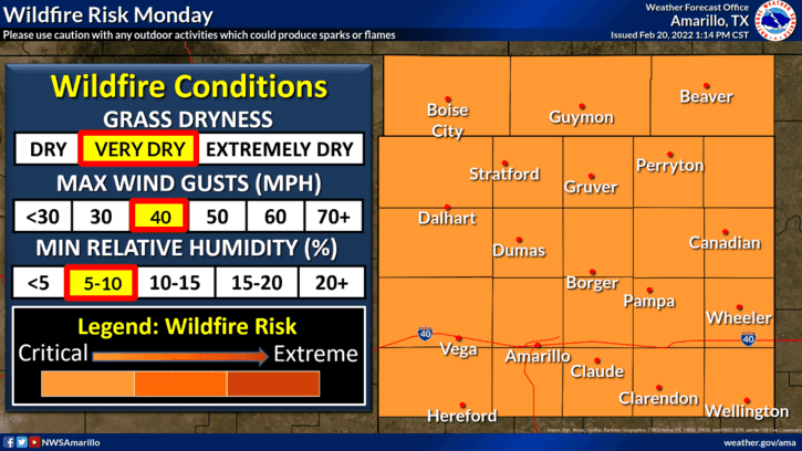
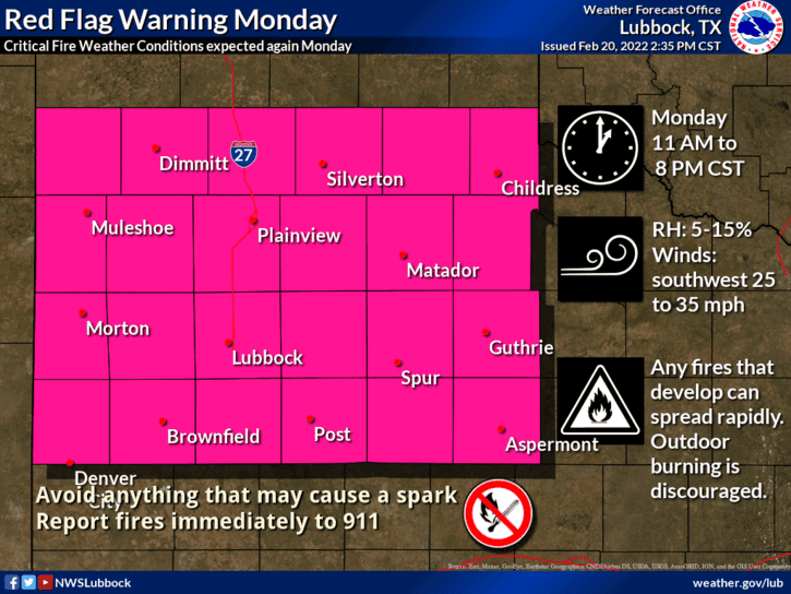
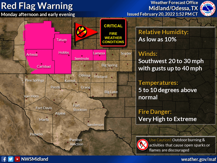
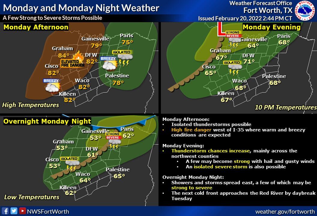
I hope everyone enjoyed the lovely weather we had this weekend, as we’re about to do a 360 temperature-wise with the arrival of our next strong cold front. For Monday, we’re looking at highs in the upper 70s and low 80s which is unseasonably warm for this time of the year. It will also be windy, especially across far western Texas, the Texas panhandle region, south rolling plains and northwest Texas where winds gusting up to 35 to 45mph or higher are possible. Critical Fire Weather conditions will also be present on Monday for most areas across western north Texas, the panhandle region and into portions of far western Texas into eastern New Mexico. With that said, be extra careful on Monday to avoid doing any type of activity that could throw a spark and start a wildfire.
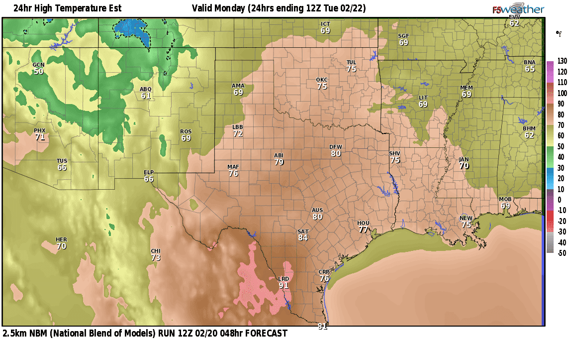
Monday’s forecast high temperature graphic is courtesy of F5 Weather -2.5k National Blend of Models – 12Z 2/20
Severe Weather Chances on Monday into Monday Night
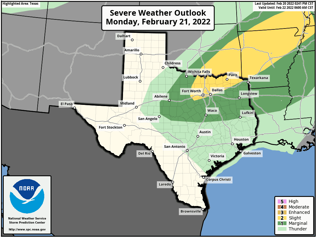
As of this writing (Sunday evening) the Storm Prediction Center has outlined much of central, north central and northeast Texas under Marginal Risk (Level 1) and Slight Risk (Level 2) for seeing strong to severe storm development late Monday into Monday night. (If you’re not in the Marginal or Slight risk area on the map above, then you are not under any threat for severe weather.) The mitigating factors for widespread severe storm development during the day on Monday will be…1) the existence of a strong capping inversion about 5,000 to 7,000 feet above the surface which will keep a lid on storm development, and…2) overall lack of instability and buoyancy due to forecast cloud cover. IF we can get some breaks in the clouds, which will allow for better surface heating and buoyancy, then we will likely see an increased risk of severe weather, but at this time, that looks unlikely to happen. What will likely happen is the development of a few widely scattered storms, some severe, during the late afternoon, late evening and overnight hours mainly west and northwest of the immediate DFW metroplex. A few of these late night storms could pose a threat for large hail and damaging winds before the quickly move off to the northeast across the Red River and into south central and southeast Oklahoma. Due to the presence of strong wind shear (wind changing in directions with height), the tornado threat is non-zero, but at this time remains a low-end threat. Once again because this will be a mainly after dark event, if you use your cell phone to receive severe weather notifications, make sure you have your phone volume up loud enough to wake you!
Winter Weather Chances Wednesday and Thursday
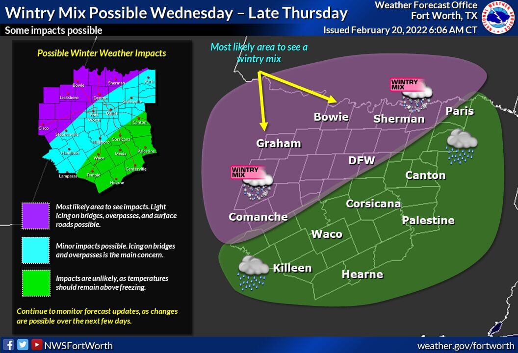
In typical fashion, winter weather remains a complex forecast for Texas. Unlike locations in the central and high plains, Texas…especially northern Texas…usually remains on the cusp of the freezing line which leaves forecasters constantly playing a guessing game of how far south the freezing line will reach when precipitation is also in the forecast. This is the scenario we are facing on Wednesday and into Thursday when a piece of upper level energy over the desert southwest will work to draw moisture up over our state on top of the cold front that arrived on Tuesday. At this time, the forecast calls for most of the “Winter Stuff” (a BaldyInChief term) to remain north and west of the immediate DFW metro area with only light impacts expected for the metro area. That’s not to say it won’t change, but for now, widespread direct impacts from freezing rain or sleet do not look as likely for the metro area as they do for areas outside of the metroplex where we are more likely to reach 32 degrees or below while precipitation is falling. If we see precipitation continuing into the overnight hours when temperatures are forecast to fall below freezing in the DFW metro and surrounding cities, then we will see impacts. As always, this will likely be a “wait and see” game. The NWS Fort Worth office has provided the graphic below which at this time best depicts at this time who will see “Winter Stuff” and experience the greatest impacts. If you’re not in or very near the pink shaded region on this map, you will most likely NOT see any impacts from winter weather. We’ll be monitoring the latest data as it rolls in over night and will continue to update you on this next threat of winter mischief as the forecast continues to evolve.
Last but not least, our Jason Cooley just finished a terrific live video update on the Winter Weather potential for Texas, Oklahoma and Arkansas. If you’re looking for a more in depth discussion of the current forecast for Wednesday and Thursday, be sure to check out his Wild Weather Week recording.


0 Comments