
Active weather doesn’t begin to describe the upcoming several days for several regions in Texas. We’re not necessarily expecting extreme-impact weather, but we will have multiple hazards and headaches. We’ll be discussing the threat of a few severe thunderstorms this evening, the timing of an arctic cold front tomorrow and Wednesday, and the potential for light freezing rain and sleet on Wednesday and Thursday. Oh, and near-record high temperatures and wildfire danger both today and tomorrow. Texas and Mother Nature are having a moment this week.
Tonight: Severe Thunderstorm Potential for Texoma and North Texas
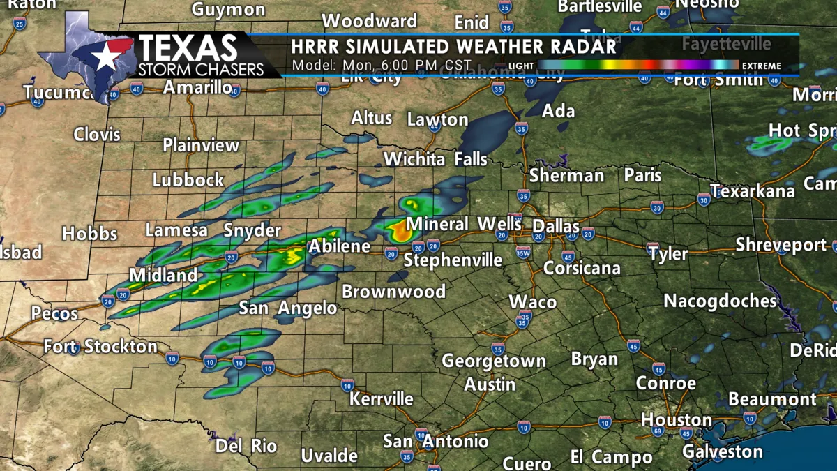
Scattered thunderstorms will increase in coverage after sunset in portions of the Big Country and western North Texas. Those thunderstorms will move northeast into Texoma and areas north of the D/FW Metroplex by 9-10 PM. We may see new thunderstorms continue developing into the overnight hours in those same regions. We should start calming down by 3-4 AM. Showers and a few storms may continue in East Texas through the morning hours.
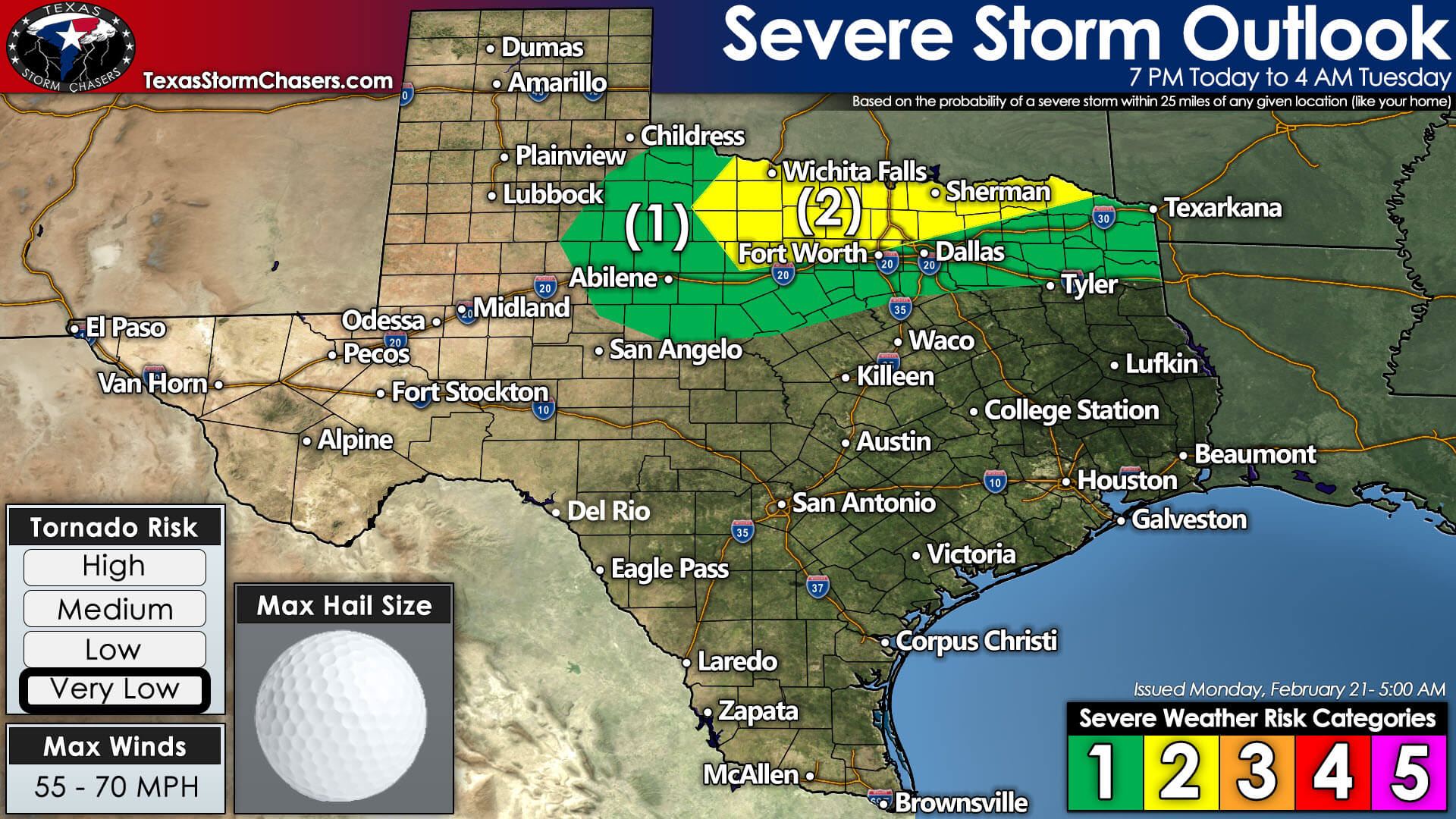
A few thunderstorms will likely be strong to severe. Large hail up to the size of golfballs and localized damaging wind gusts over 60 MPH may occur with the most intense storms. The tornado threat should remain very low as most storms will be located ‘above’ a capping inversion. If surface-based storm development does occur, there may be a limited tornado threat near the Red River overnight (from near Interstate 35 to Paris). However, the tornado threat does seem to be comparatively higher in eastern Oklahoma and western Arkansas early Tuesday.
The Storm Prediction Center has highlighted the aforementioned regions in their standard level two severe weather risk for tonight. A level one risk of severe weather, meaning a low probability, includes the Big Country, Northwest Texas, and North/Northeast Texas north of a line from Stephenville to Longview. You can view Texas’s latest severe weather outlooks, including hazard probabilistic and detailed meteorological information, by clicking here.
Crashy the Cold Front Blasts into Texas Tomorrow
On Tuesday, a strong, arctic cold front will begin pushing south into Texas. The timing slowed somewhat compared to my initial thinking a few days ago. However, the front itself will be like a freight train barreling down the tracks (or Plains in this analogy). There’s no stopping it, so get ready for blustery north winds.
Both the midnight run of the North American Model (NAM) and High-Resolution Rapid Refresh (HRRR) models are in decent agreement on the front’s timing. We’ll be using those two models as a basis for our timeline. They typically handle shallow, arctic cold fronts better than other weather models.
We anticipate crashy the cold front to arrive in the Texas Panhandle at about midnight tonight. By 4 AM Tuesday, the front should be south of Interstate 40. Fast-forward to 8 AM, and the cold front should be around Gainesville to Haskell to near Dimitt.
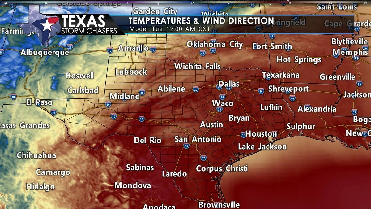
The diurnal cycle tomorrow afternoon may cause the front to slow, but it’ll continue moving south. We note high temperatures tomorrow afternoon, south of the cold front across the southern half of Texas, will likely be from near 80 degrees to 95-98 degrees in South Texas. We’ll jump out to midnight Wednesday, and the cold front should be near San Antonio to Conroe to Jasper.
Do not be surprised if the cold front ends up being faster than what I’ve described timing-wise. The initial surge of cooler air will be shallow and only extend about one thousand feet off the ground. These shallow cold-air intrusions often have a way of ‘sneaking’ south more quickly. Regardless, the second half of this week will feature much cooler temperatures across Texas.
We’re not talking record cold or even as cold as some earlier events this winter. Still, it’ll certainly be a sharp contrast to today’s and tomorrow’s spring-like weather.
Ice, Ice, Baby!
Tuesday and most of Wednesday look dry. We will need to monitor surface temperatures on Wednesday closely. We may see some spotty drizzle from Texoma/Red River south into the Hill Country. Where surface temperatures are below freezing (32 degrees), that drizzle would be capable of producing minor ice accumulations on elevated surfaces. A conditional threat we’ll be closely tracking as we get into the 36-48 hour range.
Ice impacts & what temperatures they occur
Our primary chance for winter precipitation will likely come Wednesday Night into Thursday as light precipitation develops across the eastern two-thirds of Texas. We’re not talking heavy precipitation, but more of a drizzly period with some light showers. The issue will be where surface temperatures are below freezing and where surface temperatures fall below 28-29 degrees.
While we may see a few icy bridges and overpasses with temperatures in the 30-32 degree range, we start seeing slick surface roads, in addition to widespread ice on elevated surfaces, once we’re down into the mid and upper 20s. In terms of precipitation totals – we may see between a few hundreds of an inch and perhaps two-tenths of an inch (on the high side) across the eastern half of Texas between Wednesday and Thursday.
Highest chance for freezing rain & sleet is Wednesday Night & Thursday
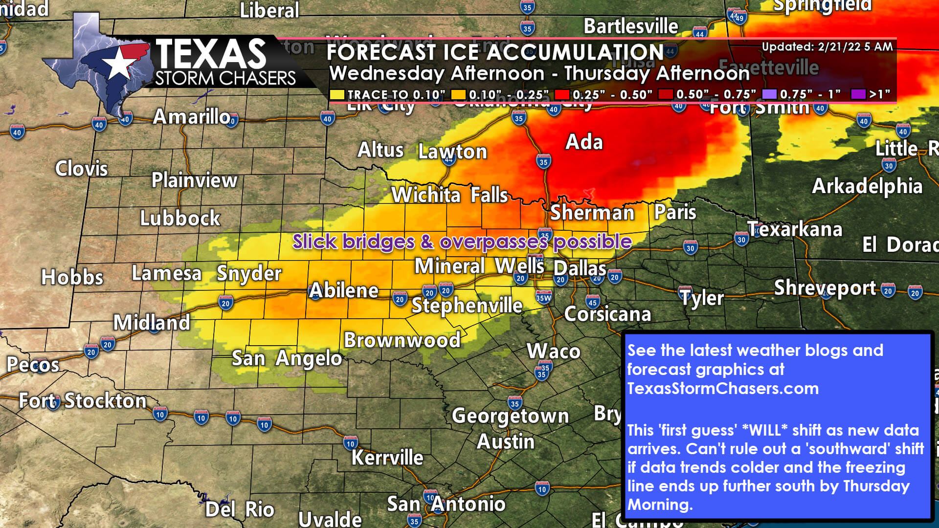
We continue to anticipate the highest chance for winter precipitation to occur across the Big Country, Texoma, portions of North Texas (Goldwathe to D/FW to Paris north), and Northeast Texas late Wednesday through Thursday afternoon. Freezing rain and sleet look to be the primary winter precipitation types. Perhaps a few light snow showers in the Texas Panhandle, but this isn’t expected to be a ‘snow event’.
Accumulations continue to look on the ‘light’ side. Still, any ice can cause impacts to travel. So we are anticipating at least some travel impacts late Wednesday into Thursday in the regions mentioned above.
Mother Nature is likely to throw in surprises; so don’t be surprised.
However, I need to stress we still need to get a better grasp of where the freezing line will end up by Thursday morning. Some weather models have the freezing line extending another 150 miles south – including all of the Hill Country, down to San Antonio, and into the Brazos Valley. Other weather models keep the freezing line north/west of the D/FW Metroplex.
We’re still in the ‘trying to put this whole clown show act together’ phase in weather-forecasting land. There will be changes, and if the colder solutions do verify, we’re going to see the chance for icy travel (elevated roadways/bridges/overpasses) extend way farther south than what we ‘currently expected’. Precipitation will conclude late Thursday afternoon – with dry weather on Friday as another cold front begins to arrive.
We got lucky with the last several winter storms. They were synoptically evident, and we could start pinning down details 3-5 days in advance. That is not the case with our mid-week system – and that’s how winter weather forecasting in the south typically works. All the ingredients are usually ‘right on the edge,’ and sometimes we have to be even inside one or two days before all the data becomes apparent.
Not a crippling, multi-day winter storm.
Regardless, we are not anticipating a significant winter storm in terms of multiple inches of sleet or snow – or a crippling ice storm that causes widespread infrastructure damage. Travel impacts from slick bridges, overpasses, and even some surface roads? That looks to be our primary ‘issue’ from a societal impact viewpoint. We’ll let you know how the data trends today and if we need to extend the ‘ice chances’ farther south.


0 Comments