
Critical fire weather danger will continue for the next several hours across the western third of Texas. East of the dryline, the atmosphere remains capped as of 4:30 PM. For the most part, we anticipate a mostly quiet evening storm-wise across the dryline in Texas. An exception could be across Northwest Texas, and especially north of the Red River into Central Oklahoma.
Severe weather outlooks issued by the Storm Prediction Center utilize a five-level risk scale. Each risk level is based on the probability of severe storms within twenty-five miles of any given point, such as your location. A level one risk is the lowest and means isolated/short-lived severe storms are possible. A level five risk is the highest, is quite rare, and indicates a significant tornado outbreak or derecho is likely. Being in or near any risk zone means you may have stronger storms in your vicinity.
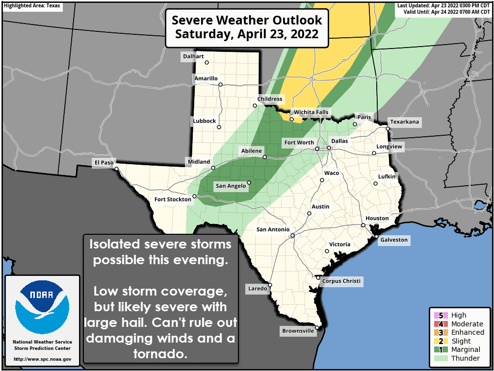
The Storm Prediction Center has highlighted a level 2 out of 5 risk for a few supercell thunderstorms in far Northwest Texas this evening. A level 1 out of 5 risk of severe storms runs down the dryline into the Concho Valley. We will not see many storms today, but those that do develop have a decent chance of being severe. Large hail will be the primary severe weather hazard. Localized damaging wind gusts and the potential for a tornado will also exist.
Isolated thunderstorm development will become more likely after 6-7PM across Central Oklahoma southwestward into Northwest Texas. We may see thunderstorm development occur closer to sunset. The mean storm motion will be to the northeast, with some ‘splitting storms’ possible. Left-splits would move quickly to the north/northeast, while right-splits would move more to the east. The threat for severe weather will continue several hours past sunset. This evening’s storm chances will feature low coverage, high-impact severe weather potential.
We may see a line of thunderstorms well after midnight north of the Red River, but we’ll also have to monitor those storms in case they try to sneak south of the Red River.
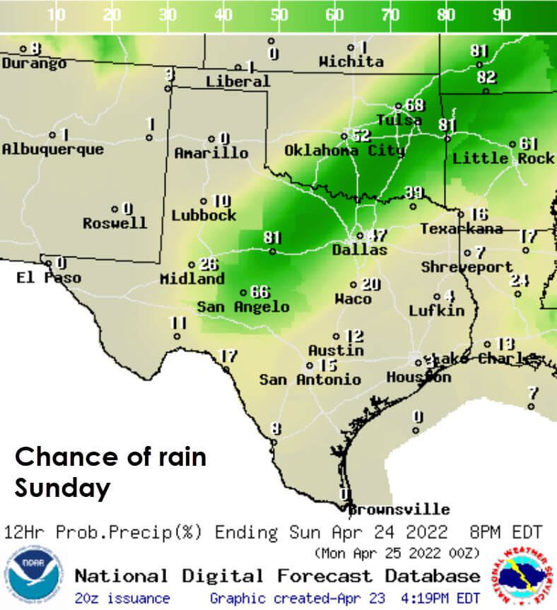
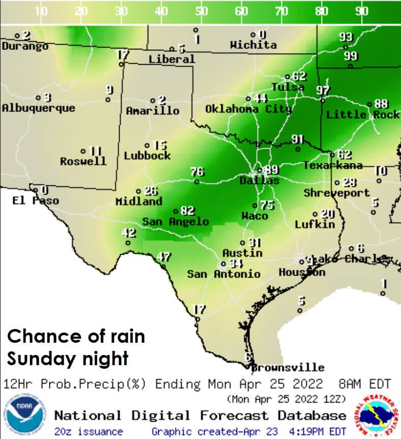
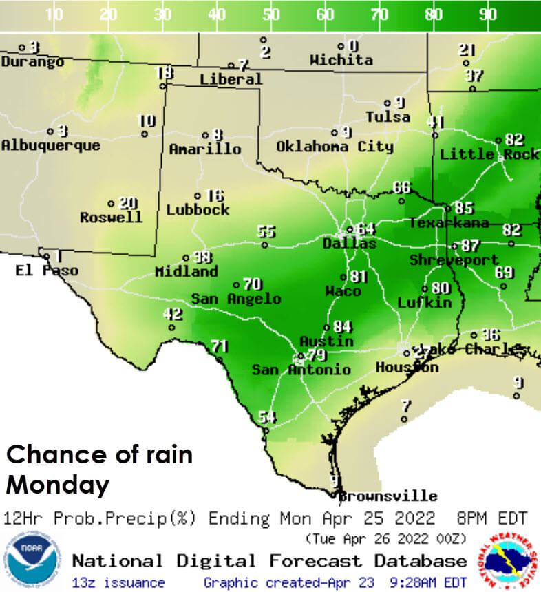
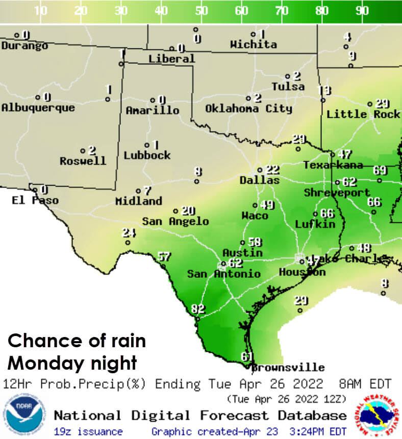
Rain chances will significantly increase on Sunday and Monday. While a few marginally severe storms are possible, the main issue may eventually become locally heavy rain and some threat for flooding. We’ll take a look at the next


0 Comments