
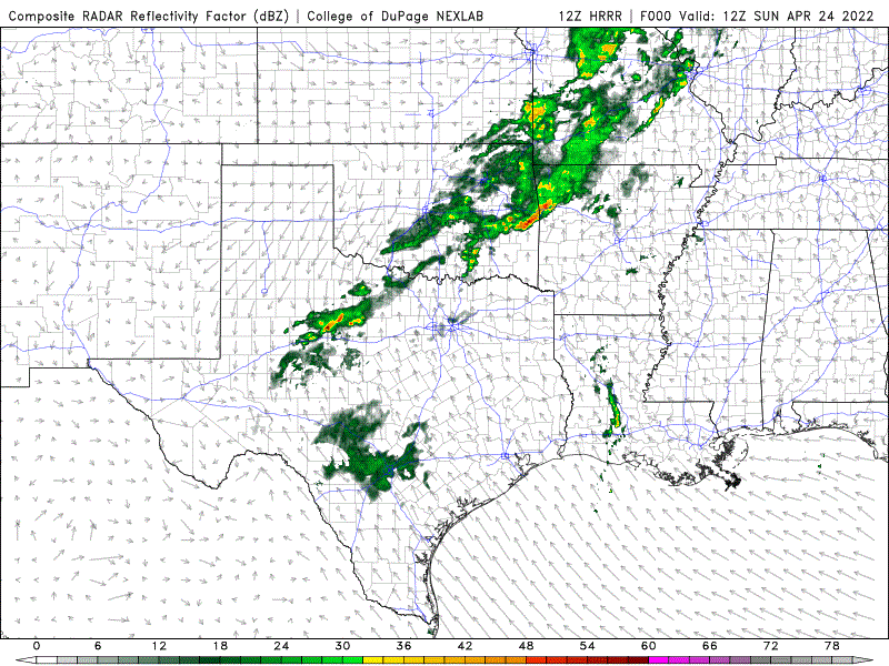
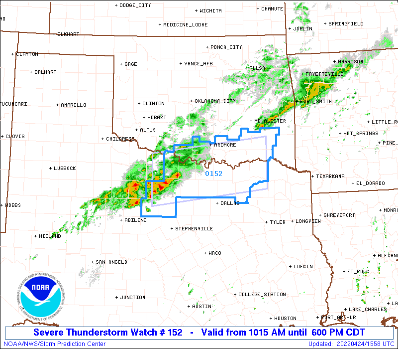
A slow moving cold front will bring widespread rain and strong to severe storms to parts of northern, central and southern Texas over the next 48 hours. The cold front is currently draped across western north Texas from about Wichita Falls down to I-20 near Pecos. A large cluster of strong to severe storms developed earlier this morning west of the DFW metroplex and we expect storms to continue to develop and train across this area over the next several hours while the whole line slowly moves east/southeast as the front slowly pushes its way south. A Severe Thunderstorm WATCH is currently in place for portions of north central Texas, including the northern and western DFW counties until 6pm today. With a focus on the rainfall, this will be what we call a “training event” where storms continually develop along and behind the cold front and move over the same area until the front gets more of a push later today and overnight which will shift the location of rain and storms with it. We are very dry, so we do not expect this to become a widespread flooding event; however, isolated to scattered occurrences of flash flooding are possible…especially north of DFW along the Red River where the majority of rainfall from this event is expected to occur. A lot will depend on how much the storms develop and train across the same area repeatedly, so just be aware of this localized flooding threat. The animated radar loop below from the HRRR high-resolution model for the next 24 hours beginning at 7am this morning will give you an idea of how the radar may look through 7am on Tuesday. As we always say, don’t focus on precise locations of storms…just take this as guidance for how things may unfold over the next 48 hours.
Severe Thunderstorm WATCH until 6pm Sunday
Sunday Severe Weather Threats
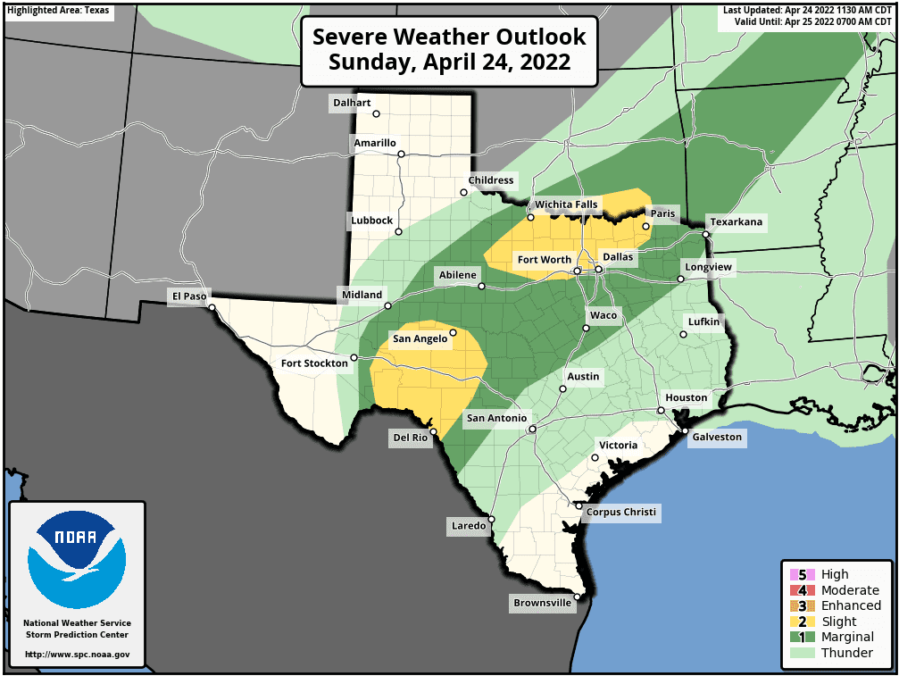
Two areas are currently highlighted by the Storm Prediction Center for a Slight Risk (Level 2) for seeing strong to severe storms today. The first encompasses much of western north Texas including the western half of the DFW area. For this area today, we don’t really have all the ingredients in place for a widespread severe weather event, so periods of heavy rainfall and the aforementioned “training” of storms over the same area repeatedly will probably be the best bet. However, we can’t rule out a few isolated severe storms with hail up to the size of quarters, gusty winds with the training bands of heavy rainfall which could trigger scattered to isolated flash flooding issues. Further south into the Concho Valley and lower Pecos Valley region, we may see the dryline light up later this afternoon into early evening with a few supercells possible. Large hail, perhaps very large hail 2+ inches in diameter and damaging winds will be the main threats with these storms before they decrease in intensity as we get into the overnight hours.
Monday Severe Weather Threats
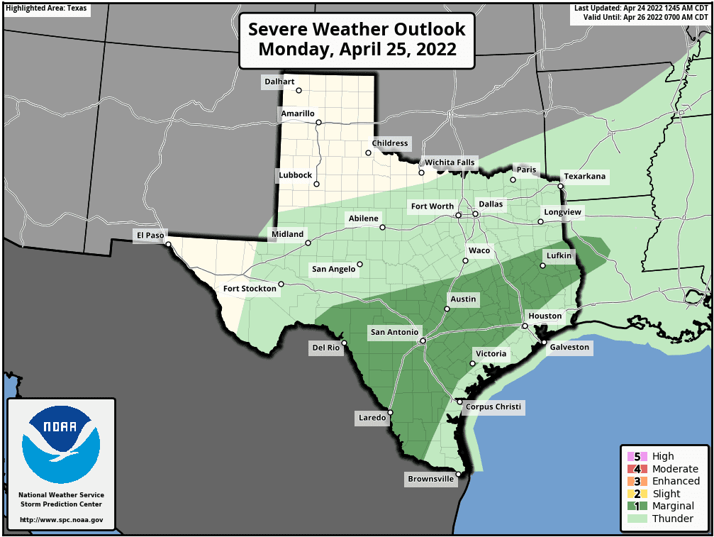
At this point, we only have a Marginal Risk (Level 1) threat for strong to severe storms as the cold front as it continues to slowly drop south through central Texas and makes it way towards the coast. The greatest threat will be widespread heavy rainfall along and behind the front, but if we get enough surface heating ahead of the front, we could see a few severe storms pop up with mainly a downburst wind threat. Definitely not a major severe weather event expected on Monday, but just keep an eye on any stronger storms that develop as they could carry that threat of damaging wind gusts.
48 Hour Rainfall Outlook
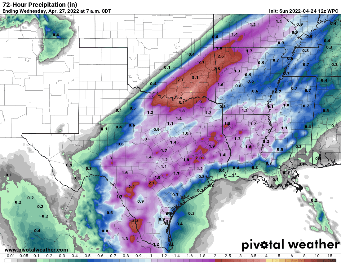
Lots of good expected precipitation totals on the map above! Keep in mind this is just the model forecast and exact locations of heavy rain bands will depend on where they set up as this event unfolds. At any rate, this is good to see. I just wish we could share it with more folks in the panhandle and far western Texas.


0 Comments