
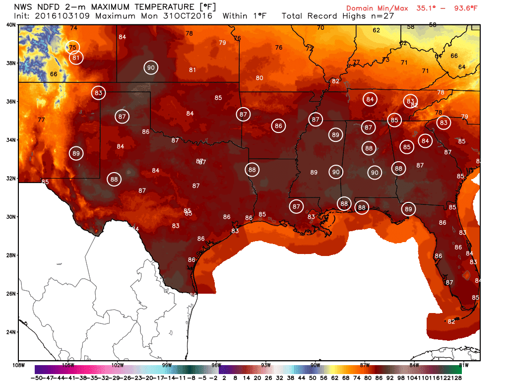
As a child I remember vividly of a couple downright frigid evenings while out in my costume gathering candy. That will not be the case this evening with temperatures still expected to be in the 60s, 70s, and lower 80s. The angle of the sun is lower than in the summer, but dry soil moisture helps to warm temperatures easily. That’ll be the case today with south to southwest winds and a ridge of high pressure overhead. Temperatures this afternoon will top out in the 80s and 90s across Texas. Some cities in our state will likely set new record highs this afternoon, but it won’t be nearly as bad as in the Southeast United States. A vast majority of major cities out there will easily hit their previous record highs by lunch time.
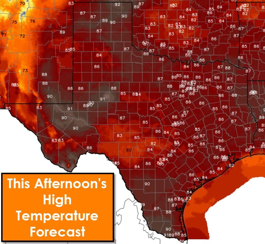
Most folks in Texas will top out in the upper 80s to lower 90s this afternoon. A few folks in the Hill Country will be on the lower-side of the spectrum with lower to mid 80s – while more folks will be on the higher end with mid 90s. If this was August we would likely have high temperatures well above the century mark for all of Texas today – some even above 110 degrees. Luckily, this isn’t August. Wildfire risk will be notably high in the Texas Panhandle where winds will be gusting upwards of 30 MPH out of the southwest this afternoon. Humidity values below 35 percent will also be conducive for enhanced wildfire potential.
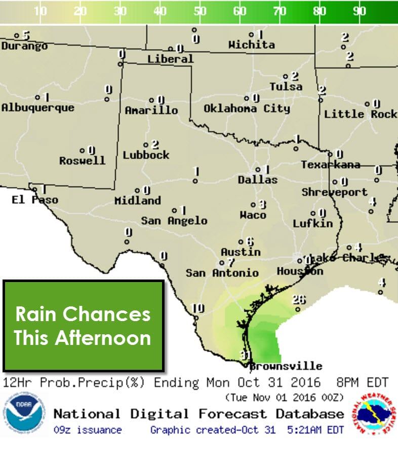

Most of the state will be dry today and tonight – a good forecast for those heading out for evening festivities. The exception will be positions of the Middle Texas Coast and the Rio Grande Valley. Isolated to scattered showers will be possible today in those two regions – including Brownsville, Corpus Christi, up to Victoria. The good news is we shouldn’t see rain everywhere or all the time today. By early this evening the coverage of showers should come down to isolated levels. A washout isn’t anticipated nor is severe weather.

Low temperatures tonight will drop back into the upper 40s and 50s where dewpoint values are lower. That won’t be the case across the eastern two-thirds of Texas where lows will only get back into the 60s to lower 70s tonight. Another round of patchy dense fog will form after midnight and increase in coverage/density through sunrise. Like this morning fog will generally burn off by 11 AM.

A cool front will push south into Texas on Wednesday and Thursday. Scattered showers and thunderstorms are expected in proximity of the front. Severe weather and flash flooding are not expected at this time. Rain chances could continue into the weekend across the Texas Panhandle, Northwest Texas, West Texas, into the Permian Basin. Up to two inches of rain will be possible on the high end of the spectrum, with most folks, who actually get rained on, receiving about half an inch of rain. This won’t break the drought that has been developing over recent weeks.


0 Comments