
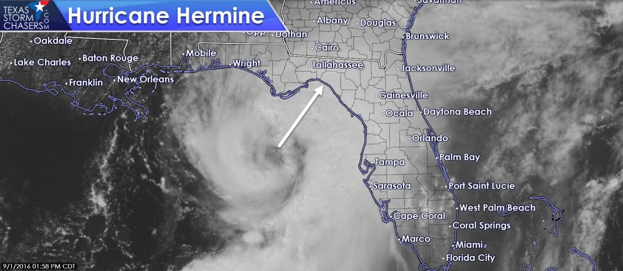
Data from the hurricane hunters indicate that Hermine has become a hurricane. Located 115 miles south/southwest of Apalachicola the system is moving northeast at 14 MPH. Continued strengthening is anticipated until landfall tonight. Tornadoes are possible across Central, North, and Northwest Florida where a tornado watch is in effect. A life-threatening storm surge is anticipated near and to the right (east/south) of the landfalling hurricane in west Florida.
HURRICANE HERMINE TROPICAL CYCLONE UPDATE
NWS NATIONAL HURRICANE CENTER MIAMI FL AL092016
155 PM CDT THU SEP 01 2016
…DATA FROM AN AIR FORCE HURRICANE HUNTER AIRCRAFT INDICATE THAT
HERMINE HAS STRENGTHENED TO A HURRICANE…
Data from an Air Force Reserve Hurricane Hunter aircraft indicate
that maximum sustained winds in Hermine have increased to near 75
mph (120 km/h). Based on these data, Hermine is now upgraded to a
hurricane, the fourth hurricane of 2016 in the Atlantic basin.
SUMMARY OF 155 PM CDT…1855 UTC…INFORMATION
———————————————-
LOCATION…28.1N 85.4W
ABOUT 115 MI…180 KM SSW OF APALACHICOLA FLORIDA
ABOUT 175 MI…285 KM W OF TAMPA FLORIDA
MAXIMUM SUSTAINED WINDS…75 MPH…120 KM/H
PRESENT MOVEMENT…NNE OR 30 DEGREES AT 14 MPH…22 KM/H
MINIMUM CENTRAL PRESSURE…988 MB…29.18 INCHES


0 Comments