
Good morning and welcome to the first day of meteorological fall! Does it feel any different outside? Yeah… don’t expect it to. Meteorological fall runs from September through November. Meteorological fall denotes the period when we transition from our typical summertime pattern across the United States to a more active time with cool front intrusions and storm tracks further south. The start of astronomical fall in the Northern Hemisphere begins on September 22.
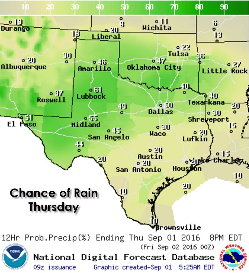
We’re seeing a few showers out there this morning mainly across the western half of Texas. This activity is fairly light but some folks could get a quick downpour this morning. Scattered afternoon thunderstorms are a good bet again today across the Texas Panhandle, Rolling Plains, South Plains, Northwest Texas, North Texas, Northeast Texas, the Big Country, Concho Valley, Permian Basin, and the Borderland. Showers and storms will pop up, move very little, and generally rain themselves out within an hour. Outflow generated by the collapsing storm will than try and generate new activity. That regeneration process will begin by the early afternoon and continue through about 5 to 6 PM. Severe weather and widespread flash flooding is not anticipated today.
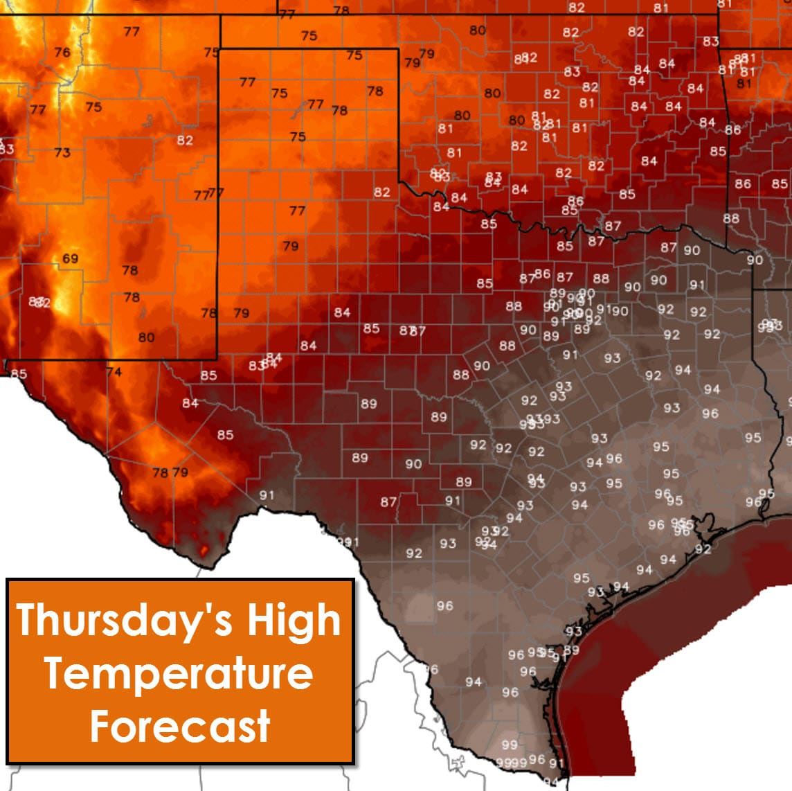
High temperatures this afternoon will be near average for early September in the southeastern half of Texas with middle 90s expected. With afternoon rain chances and associated cloud cover temperatures will be a bit cooler across the northwestern half of Texas. The Texas Panhandle and West Texas will be coolest with high temperatures only in the upper 70s today. Northwest Texas, the Big Country, Concho Valley, and Permian Basin will generally top out in the 80s.
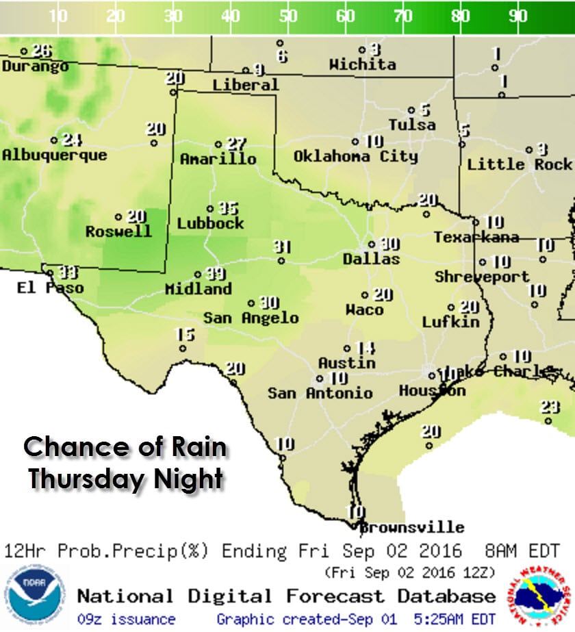
By this evening we should see a general decrease in convective coverage. Isolated to widely scattered showers and storms across the southern half of the Texas Panhandle, West Texas, the Borderland, Permian Basin, Big Country, Concho Valley, and western North Texas.
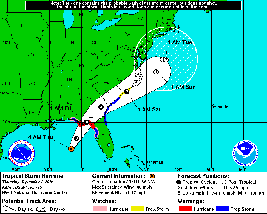
Tropical Storm Hermine is located 250 miles south/southwest of Apalachicola, Florida. The system has been organizing overnight and is likely on the verge of becoming a hurricane later this morning. Landfall is expected later this evening with impacts being felt across much of the Florida Gulf Coast. Please read the full statement from the National Hurricane Center for more information and follow us on Twitter (you can also do that in the sidebar tweet column) for detailed updates on the system today.


0 Comments