
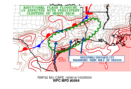
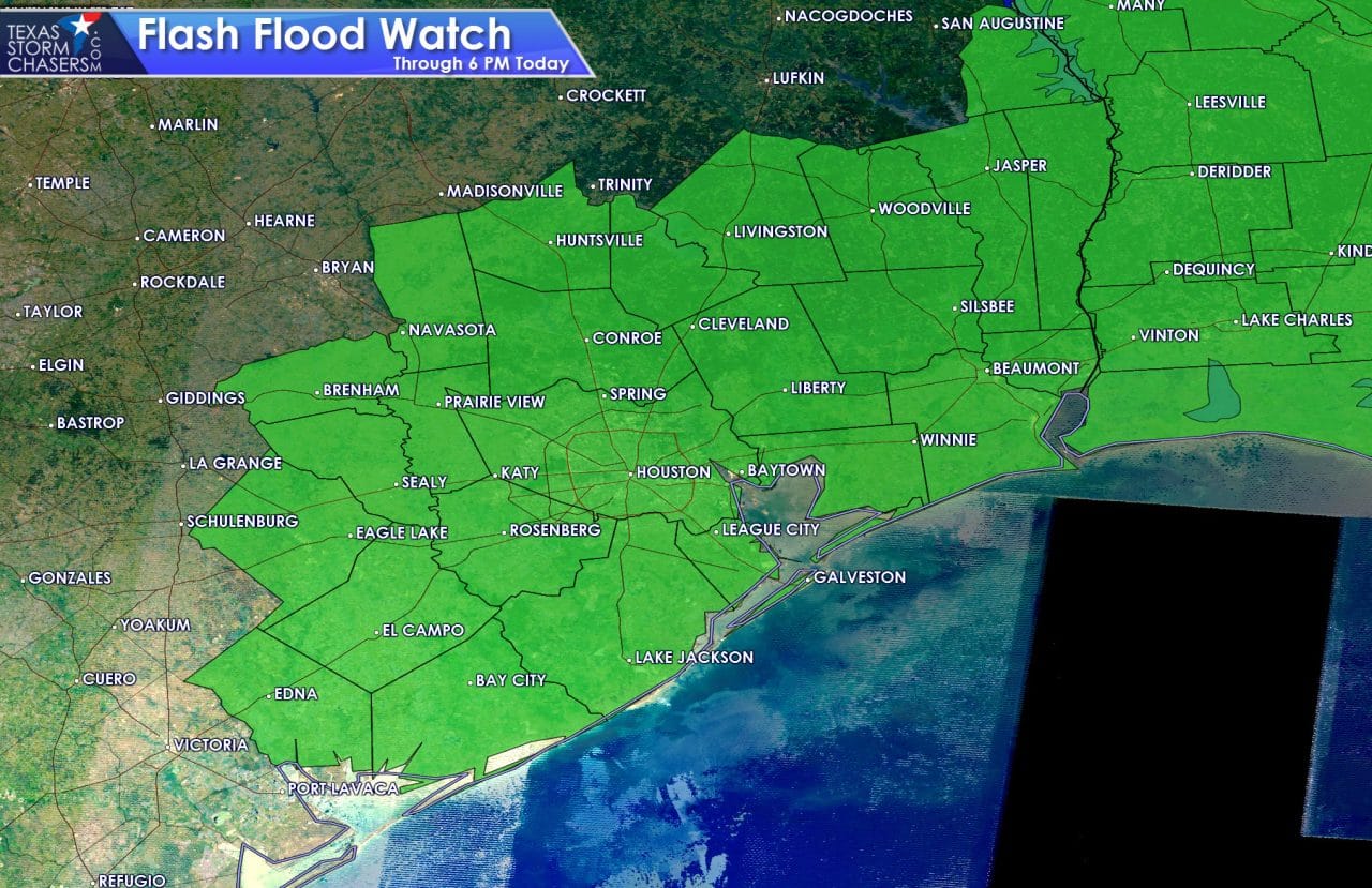
Heavy rainfall across southeast Texas has been the main concern this morning with a Flash Flood Watch in effect for the region through 7pm this evening. Clusters of storms which developed overnight have dumped over 8 inches of rain across parts of northwest Houston. Elsewhere, lesser amounts, but still enough to cause some localized flash flooding issues. Rainfall rates have decreased for the time being which is allowing flood waters to recede, but additional clusters of storms with the threat of heavy rainfall are expected to redevelop across the region later today.
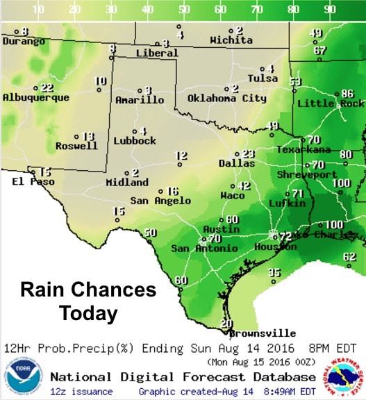
Once again today, much of the rainfall today expected will reside well south of the I-20 corridor across southeast, south central and deep south Texas. No severe weather is expected, but a few of the cells could become strong with downburst wind potential. Other than that, just lightning and brief heavy downpours before the storms “rain themselves out” and bubble up again further down the line.
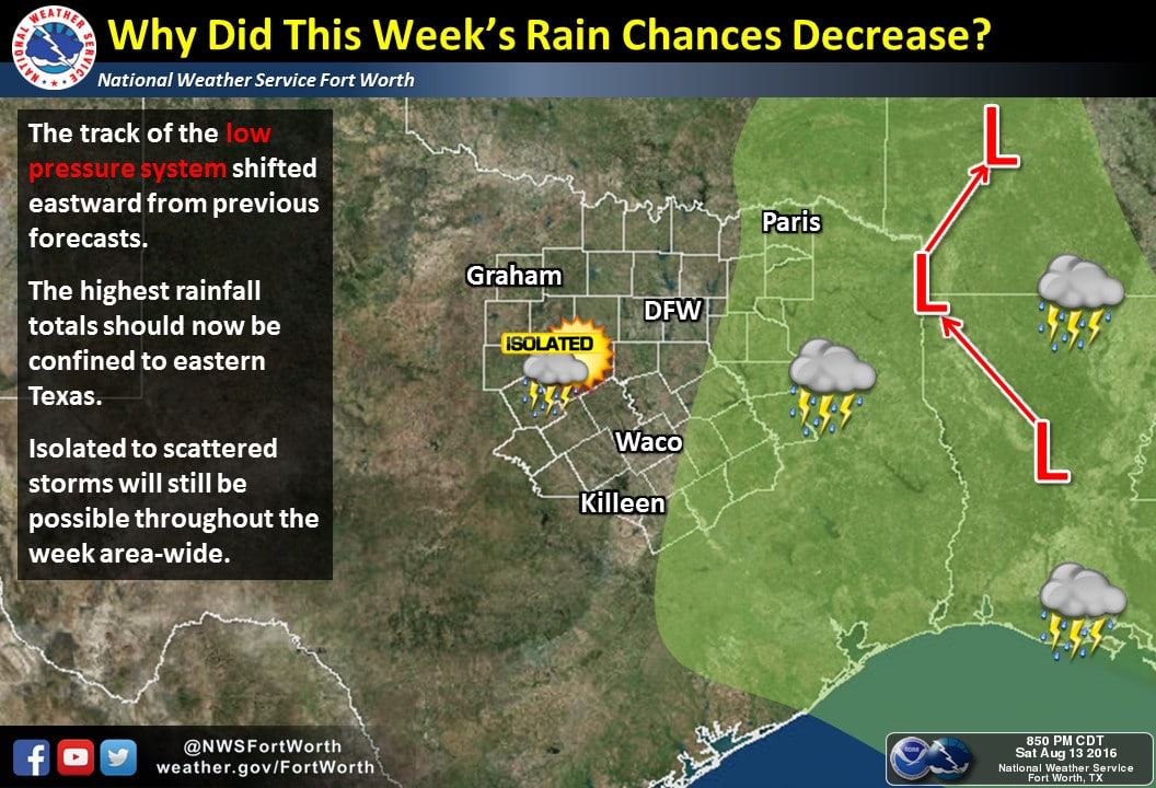
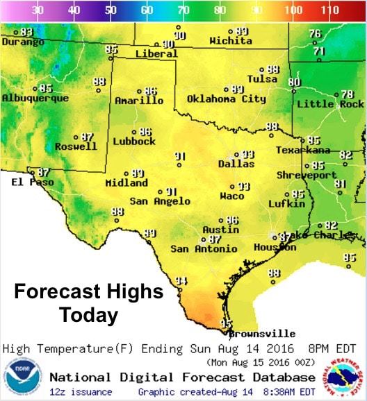
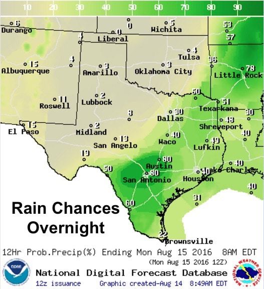 The low pressure system which was over Louisiana yesterday has not shifted as far west as anticipated, which will leave northern Texas on the dry side of things today. The benefit of this though is the marked decrease in dewpoint values which means less muggy air to contend with. Highs today will remain mostly below normal for this time of the year. It’s a rare treat to see highs in the 80s in August across west Texas and the panhandle region…and upper 80s to low 90s across much of central Texas.

0 Comments