
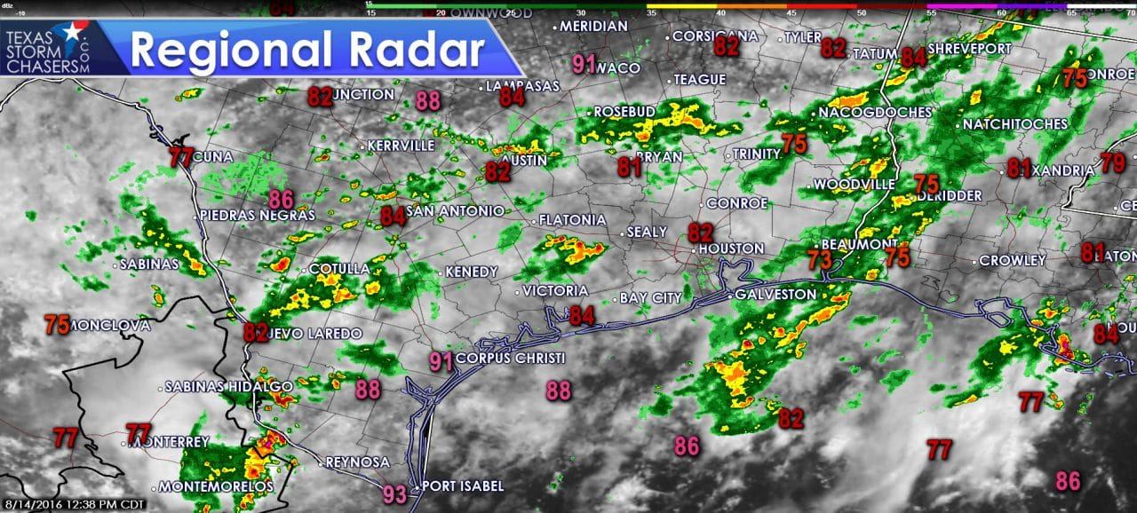
Folks northwest of Houston are getting a break in the rain after a very wet morning. The bayou system functioned as designed and waters remained in their flood-control channels. Pretty good considering six to seven inches of rain fell in three hours. With daytime heating we’re starting to see an uptick in convective activity across East Texas, Central Texas, into South Texas, and the Rio Grande Valley. Severe weather is not expected today in the form of damaging wind gusts, but very high precipitable water values indicate prolific rainfall rates are possible from stronger cells. Weak winds aloft mean there is no common storm movement today. Some activity is slowly moving south while others are slowly moving north.
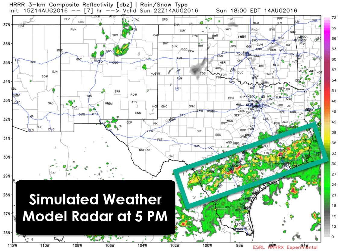
High resolution weather models are indicating an uptick in thunderstorms this afternoon across South Texas into Southeast Texas this afternoon. Not everyone will be impacted by rain today but some will certainly receive more than their fair share of it today. Stronger activity may produce excessive rainfall rates up to 3 inches per hour. If that kind of rain falls over areas that have already experienced heavy rains this weekend we’re going to have problems rapidly develop. Localized flash flooding may also develop if we see very heavy rains continue for a longer period of time. Of-course minor flooding is a good bet with any heavy rains in urban centers. Widespread flooding is not expected today. Any flooding issues that develop will be fairly localized today.


0 Comments